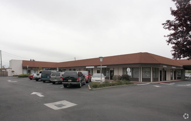
Property Record
831 Alamo Dr, Vacaville, CA 95688


NEARBY LISTINGS FOR SALE OR LEASE
Property Detail
831 Alamo Dr
0126-331-180
Los Putos Rancho
Medicalbuilding
BK-BG 00-00
X
Solano
06095C0276E
California
2024
1.03 AC
2025
Vacaville
253101
North Bay/Santa Rosa
12,039 SF
Vallejo-Fairfield, CA
DEMOGRAPHICS near 831 Alamo Dr
1 Mile
3 Mile
5 Mile
2024 Total Population
11,641
75,113
128,344
2029 Population
11,521
74,486
127,271
Pop Growth 2024-2029
(1.03%)
(0.83%)
(0.84%)
Average Age
41
40
40
2024 Total Households
4,465
25,584
43,808
HH Growth 2024-2029
(1.03%)
(0.93%)
(0.96%)
Median Household Inc
$85,478
$90,280
$101,215
Avg Household Size
2.60
2.70
2.70
2024 Avg HH Vehicles
2.00
2.00
2.00
Median Home Value
$573,679
$551,708
$620,020
Median Year Built
1971
1980
1986
Nearby Places
Map Layers
Map Styles
 Street
 Aerial
- Restaurants
- Banks
- Shops
- Fitness
- Groceries
PUBLIC TRANSPORTATION
COMMUTER RAIL
Fairfield-Vacaville (Capitol Corridor - Amtrak)
DRIVE
WALK
Distance
Fairfield-Vacaville (Capitol Corridor - Amtrak)
11 min
5.6 mi
Freight Ports
Port of Richmond
DRIVE
WALK
Distance
Port of Richmond
56 min
42.8 mi
SALE & LEASE HISTORY
LISTING DATE
SALE/LEASE

Sep 25, 2016
For Lease
Nearby Properties
Address
Land Use
TOTAL SIZE
Lot Size
Zoning
Address
Land Use
TOTAL SIZE
Lot Size
Zoning
12.64 AC
Address
Land Use
TOTAL SIZE
Lot Size
Zoning
332,833 SF
18.53 AC
Address
Land Use
TOTAL SIZE
Lot Size
Zoning
104,468 SF
1.30 AC
Address
Land Use
TOTAL SIZE
Lot Size
Zoning
210,900 SF
26.31 AC
Address
Land Use
TOTAL SIZE
Lot Size
Zoning
151,756 SF
10.07 AC
Address
Land Use
TOTAL SIZE
Lot Size
Zoning
159,056 SF
11.07 AC
Address
Land Use
TOTAL SIZE
Lot Size
Zoning
7.69 AC
Address
Land Use
TOTAL SIZE
Lot Size
Zoning
224,536 SF
11.77 AC
CG W/RES O
Address
Land Use
TOTAL SIZE
Lot Size
Zoning
597,816 SF
32.25 AC
Address
Land Use
TOTAL SIZE
Lot Size
Zoning
9.78 AC
Address
Land Use
TOTAL SIZE
Lot Size
Zoning
Address
Land Use
TOTAL SIZE
Lot Size
Zoning
164,256 SF
6.74 AC
Address
Land Use
TOTAL SIZE
Lot Size
Zoning
323,918 SF
7.18 AC
Address
Land Use
TOTAL SIZE
Lot Size
Zoning
7,302 SF
17.10 AC
Address
Land Use
TOTAL SIZE
Lot Size
Zoning
242,472 SF
12.13 AC
Address
Land Use
TOTAL SIZE
Lot Size
Zoning
242,472 SF
12.39 AC
Address
Land Use
TOTAL SIZE
Lot Size
Zoning
323,918 SF
7.72 AC
Address
Land Use
TOTAL SIZE
Lot Size
Zoning
123,136 SF
5.27 AC
Address
Land Use
TOTAL SIZE
Lot Size
Zoning
177,626 SF
10.04 AC
Address
Land Use
TOTAL SIZE
Lot Size
Zoning
131,348 SF
14.77 AC
Address
Land Use
TOTAL SIZE
Lot Size
Zoning
120,753 SF
10.05 AC
Address
Land Use
TOTAL SIZE
Lot Size
Zoning
38,696 SF
5.47 AC
Address
Land Use
TOTAL SIZE
Lot Size
Zoning
126,000 SF
10.28 AC
Address
Land Use
TOTAL SIZE
Lot Size
Zoning
3,759 SF
13.93 AC
Address
Land Use
TOTAL SIZE
Lot Size
Zoning
97,536 SF
5.21 AC
Address
Land Use
TOTAL SIZE
Lot Size
Zoning
159,947 SF
10.98 AC
Address
Land Use
TOTAL SIZE
Lot Size
Zoning
100,079 SF
6.37 AC
RM2000PD
Address
Land Use
TOTAL SIZE
Lot Size
Zoning
63,965 SF
10.11 AC
Address
Land Use
TOTAL SIZE
Lot Size
Zoning
112,080 SF
9.06 AC
Address
Land Use
TOTAL SIZE
Lot Size
Zoning
4.19 AC
The World's #1 Commercial Real Estate Marketplace
Connect with us
© 2025 CoStar Group
The information above has been obtained from sources believed reliable. While we do not doubt its accuracy we have not verified it and make no guarantee, warranty or representation about it. It is your responsibility to independently confirm its accuracy and completeness. Any projections, opinions, assumptions, or estimates used are for example only and do not represent the current or future performance of the property. The value of this transaction to you depends on tax and other factors which should be evaluated by your tax, financial, and legal advisors. You and your advisors should conduct a careful, independent investigation of the property to determine to your satisfaction the suitability of the property for your needs.