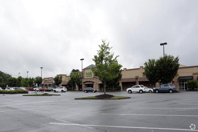
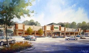
Property Record
831 Auburn Rd, Dacula, GA 30019

Property Detail
831 Auburn Rd
2-001A-127
TRACT 2/PUBLIX TRACT MULBERRY VILLAGE - PB152-300
Regionalshoppingcenterormallwithanchorstore
Gwinnett
C2
Georgia
B and X Area of moderate flood hazard, usually the area between the limits of the 100-year and 500-year floods.
14.82 AC
2025
Suwanee/Buford
2025
Atlanta
050628
Atlanta-Sandy Springs-Roswell, GA
75,160 SF
NEARBY LISTINGS FOR SALE OR LEASE
DEMOGRAPHICS near 831 Auburn Rd
1 mile
3 mile
5 mile
2025 Total Population
5,052
47,768
111,829
2030 Population
5,352
50,566
118,796
Pop Growth 2025-2030
+ 5.94%
+ 5.86%
+ 6.23%
Average Age
38
38
38
2025 Total Households
1,541
14,660
34,685
HH Growth 2025-2030
+ 6.04%
+ 6.06%
+ 6.48%
Median Household Inc
$109,698
$112,972
$105,511
Avg Household Size
3.30
3.20
3.20
2025 Avg HH Vehicles
3.00
2.00
2.00
Median Home Value
$399,887
$433,160
$417,604
Median Year Built
2006
2003
2002
Nearby Places
Map Layers
Map Styles
 Street
 Aerial
Transit
 Traffic
 Biking
Places
Listings with unknown addresses are not visible on the map
- Restaurants
- Banks
- Shops
- Fitness
- Groceries
SALE & LEASE HISTORY
LISTING DATE
SALE/LEASE

Dec 05, 2016
For Lease
Nearby Properties
Address
Land Use
TOTAL SIZE
Lot Size
Zoning
Address
Land Use
TOTAL SIZE
Lot Size
Zoning
891.66 AC
R100
Address
Land Use
TOTAL SIZE
Lot Size
Zoning
250,960 SF
17.55 AC
OI
Address
Land Use
TOTAL SIZE
Lot Size
Zoning
101,343 SF
44.33 AC
R1400
Address
Land Use
TOTAL SIZE
Lot Size
Zoning
204,895 SF
26.89 AC
R1200
Address
Land Use
TOTAL SIZE
Lot Size
Zoning
134,673 SF
29.74 AC
RA200
Address
Land Use
TOTAL SIZE
Lot Size
Zoning
178,635 SF
28.77 AC
R1200
Address
Land Use
TOTAL SIZE
Lot Size
Zoning
138,229 SF
7.97 AC
OI
Address
Land Use
TOTAL SIZE
Lot Size
Zoning
23,126 SF
88.56 AC
RA200
Address
Land Use
TOTAL SIZE
Lot Size
Zoning
124,425 SF
20.73 AC
RA200
Address
Land Use
TOTAL SIZE
Lot Size
Zoning
160,446 SF
12 AC
GOV
Address
Land Use
TOTAL SIZE
Lot Size
Zoning
110,356 SF
20.42 AC
RA200
Address
Land Use
TOTAL SIZE
Lot Size
Zoning
97,824 SF
13.71 AC
M1
Address
Land Use
TOTAL SIZE
Lot Size
Zoning
61,686 SF
10 AC
R1400
Address
Land Use
TOTAL SIZE
Lot Size
Zoning
93,702 SF
5.66 AC
C2
Address
Land Use
TOTAL SIZE
Lot Size
Zoning
102,618 SF
18 AC
R1200
Address
Land Use
TOTAL SIZE
Lot Size
Zoning
99,516 SF
10.83 AC
C3
Address
Land Use
TOTAL SIZE
Lot Size
Zoning
84,890 SF
20.02 AC
RA200
Address
Land Use
TOTAL SIZE
Lot Size
Zoning
41,757 SF
19.66 AC
RA200
Address
Land Use
TOTAL SIZE
Lot Size
Zoning
91,115 SF
5.20 AC
C2
Address
Land Use
TOTAL SIZE
Lot Size
Zoning
80,429 SF
9.67 AC
C2
Address
Land Use
TOTAL SIZE
Lot Size
Zoning
78,086 SF
7.17 AC
C2
Address
Land Use
TOTAL SIZE
Lot Size
Zoning
69,901 SF
10.01 AC
C2
Address
Land Use
TOTAL SIZE
Lot Size
Zoning
52,024 SF
8.04 AC
C2
Address
Land Use
TOTAL SIZE
Lot Size
Zoning
11,324 SF
25 AC
R1200
Address
Land Use
TOTAL SIZE
Lot Size
Zoning
24,490 SF
8.30 AC
C2
Address
Land Use
TOTAL SIZE
Lot Size
Zoning
37,436 SF
4.13 AC
C2
Address
Land Use
TOTAL SIZE
Lot Size
Zoning
32,908 SF
3.51 AC
C2
Address
Land Use
TOTAL SIZE
Lot Size
Zoning
70.45 AC
R1400
Address
Land Use
TOTAL SIZE
Lot Size
Zoning
54,893 SF
5.80 AC
C2
Address
Land Use
TOTAL SIZE
Lot Size
Zoning
1,000 SF
25 AC
R1200
The World's #1 Commercial Real Estate Marketplace
Connect with us
© 2026 CoStar Group
The information above has been obtained from sources believed reliable. While we do not doubt its accuracy we have not verified it and make no guarantee, warranty or representation about it. It is your responsibility to independently confirm its accuracy and completeness. Any projections, opinions, assumptions, or estimates used are for example only and do not represent the current or future performance of the property. The value of this transaction to you depends on tax and other factors which should be evaluated by your tax, financial, and legal advisors. You and your advisors should conduct a careful, independent investigation of the property to determine to your satisfaction the suitability of the property for your needs.