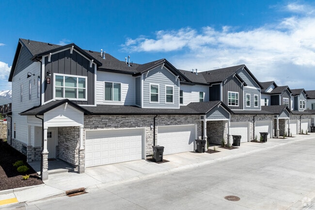
Property Record
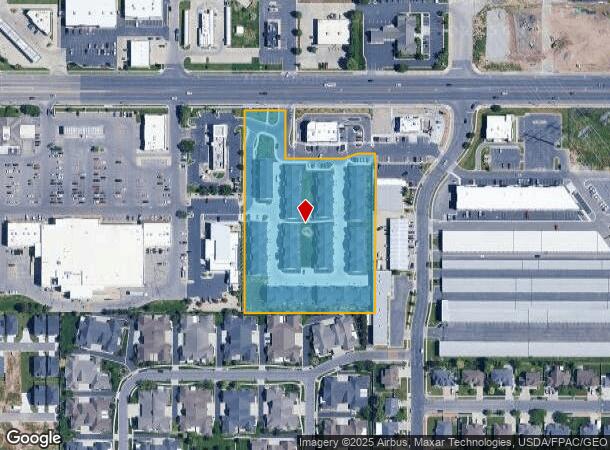
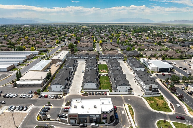
831 W Antelope Dr S, Layton, UT 84041
NEARBY LISTINGS FOR SALE OR LEASE
-
-
View all Layton listings for sale on LoopNet.com
Property Detail
831 W Antelope Dr S
Salt Lake City
Aria Briggs Subdivision
Ogden-Clearfield, UT
ALL OF LOT 2, ARIA BRIGGS SUBDIVISION. CONT. 4.47000 ACRES
12-966-0002
Davis
Multifamilydwelling
Utah
2025
2
2025
4.47 AC
125805
Outer Northern Davis County
11,043 SF
DEMOGRAPHICS near 831 W Antelope Dr S
1 Mile
3 Mile
5 Mile
2024 Total Population
12,964
97,416
175,933
2029 Population
13,702
104,159
187,381
Pop Growth 2024-2029
+ 5.69%
+ 6.92%
+ 6.51%
Average Age
33
33
33
2024 Total Households
3,551
29,265
53,428
HH Growth 2024-2029
+ 5.74%
+ 7.15%
+ 6.58%
Median Household Inc
$103,043
$86,246
$86,201
Avg Household Size
3.60
3.30
3.20
2024 Avg HH Vehicles
3.00
2.00
2.00
Median Home Value
$403,213
$390,717
$388,579
Median Year Built
1998
1999
1996
Nearby Places
Map Layers
Map Styles
 Street
 Aerial
- Restaurants
- Banks
- Shops
- Fitness
- Groceries
PUBLIC TRANSPORTATION
COMMUTER RAIL
Clearfield (FrontRunner North - Utah Transit Authority (UTA))
DRIVE
WALK
Distance
Clearfield (FrontRunner North - Utah Transit Authority (UTA))
7 min
2.8 mi
Layton (FrontRunner North - Utah Transit Authority (UTA))
DRIVE
WALK
Distance
Layton (FrontRunner North - Utah Transit Authority (UTA))
10 min
5.2 mi
AIRPORT
Salt Lake City International
DRIVE
WALK
Distance
Salt Lake City International
39 min
30.8 mi
Freight Ports
Port of Stockton
DRIVE
WALK
Distance
Port of Stockton
740 min
721.2 mi
Nearby Properties
Address
Land Use
TOTAL SIZE
Lot Size
Zoning
Address
Land Use
TOTAL SIZE
Lot Size
Zoning
399,630 SF
31.55 AC
I
Address
Land Use
TOTAL SIZE
Lot Size
Zoning
664,440 SF
37.07 AC
Address
Land Use
TOTAL SIZE
Lot Size
Zoning
217,412 SF
13.23 AC
RS
Address
Land Use
TOTAL SIZE
Lot Size
Zoning
151,064 SF
48.81 AC
Address
Land Use
TOTAL SIZE
Lot Size
Zoning
233,780 SF
14.77 AC
C-H
Address
Land Use
TOTAL SIZE
Lot Size
Zoning
86,213 SF
12.27 AC
Address
Land Use
TOTAL SIZE
Lot Size
Zoning
123,824 SF
41.89 AC
M1
Address
Land Use
TOTAL SIZE
Lot Size
Zoning
125,164 SF
7.12 AC
Address
Land Use
TOTAL SIZE
Lot Size
Zoning
53,494 SF
8.08 AC
Address
Land Use
TOTAL SIZE
Lot Size
Zoning
3,830 SF
16.64 AC
R3
Address
Land Use
TOTAL SIZE
Lot Size
Zoning
121,332 SF
44.40 AC
Address
Land Use
TOTAL SIZE
Lot Size
Zoning
86,536 SF
8.75 AC
Address
Land Use
TOTAL SIZE
Lot Size
Zoning
123,445 SF
27.94 AC
M1
Address
Land Use
TOTAL SIZE
Lot Size
Zoning
27,763 SF
11.41 AC
Address
Land Use
TOTAL SIZE
Lot Size
Zoning
4,281 SF
16.55 AC
RM1
Address
Land Use
TOTAL SIZE
Lot Size
Zoning
75,946 SF
5.67 AC
CH
Address
Land Use
TOTAL SIZE
Lot Size
Zoning
638,065 SF
33.77 AC
M1
Address
Land Use
TOTAL SIZE
Lot Size
Zoning
182,344 SF
7.41 AC
CP-3
Address
Land Use
TOTAL SIZE
Lot Size
Zoning
91,750 SF
6.76 AC
C2
Address
Land Use
TOTAL SIZE
Lot Size
Zoning
63,828 SF
5.30 AC
PF
Address
Land Use
TOTAL SIZE
Lot Size
Zoning
1,540 SF
11.52 AC
Address
Land Use
TOTAL SIZE
Lot Size
Zoning
453,129 SF
24.72 AC
M1
Address
Land Use
TOTAL SIZE
Lot Size
Zoning
76,778 SF
5.51 AC
Address
Land Use
TOTAL SIZE
Lot Size
Zoning
26,058 SF
5.86 AC
Address
Land Use
TOTAL SIZE
Lot Size
Zoning
5,481 SF
15.54 AC
Address
Land Use
TOTAL SIZE
Lot Size
Zoning
2,373 SF
6.63 AC
RM2PRUD
The World's #1 Commercial Real Estate Marketplace
Connect with us
© 2026 CoStar Group
The information above has been obtained from sources believed reliable. While we do not doubt its accuracy we have not verified it and make no guarantee, warranty or representation about it. It is your responsibility to independently confirm its accuracy and completeness. Any projections, opinions, assumptions, or estimates used are for example only and do not represent the current or future performance of the property. The value of this transaction to you depends on tax and other factors which should be evaluated by your tax, financial, and legal advisors. You and your advisors should conduct a careful, independent investigation of the property to determine to your satisfaction the suitability of the property for your needs.