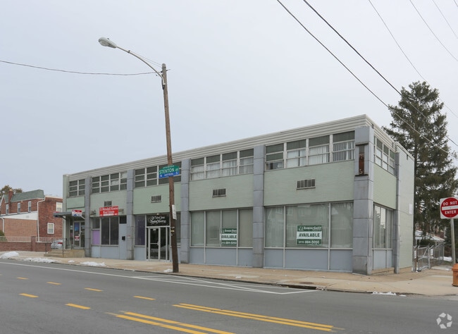
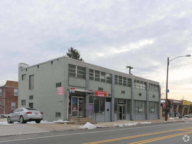
Property Record
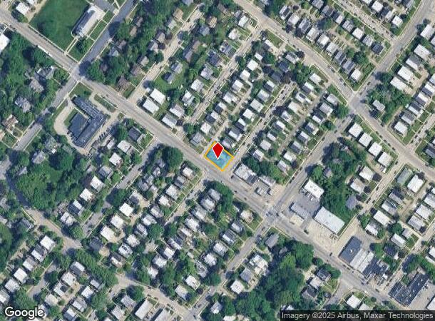
8319 Stenton Ave, Philadelphia, PA 19150
NEARBY LISTINGS FOR SALE OR LEASE
Property Detail
8319 Stenton Ave
883839000
NWC ALLENS LA
Officebuilding
Philadelphia
X
Pennsylvania
42091C0383G
0.16 AC
2024
Northwest Philadelphia
2026
Philadelphia
025800
Philadelphia-Camden-Wilmington, PA-NJ-DE-MD
4,500 SF
DEMOGRAPHICS near 8319 Stenton Ave
1 Mile
3 Mile
5 Mile
2024 Total Population
31,825
203,195
494,912
2029 Population
30,417
198,929
485,555
Pop Growth 2024-2029
(4.42%)
(2.10%)
(1.89%)
Average Age
45
42
40
2024 Total Households
14,232
85,213
201,476
HH Growth 2024-2029
(4.81%)
(2.36%)
(2.00%)
Median Household Inc
$64,084
$59,903
$60,744
Avg Household Size
2.20
2.20
2.30
2024 Avg HH Vehicles
1.00
1.00
1.00
Median Home Value
$256,544
$254,716
$248,833
Median Year Built
1951
1950
1950
Nearby Places
Map Layers
Map Styles
 Street
 Aerial
- Restaurants
- Banks
- Shops
- Fitness
- Groceries
PUBLIC TRANSPORTATION
COMMUTER RAIL
Sedgwick (R7 - Southeastern Pennsylvania Transportation Authority Regional Rail (SEPTA Regional Rail))
DRIVE
WALK
Distance
Sedgwick (R7 - Southeastern Pennsylvania Transportation Authority Regional Rail (SEPTA Regional Rail))
1 min
13 min
0.7 mi
Mount Airy (R7 - Southeastern Pennsylvania Transportation Authority Regional Rail (SEPTA Regional Rail))
DRIVE
WALK
Distance
Mount Airy (R7 - Southeastern Pennsylvania Transportation Authority Regional Rail (SEPTA Regional Rail))
2 min
13 min
0.7 mi
AIRPORT
Philadelphia International
DRIVE
WALK
Distance
Philadelphia International
36 min
20.2 mi
Trenton Mercer
DRIVE
WALK
Distance
Trenton Mercer
50 min
36.0 mi
Freight Ports
Port of Philadelphia
DRIVE
WALK
Distance
Port of Philadelphia
16 min
9.6 mi
SALE & LEASE HISTORY
LISTING DATE
SALE/LEASE

Sep 25, 2016
For Lease
Sep 24, 2016
For Sale
Nov 16, 2017
For Sale
Jan 31, 2019
For Sale
Dec 11, 2017
For Lease
Nearby Properties
Address
Land Use
TOTAL SIZE
Lot Size
Zoning
Address
Land Use
TOTAL SIZE
Lot Size
Zoning
638,776 SF
20 AC
RM2
Address
Land Use
TOTAL SIZE
Lot Size
Zoning
520,280 SF
14.84 AC
RM3
Address
Land Use
TOTAL SIZE
Lot Size
Zoning
2,146,150 SF
119.95 AC
M1
Address
Land Use
TOTAL SIZE
Lot Size
Zoning
22,648 SF
38.69 AC
RM3
Address
Land Use
TOTAL SIZE
Lot Size
Zoning
609,000 SF
22.44 AC
RM2
Address
Land Use
TOTAL SIZE
Lot Size
Zoning
563,768 SF
20.20 AC
RM2
Address
Land Use
TOTAL SIZE
Lot Size
Zoning
121,578 SF
3.13 AC
RSA3
Address
Land Use
TOTAL SIZE
Lot Size
Zoning
287,286 SF
1.26 AC
CMX5
Address
Land Use
TOTAL SIZE
Lot Size
Zoning
649,400 SF
55.03 AC
R1
Address
Land Use
TOTAL SIZE
Lot Size
Zoning
193,228 SF
18.06 AC
RMX1
Address
Land Use
TOTAL SIZE
Lot Size
Zoning
249,341 SF
21.82 AC
CA2
Address
Land Use
TOTAL SIZE
Lot Size
Zoning
415,059 SF
11.59 AC
RSD3
Address
Land Use
TOTAL SIZE
Lot Size
Zoning
211,200 SF
1.46 AC
CMX2
Address
Land Use
TOTAL SIZE
Lot Size
Zoning
300 AC
RSD1
Address
Land Use
TOTAL SIZE
Lot Size
Zoning
363,136 SF
16.47 AC
RSA3
Address
Land Use
TOTAL SIZE
Lot Size
Zoning
57,301 SF
49.77 AC
SPPOA
Address
Land Use
TOTAL SIZE
Lot Size
Zoning
170,842 SF
16.51 AC
RSD1
Address
Land Use
TOTAL SIZE
Lot Size
Zoning
148,293 SF
7.45 AC
RM2
Address
Land Use
TOTAL SIZE
Lot Size
Zoning
705,687 SF
19.89 AC
C1
Address
Land Use
TOTAL SIZE
Lot Size
Zoning
263,000 SF
5.31 AC
RM2
Address
Land Use
TOTAL SIZE
Lot Size
Zoning
234,934 SF
43.63 AC
AA
Address
Land Use
TOTAL SIZE
Lot Size
Zoning
233,235 SF
7.93 AC
RM2
Address
Land Use
TOTAL SIZE
Lot Size
Zoning
635,387 SF
10.12 AC
C1
Address
Land Use
TOTAL SIZE
Lot Size
Zoning
131,720 SF
4.33 AC
RM2
Address
Land Use
TOTAL SIZE
Lot Size
Zoning
3,104 SF
0.09 AC
RSA2
Address
Land Use
TOTAL SIZE
Lot Size
Zoning
135,423 SF
5.04 AC
RM3
Address
Land Use
TOTAL SIZE
Lot Size
Zoning
134,345 SF
25.45 AC
RSD1
Address
Land Use
TOTAL SIZE
Lot Size
Zoning
360,524 SF
59.87 AC
INST
Address
Land Use
TOTAL SIZE
Lot Size
Zoning
273,509 SF
1.40 AC
RM3
Address
Land Use
TOTAL SIZE
Lot Size
Zoning
582,294 SF
9.07 AC
C1
The World's #1 Commercial Real Estate Marketplace
Connect with us
© 2025 CoStar Group
The information above has been obtained from sources believed reliable. While we do not doubt its accuracy we have not verified it and make no guarantee, warranty or representation about it. It is your responsibility to independently confirm its accuracy and completeness. Any projections, opinions, assumptions, or estimates used are for example only and do not represent the current or future performance of the property. The value of this transaction to you depends on tax and other factors which should be evaluated by your tax, financial, and legal advisors. You and your advisors should conduct a careful, independent investigation of the property to determine to your satisfaction the suitability of the property for your needs.