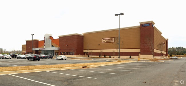
Property Record
832 Cabela Dr, Augusta, GA 30909

Save to a Folder
{{folder.Name}}
{{folder.ListingIds.length}} Properties
{{folder.ListingIds.length}} Property
Create a New Folder
Property Detail
832 Cabela Dr
0082002000
832 CABELA DR LOT 8
Commercialacreage
Richmond
LI
Georgia
B and X Area of moderate flood hazard, usually the area between the limits of the 100-year and 500-year floods.
8
2025
8.37 AC
2025
North Richmond County
010101
Augusta/Richmond County
75,295 SF
Augusta-Richmond County, GA-SC
NEARBY LISTINGS FOR SALE OR LEASE
-
-
View all Augusta listings for sale on LoopNet.com
DEMOGRAPHICS near 832 Cabela Dr
1 mile
3 mile
5 mile
2025 Total Population
4,110
37,475
118,565
2030 Population
4,114
38,046
121,608
Pop Growth 2025-2030
+ 0.10%
+ 1.52%
+ 2.57%
Average Age
37
40
40
2025 Total Households
2,057
17,024
51,775
HH Growth 2025-2030
+ 0.19%
+ 1.21%
+ 2.37%
Median Household Inc
$73,839
$80,204
$70,416
Avg Household Size
2.00
2.20
2.20
2025 Avg HH Vehicles
2.00
2.00
2.00
Median Home Value
$197,332
$287,508
$262,978
Median Year Built
1990
1983
1979
Nearby Places
Map Layers
Map Styles
 Street
 Aerial
Layers
 Traffic
 Biking
Places
Listings with unknown addresses are not visible on the map
- Restaurants
- Banks
- Shops
- Fitness
- Groceries
PUBLIC TRANSPORTATION
AIRPORT
Augusta Regional at Bush Field
Drive
Walk
Distance
Augusta Regional at Bush Field
27 min
13.0 mi
Freight Ports
Georgia Ports - Savannah
Drive
Walk
Distance
Georgia Ports - Savannah
164 min
124.6 mi
Nearby Properties
Address
Land Use
TOTAL SIZE
Lot Size
Zoning
Address
Land Use
TOTAL SIZE
Lot Size
Zoning
8,993 SF
351.84 AC
R-1_B-2
Address
Land Use
TOTAL SIZE
Lot Size
Zoning
4,214 SF
12.73 AC
LI_B-2
Address
Land Use
TOTAL SIZE
Lot Size
Zoning
6,694 SF
17.75 AC
R-3B
Address
Land Use
TOTAL SIZE
Lot Size
Zoning
33,784 SF
22.27 AC
B-2
Address
Land Use
TOTAL SIZE
Lot Size
Zoning
6,516 SF
15.33 AC
R-3B
Address
Land Use
TOTAL SIZE
Lot Size
Zoning
2,326 SF
21.90 AC
R-3B
Address
Land Use
TOTAL SIZE
Lot Size
Zoning
4,800 SF
19.81 AC
B-2
Address
Land Use
TOTAL SIZE
Lot Size
Zoning
Address
Land Use
TOTAL SIZE
Lot Size
Zoning
3,447 SF
16.67 AC
R-3B
Address
Land Use
TOTAL SIZE
Lot Size
Zoning
61,769 SF
12.06 AC
B-2
Address
Land Use
TOTAL SIZE
Lot Size
Zoning
150,807 SF
16.91 AC
R-1A SPEX
Address
Land Use
TOTAL SIZE
Lot Size
Zoning
114,153 SF
12.91 AC
B-2
Address
Land Use
TOTAL SIZE
Lot Size
Zoning
66,300 SF
18.22 AC
B-1
Address
Land Use
TOTAL SIZE
Lot Size
Zoning
25,504 SF
9.87 AC
B-2
Address
Land Use
TOTAL SIZE
Lot Size
Zoning
21,615 SF
207.78 AC
R-1
Address
Land Use
TOTAL SIZE
Lot Size
Zoning
2,355 SF
12.97 AC
B-2
Address
Land Use
TOTAL SIZE
Lot Size
Zoning
6,424 SF
15.16 AC
R-3C
Address
Land Use
TOTAL SIZE
Lot Size
Zoning
68,640 SF
12.02 AC
R-3B
Address
Land Use
TOTAL SIZE
Lot Size
Zoning
143,547 SF
9.88 AC
B-2
Address
Land Use
TOTAL SIZE
Lot Size
Zoning
79,224 SF
2.90 AC
B-2
Address
Land Use
TOTAL SIZE
Lot Size
Zoning
20,736 SF
15.51 AC
R-3B
Address
Land Use
TOTAL SIZE
Lot Size
Zoning
16,914 SF
29.85 AC
R-1
Address
Land Use
TOTAL SIZE
Lot Size
Zoning
82,224 SF
2.69 AC
B-2
Address
Land Use
TOTAL SIZE
Lot Size
Zoning
77,830 SF
4.12 AC
B-2
Address
Land Use
TOTAL SIZE
Lot Size
Zoning
18,402 SF
10 AC
B-1 SPEX
Address
Land Use
TOTAL SIZE
Lot Size
Zoning
2,066 SF
11.52 AC
R-3B
Address
Land Use
TOTAL SIZE
Lot Size
Zoning
34,080 SF
12 AC
B-2
Address
Land Use
TOTAL SIZE
Lot Size
Zoning
53,022 SF
16.48 AC
R-3B
Address
Land Use
TOTAL SIZE
Lot Size
Zoning
36.89 AC
Address
Land Use
TOTAL SIZE
Lot Size
Zoning
106,400 SF
13.53 AC
002
The World's #1 Commercial Real Estate Marketplace
Connect with us
© 2026 CoStar Group
The information above has been obtained from sources believed reliable. While we do not doubt its accuracy we have not verified it and make no guarantee, warranty or representation about it. It is your responsibility to independently confirm its accuracy and completeness. Any projections, opinions, assumptions, or estimates used are for example only and do not represent the current or future performance of the property. The value of this transaction to you depends on tax and other factors which should be evaluated by your tax, financial, and legal advisors. You and your advisors should conduct a careful, independent investigation of the property to determine to your satisfaction the suitability of the property for your needs.