Property Record
832 N Lallendorf Rd, Oregon, OH 43616
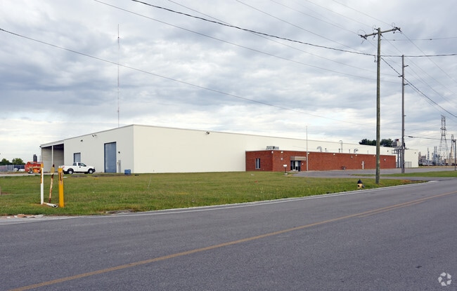

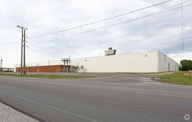
Property Detail
832 N Lallendorf Rd
44-05941
8 9 27 SE 1/4 S 660 FT E 880 FT
Foundry
Lucas
40-CI
Ohio
A Areas with a 1% annual chance of flooding and a 26% chance of flooding over the life of a 30-year mortgage.
13.34 AC
0
East Toledo/Oregon
2025
Toledo
009902
Toledo, OH
112,500 SF
NEARBY LISTINGS FOR SALE OR LEASE
DEMOGRAPHICS near 832 N Lallendorf Rd
1 mile
3 mile
5 mile
2025 Total Population
91
24,061
88,632
2030 Population
91
23,946
88,976
Pop Growth 2025-2030
0.00%
(0.48%)
+ 0.39%
Average Age
42
42
39
2025 Total Households
36
9,479
36,292
HH Growth 2025-2030
0.00%
(0.47%)
+ 0.26%
Median Household Inc
$74,999
$63,461
$47,385
Avg Household Size
2.50
2.30
2.30
2025 Avg HH Vehicles
2.00
2.00
2.00
Median Home Value
$220,000
$187,135
$118,695
Median Year Built
1954
1965
1954
Nearby Places
Map Layers
Map Styles
 Street
 Aerial
Layers
 Traffic
 Biking
Places
Listings with unknown addresses are not visible on the map
- Restaurants
- Banks
- Shops
- Fitness
- Groceries
PUBLIC TRANSPORTATION
COMMUTER RAIL
Toledo (Capitol Limited - Amtrak, Lake Shore Limited - Amtrak)
Drive
Walk
Distance
Toledo (Capitol Limited - Amtrak, Lake Shore Limited - Amtrak)
13 min
6.4 mi
AIRPORT
Eugene F Kranz Toledo Express
Drive
Walk
Distance
Eugene F Kranz Toledo Express
44 min
24.4 mi
Freight Ports
Port of Toledo
Drive
Walk
Distance
Port of Toledo
8 min
2.8 mi
Nearby Properties
Address
Land Use
TOTAL SIZE
Lot Size
Zoning
Address
Land Use
TOTAL SIZE
Lot Size
Zoning
286,525 SF
105.33 AC
10-RS6
Address
Land Use
TOTAL SIZE
Lot Size
Zoning
605,609 SF
9.66 AC
40-C4
Address
Land Use
TOTAL SIZE
Lot Size
Zoning
311,537 SF
35.14 AC
40-R1
Address
Land Use
TOTAL SIZE
Lot Size
Zoning
225,407 SF
128.05 AC
10-MX
Address
Land Use
TOTAL SIZE
Lot Size
Zoning
73,802 SF
22.50 AC
40-R1
Address
Land Use
TOTAL SIZE
Lot Size
Zoning
334,732 SF
516.10 AC
40-M2
Address
Land Use
TOTAL SIZE
Lot Size
Zoning
22.93 AC
40-R3
Address
Land Use
TOTAL SIZE
Lot Size
Zoning
214,312 SF
35.35 AC
40-C5
Address
Land Use
TOTAL SIZE
Lot Size
Zoning
27.41 AC
40-CI
Address
Land Use
TOTAL SIZE
Lot Size
Zoning
102,535 SF
20 AC
40-R2
Address
Land Use
TOTAL SIZE
Lot Size
Zoning
73,731 SF
2 AC
10-RD6
Address
Land Use
TOTAL SIZE
Lot Size
Zoning
150,000 SF
17.55 AC
40-CI
Address
Land Use
TOTAL SIZE
Lot Size
Zoning
187,988 SF
20 AC
40-M2
Address
Land Use
TOTAL SIZE
Lot Size
Zoning
29.92 AC
40-CI
Address
Land Use
TOTAL SIZE
Lot Size
Zoning
117,094 SF
28.04 AC
40-R2
Address
Land Use
TOTAL SIZE
Lot Size
Zoning
77,079 SF
3.87 AC
40-R3
Address
Land Use
TOTAL SIZE
Lot Size
Zoning
18,843 SF
30.05 AC
40-M2
Address
Land Use
TOTAL SIZE
Lot Size
Zoning
265,601 SF
11.34 AC
10-IG
Address
Land Use
TOTAL SIZE
Lot Size
Zoning
178,841 SF
19 AC
10-RM36
Address
Land Use
TOTAL SIZE
Lot Size
Zoning
55,544 SF
13 AC
40-R2
Address
Land Use
TOTAL SIZE
Lot Size
Zoning
91,261 SF
5.47 AC
40-C2
Address
Land Use
TOTAL SIZE
Lot Size
Zoning
58,281 SF
2.60 AC
40-C2
Address
Land Use
TOTAL SIZE
Lot Size
Zoning
46,267 SF
3.22 AC
40-R3
Address
Land Use
TOTAL SIZE
Lot Size
Zoning
69,259 SF
13.65 AC
40-R2
Address
Land Use
TOTAL SIZE
Lot Size
Zoning
454,080 SF
54.59 AC
10-IG
Address
Land Use
TOTAL SIZE
Lot Size
Zoning
93,191 SF
11.13 AC
40-C4
Address
Land Use
TOTAL SIZE
Lot Size
Zoning
104,012 SF
7.14 AC
40-R3
Address
Land Use
TOTAL SIZE
Lot Size
Zoning
398,978 SF
79.82 AC
40-M2
Address
Land Use
TOTAL SIZE
Lot Size
Zoning
47,907 SF
10.24 AC
40-A1
Address
Land Use
TOTAL SIZE
Lot Size
Zoning
127.78 AC
10-MX
The World's #1 Commercial Real Estate Marketplace
Connect with us
© 2026 CoStar Group
The information above has been obtained from sources believed reliable. While we do not doubt its accuracy we have not verified it and make no guarantee, warranty or representation about it. It is your responsibility to independently confirm its accuracy and completeness. Any projections, opinions, assumptions, or estimates used are for example only and do not represent the current or future performance of the property. The value of this transaction to you depends on tax and other factors which should be evaluated by your tax, financial, and legal advisors. You and your advisors should conduct a careful, independent investigation of the property to determine to your satisfaction the suitability of the property for your needs.