Property Record
8320 Us Highway 281 Blvd N, San Antonio, TX 78216
NEARBY LISTINGS FOR SALE OR LEASE
Property Detail
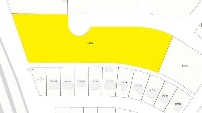
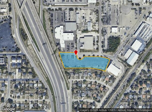
8320 Us Highway 281 Blvd N
San Antonio-New Braunfels, TX
Bmw Center Bl 11954
11954-003-0180
NCB 11954 BLK 3 LOT 18 (BMW CENTER)
Miscellaneous
Bexar
X
Texas
48029C0263H
18
2024
2.54 AC
2025
North Central
191201
San Antonio
DEMOGRAPHICS near 8320 Us Highway 281 Blvd N
1 Mile
3 Mile
5 Mile
2024 Total Population
10,791
89,915
286,818
2029 Population
11,502
95,843
305,428
Pop Growth 2024-2029
+ 6.59%
+ 6.59%
+ 6.49%
Average Age
42
40
39
2024 Total Households
4,964
38,405
121,017
HH Growth 2024-2029
+ 7.05%
+ 6.90%
+ 6.73%
Median Household Inc
$64,528
$62,453
$55,737
Avg Household Size
2.00
2.30
2.30
2024 Avg HH Vehicles
1.00
2.00
2.00
Median Home Value
$232,644
$303,638
$255,509
Median Year Built
1972
1967
1973
Nearby Places
Map Layers
Map Styles
 Street
 Aerial
- Restaurants
- Banks
- Shops
- Fitness
- Groceries
PUBLIC TRANSPORTATION
COMMUTER RAIL
San Antonio Amtrak Station (Sunset Limited - Amtrak, Texas Eagle - Amtrak)
DRIVE
WALK
Distance
San Antonio Amtrak Station (Sunset Limited - Amtrak, Texas Eagle - Amtrak)
12 min
8.1 mi
AIRPORT
San Antonio International
DRIVE
WALK
Distance
San Antonio International
3 min
0.9 mi
Freight Ports
Calhoun Port
DRIVE
WALK
Distance
Calhoun Port
187 min
153.6 mi
Nearby Properties
Address
Land Use
TOTAL SIZE
Lot Size
Zoning
Address
Land Use
TOTAL SIZE
Lot Size
Zoning
557,078 SF
10.73 AC
Address
Land Use
TOTAL SIZE
Lot Size
Zoning
632,091 SF
27.82 AC
Address
Land Use
TOTAL SIZE
Lot Size
Zoning
324,360 SF
15.05 AC
Address
Land Use
TOTAL SIZE
Lot Size
Zoning
246,000 SF
22.54 AC
Address
Land Use
TOTAL SIZE
Lot Size
Zoning
25,513 SF
18.14 AC
Address
Land Use
TOTAL SIZE
Lot Size
Zoning
46,451 SF
7.03 AC
Address
Land Use
TOTAL SIZE
Lot Size
Zoning
317,537 SF
25.06 AC
Address
Land Use
TOTAL SIZE
Lot Size
Zoning
56,042 SF
14.60 AC
Address
Land Use
TOTAL SIZE
Lot Size
Zoning
239,264 SF
9.02 AC
Address
Land Use
TOTAL SIZE
Lot Size
Zoning
262,515 SF
6.38 AC
Address
Land Use
TOTAL SIZE
Lot Size
Zoning
316,556 SF
6.56 AC
Address
Land Use
TOTAL SIZE
Lot Size
Zoning
10,342 SF
1.41 AC
Address
Land Use
TOTAL SIZE
Lot Size
Zoning
506,058 SF
25.23 AC
Address
Land Use
TOTAL SIZE
Lot Size
Zoning
250,990 SF
4.89 AC
Address
Land Use
TOTAL SIZE
Lot Size
Zoning
23,738 SF
4.84 AC
Address
Land Use
TOTAL SIZE
Lot Size
Zoning
268,495 SF
13.04 AC
Address
Land Use
TOTAL SIZE
Lot Size
Zoning
314,264 SF
4.27 AC
Address
Land Use
TOTAL SIZE
Lot Size
Zoning
219,400 SF
6.16 AC
Address
Land Use
TOTAL SIZE
Lot Size
Zoning
307,193 SF
7.18 AC
Address
Land Use
TOTAL SIZE
Lot Size
Zoning
157,762 SF
9.26 AC
Address
Land Use
TOTAL SIZE
Lot Size
Zoning
245,160 SF
15.10 AC
Address
Land Use
TOTAL SIZE
Lot Size
Zoning
392,678 SF
21.04 AC
Address
Land Use
TOTAL SIZE
Lot Size
Zoning
248,547 SF
3.30 AC
Address
Land Use
TOTAL SIZE
Lot Size
Zoning
74,510 SF
6.58 AC
Address
Land Use
TOTAL SIZE
Lot Size
Zoning
248,413 SF
3.23 AC
Address
Land Use
TOTAL SIZE
Lot Size
Zoning
279,012 SF
12.17 AC
Address
Land Use
TOTAL SIZE
Lot Size
Zoning
192,175 SF
5.08 AC
Address
Land Use
TOTAL SIZE
Lot Size
Zoning
308,299 SF
14.55 AC
Address
Land Use
TOTAL SIZE
Lot Size
Zoning
265,015 SF
12.81 AC
Address
Land Use
TOTAL SIZE
Lot Size
Zoning
58,461 SF
3.60 AC
The World's #1 Commercial Real Estate Marketplace
Connect with us
© 2025 CoStar Group
The information above has been obtained from sources believed reliable. While we do not doubt its accuracy we have not verified it and make no guarantee, warranty or representation about it. It is your responsibility to independently confirm its accuracy and completeness. Any projections, opinions, assumptions, or estimates used are for example only and do not represent the current or future performance of the property. The value of this transaction to you depends on tax and other factors which should be evaluated by your tax, financial, and legal advisors. You and your advisors should conduct a careful, independent investigation of the property to determine to your satisfaction the suitability of the property for your needs.