Property Record
8326 Northup Dr, Punta Gorda, FL 33982
NEARBY LISTINGS FOR SALE OR LEASE
Property Detail
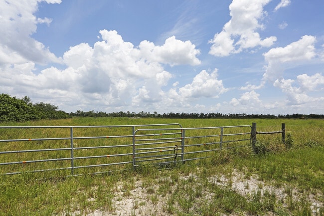
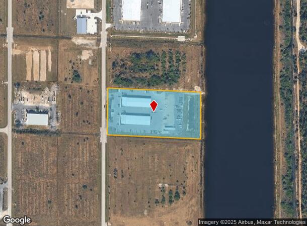
8326 Northup Dr
Punta Gorda, FL
Woodland Estates
412314400016
14 41 23 P5 4.98 AC M/L BEG AT NE COR OF SW 1/ 4 THENCE W 1307.14 FT S 329.22 FT TO POB THENCE CONT S 329.22 FT E 658.44 FT N 329.22 FT W 658.44 FT TO POB. F/K/A LT 3 BLK A WOODLAND ESTATES & LT 2 BLK I WOODLAND ACRES & ADJACENT ROW AS DESCRIBED IN O
Warehouse
Charlotte
X
Florida
12015C0261G
3
2024
4.98 AC
2025
Charlotte County
010200
Southwest Florida
23,880 SF
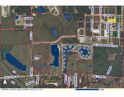
DEMOGRAPHICS near 8326 Northup Dr
1 Mile
3 Mile
5 Mile
2024 Total Population
919
6,276
27,871
2029 Population
1,084
7,459
33,494
Pop Growth 2024-2029
+ 17.95%
+ 18.85%
+ 20.18%
Average Age
49
52
54
2024 Total Households
379
2,577
13,159
HH Growth 2024-2029
+ 18.21%
+ 19.25%
+ 20.42%
Median Household Inc
$60,234
$60,092
$51,962
Avg Household Size
2.40
2.20
2.00
2024 Avg HH Vehicles
2.00
2.00
2.00
Median Home Value
$228,703
$174,610
$245,835
Median Year Built
1992
1998
1994
Nearby Places
Map Layers
Map Styles
 Street
 Aerial
- Restaurants
- Banks
- Shops
- Fitness
- Groceries
PUBLIC TRANSPORTATION
AIRPORT
Punta Gorda
DRIVE
WALK
Distance
Punta Gorda
9 min
2.6 mi
Southwest Florida International
DRIVE
WALK
Distance
Southwest Florida International
48 min
35.7 mi
Freight Ports
Port Manatee
DRIVE
WALK
Distance
Port Manatee
93 min
75.9 mi
Nearby Properties
Address
Land Use
TOTAL SIZE
Lot Size
Zoning
Address
Land Use
TOTAL SIZE
Lot Size
Zoning
164,121 SF
44.20 AC
ECAP
Address
Land Use
TOTAL SIZE
Lot Size
Zoning
161,439 SF
171 AC
RE1
Address
Land Use
TOTAL SIZE
Lot Size
Zoning
265,949 SF
22.80 AC
PD-CC
Address
Land Use
TOTAL SIZE
Lot Size
Zoning
253,440 SF
30.47 AC
ECAP
Address
Land Use
TOTAL SIZE
Lot Size
Zoning
378,000 SF
29.24 AC
ECAP
Address
Land Use
TOTAL SIZE
Lot Size
Zoning
345,043 SF
33.12 AC
ECAP
Address
Land Use
TOTAL SIZE
Lot Size
Zoning
62,415 SF
281.65 AC
ECAP
Address
Land Use
TOTAL SIZE
Lot Size
Zoning
198,916 SF
25.79 AC
HC
Address
Land Use
TOTAL SIZE
Lot Size
Zoning
385,350 SF
374.81 AC
ECAP
Address
Land Use
TOTAL SIZE
Lot Size
Zoning
134,308 SF
16 AC
RSF3.5
Address
Land Use
TOTAL SIZE
Lot Size
Zoning
8,406 SF
31.48 AC
ECAP
Address
Land Use
TOTAL SIZE
Lot Size
Zoning
136.11 AC
ECAP
Address
Land Use
TOTAL SIZE
Lot Size
Zoning
13,260 SF
2.27 AC
CG
Address
Land Use
TOTAL SIZE
Lot Size
Zoning
60,000 SF
9.87 AC
ECAP
Address
Land Use
TOTAL SIZE
Lot Size
Zoning
63,770 SF
5 AC
ECAP
Address
Land Use
TOTAL SIZE
Lot Size
Zoning
15,134 SF
2.03 AC
CG
Address
Land Use
TOTAL SIZE
Lot Size
Zoning
60,000 SF
1.44 AC
ECAP
Address
Land Use
TOTAL SIZE
Lot Size
Zoning
40,000 SF
20 AC
ECAP
Address
Land Use
TOTAL SIZE
Lot Size
Zoning
30,719 SF
107.17 AC
PKR
Address
Land Use
TOTAL SIZE
Lot Size
Zoning
642 AC
ES
Address
Land Use
TOTAL SIZE
Lot Size
Zoning
18.93 AC
HC
Address
Land Use
TOTAL SIZE
Lot Size
Zoning
68,773 SF
8.05 AC
ECAP
Address
Land Use
TOTAL SIZE
Lot Size
Zoning
17.81 AC
HC
Address
Land Use
TOTAL SIZE
Lot Size
Zoning
34,854 SF
655 AC
ES
Address
Land Use
TOTAL SIZE
Lot Size
Zoning
Address
Land Use
TOTAL SIZE
Lot Size
Zoning
12,408 SF
1.92 AC
CG
Address
Land Use
TOTAL SIZE
Lot Size
Zoning
22,597 SF
3.43 AC
HC
Address
Land Use
TOTAL SIZE
Lot Size
Zoning
7,128 SF
0.76 AC
ECAP
Address
Land Use
TOTAL SIZE
Lot Size
Zoning
636 AC
ES
Address
Land Use
TOTAL SIZE
Lot Size
Zoning
20,271 SF
6.26 AC
CG
The World's #1 Commercial Real Estate Marketplace
Connect with us
© 2025 CoStar Group
The information above has been obtained from sources believed reliable. While we do not doubt its accuracy we have not verified it and make no guarantee, warranty or representation about it. It is your responsibility to independently confirm its accuracy and completeness. Any projections, opinions, assumptions, or estimates used are for example only and do not represent the current or future performance of the property. The value of this transaction to you depends on tax and other factors which should be evaluated by your tax, financial, and legal advisors. You and your advisors should conduct a careful, independent investigation of the property to determine to your satisfaction the suitability of the property for your needs.