Property Record
833 2Nd St, Brentwood, CA 94513
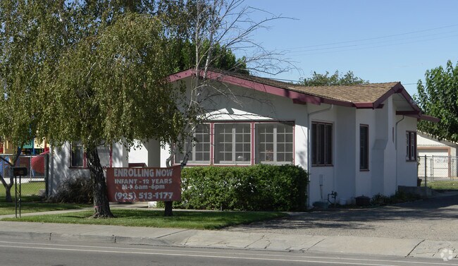


Property Detail
833 2Nd St
Oakland-Fremont-Berkeley, CA
TOWN OF BRENTWOOD LOTS 25 & 26 BLK G
013-070-004-0
CONTRA COSTA
Religious
California
B and X Area of moderate flood hazard, usually the area between the limits of the 100-year and 500-year floods.
25,26
2025
0.17 AC
2025
Antioch/Pittsburg
303107
East Bay/Oakland
1,343 SF
NEARBY LISTINGS FOR SALE OR LEASE
DEMOGRAPHICS near 833 2Nd St
1 mile
3 mile
5 mile
2025 Total Population
18,995
69,359
141,791
2030 Population
19,229
70,251
144,106
Pop Growth 2025-2030
+ 1.23%
+ 1.29%
+ 1.63%
Average Age
37
40
39
2025 Total Households
6,001
22,277
43,767
HH Growth 2025-2030
+ 1.25%
+ 1.36%
+ 1.67%
Median Household Inc
$122,695
$140,170
$139,254
Avg Household Size
3.10
3.10
3.20
2025 Avg HH Vehicles
2.00
2.00
3.00
Median Home Value
$745,119
$785,328
$757,529
Median Year Built
2000
2002
2001
Nearby Places
Map Layers
Map Styles
 Street
 Aerial
Layers
 Traffic
 Biking
Places
Listings with unknown addresses are not visible on the map
- Restaurants
- Banks
- Shops
- Fitness
- Groceries
PUBLIC TRANSPORTATION
AIRPORT
Stockton Metro
Drive
Walk
Distance
Stockton Metro
49 min
30.8 mi
Metro Oakland International
Drive
Walk
Distance
Metro Oakland International
68 min
49.7 mi
Freight Ports
Port of Stockton
Drive
Walk
Distance
Port of Stockton
44 min
28.6 mi
Nearby Properties
Address
Land Use
TOTAL SIZE
Lot Size
Zoning
Address
Land Use
TOTAL SIZE
Lot Size
Zoning
39,038 SF
14.43 AC
Address
Land Use
TOTAL SIZE
Lot Size
Zoning
55.08 AC
Address
Land Use
TOTAL SIZE
Lot Size
Zoning
14,968 SF
7.07 AC
Address
Land Use
TOTAL SIZE
Lot Size
Zoning
129,450 SF
6.69 AC
Address
Land Use
TOTAL SIZE
Lot Size
Zoning
67,691 SF
28.26 AC
Address
Land Use
TOTAL SIZE
Lot Size
Zoning
67,133 SF
8.65 AC
Address
Land Use
TOTAL SIZE
Lot Size
Zoning
117,486 SF
7.26 AC
Address
Land Use
TOTAL SIZE
Lot Size
Zoning
15,000 SF
17.17 AC
Address
Land Use
TOTAL SIZE
Lot Size
Zoning
59,066 SF
3.89 AC
Address
Land Use
TOTAL SIZE
Lot Size
Zoning
113,902 SF
9.71 AC
Address
Land Use
TOTAL SIZE
Lot Size
Zoning
141,367 SF
4.72 AC
Address
Land Use
TOTAL SIZE
Lot Size
Zoning
107,230 SF
1.54 AC
Address
Land Use
TOTAL SIZE
Lot Size
Zoning
112,715 SF
4.48 AC
Address
Land Use
TOTAL SIZE
Lot Size
Zoning
51,980 SF
3.70 AC
Address
Land Use
TOTAL SIZE
Lot Size
Zoning
62,441 SF
5.65 AC
Address
Land Use
TOTAL SIZE
Lot Size
Zoning
65,898 SF
8.72 AC
Address
Land Use
TOTAL SIZE
Lot Size
Zoning
23,822 SF
7.16 AC
Address
Land Use
TOTAL SIZE
Lot Size
Zoning
10.44 AC
Address
Land Use
TOTAL SIZE
Lot Size
Zoning
40,995 SF
10.59 AC
Address
Land Use
TOTAL SIZE
Lot Size
Zoning
96,956 SF
10.49 AC
Address
Land Use
TOTAL SIZE
Lot Size
Zoning
32,198 SF
1.08 AC
Address
Land Use
TOTAL SIZE
Lot Size
Zoning
47,642 SF
3.10 AC
Address
Land Use
TOTAL SIZE
Lot Size
Zoning
36,915 SF
6.90 AC
Address
Land Use
TOTAL SIZE
Lot Size
Zoning
18,700 SF
19.01 AC
Address
Land Use
TOTAL SIZE
Lot Size
Zoning
7,818 SF
9.03 AC
Address
Land Use
TOTAL SIZE
Lot Size
Zoning
71,680 SF
4.82 AC
Address
Land Use
TOTAL SIZE
Lot Size
Zoning
103,852 SF
9.37 AC
Address
Land Use
TOTAL SIZE
Lot Size
Zoning
6,567 SF
1.87 AC
Address
Land Use
TOTAL SIZE
Lot Size
Zoning
92,830 SF
4.45 AC
Address
Land Use
TOTAL SIZE
Lot Size
Zoning
94,156 SF
4.73 AC
The World's #1 Commercial Real Estate Marketplace
Connect with us
© 2026 CoStar Group
The information above has been obtained from sources believed reliable. While we do not doubt its accuracy we have not verified it and make no guarantee, warranty or representation about it. It is your responsibility to independently confirm its accuracy and completeness. Any projections, opinions, assumptions, or estimates used are for example only and do not represent the current or future performance of the property. The value of this transaction to you depends on tax and other factors which should be evaluated by your tax, financial, and legal advisors. You and your advisors should conduct a careful, independent investigation of the property to determine to your satisfaction the suitability of the property for your needs.