Property Record
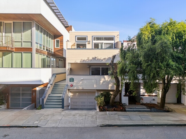
833 Corbett Ave, San Francisco, CA 94131

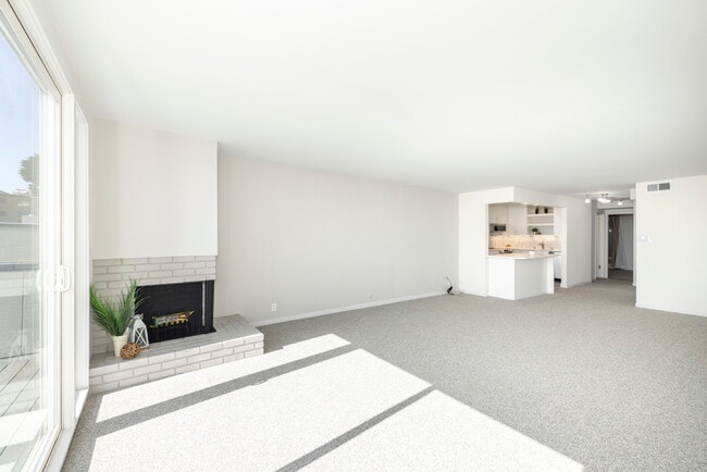
This Property Is For Sale
NEARBY LISTINGS FOR SALE OR LEASE
Property Detail
833 Corbett Ave
San Francisco-Redwood City-South San Francisco, CA
The Market Street Homestead Association
2778-034
San Francisco
Apartment
California
2024
34
2025
0.10 AC
020402
Castro
4,995 SF
San Francisco
DEMOGRAPHICS near 833 Corbett Ave
1 Mile
3 Mile
5 Mile
2024 Total Population
50,310
546,347
850,898
2029 Population
47,259
511,022
798,029
Pop Growth 2024-2029
(6.06%)
(6.47%)
(6.21%)
Average Age
44
43
43
2024 Total Households
23,221
227,395
351,219
HH Growth 2024-2029
(7.23%)
(7.39%)
(7.03%)
Median Household Inc
$195,785
$132,447
$129,868
Avg Household Size
2.10
2.20
2.30
2024 Avg HH Vehicles
1.00
1.00
1.00
Median Home Value
$1,112,227
$1,104,240
$1,094,098
Median Year Built
1948
1948
1949
Nearby Places
Map Layers
Map Styles
 Street
 Aerial
- Restaurants
- Banks
- Shops
- Fitness
- Groceries
PUBLIC TRANSPORTATION
TRANSIT/SUBWAY
Castro (K Ingleside - San Francisco Municipal Railway (MUNI Metro), L Taraval - San Francisco Municipal Railway (MUNI Metro), M Ocean View - San Francisco Municipal Railway (MUNI Metro), S Castro Shuttle - San Francisco Municipal Railway (MUNI Metro), T Third Street - San Francisco Municipal Railway (MUNI Metro))
DRIVE
WALK
Distance
Castro (K Ingleside - San Francisco Municipal Railway (MUNI Metro), L Taraval - San Francisco Municipal Railway (MUNI Metro), M Ocean View - San Francisco Municipal Railway (MUNI Metro), S Castro Shuttle - San Francisco Municipal Railway (MUNI Metro), T Third Street - San Francisco Municipal Railway (MUNI Metro))
5 min
19 min
1.0 mi
Church St & 22Nd St (CHURCH - San Francisco Municipal Railway (MUNI Metro), J Church - San Francisco Municipal Railway (MUNI Metro))
DRIVE
WALK
Distance
Church St & 22Nd St (CHURCH - San Francisco Municipal Railway (MUNI Metro), J Church - San Francisco Municipal Railway (MUNI Metro))
5 min
20 min
1.0 mi
COMMUTER RAIL
22Nd Street Caltrain Station Southbound (Express - Caltrain (Caltrain), Limited - Caltrain (Caltrain), Local Weekday - Caltrain (Caltrain), Local Weekend - Caltrain (Caltrain))
DRIVE
WALK
Distance
22Nd Street Caltrain Station Southbound (Express - Caltrain (Caltrain), Limited - Caltrain (Caltrain), Local Weekday - Caltrain (Caltrain), Local Weekend - Caltrain (Caltrain))
11 min
4.4 mi
22Nd Street (Caltrain - Caltrain (Caltrain))
DRIVE
WALK
Distance
22Nd Street (Caltrain - Caltrain (Caltrain))
11 min
4.4 mi
AIRPORT
San Francisco International
DRIVE
WALK
Distance
San Francisco International
24 min
13.9 mi
Metro Oakland International
DRIVE
WALK
Distance
Metro Oakland International
38 min
23.1 mi
Freight Ports
Port of San Francisco
DRIVE
WALK
Distance
Port of San Francisco
14 min
5.0 mi
Nearby Properties
Address
Land Use
TOTAL SIZE
Lot Size
Zoning
Address
Land Use
TOTAL SIZE
Lot Size
Zoning
1,015,000 SF
2.43 AC
RC4
Address
Land Use
TOTAL SIZE
Lot Size
Zoning
750,370 SF
3.25 AC
MBR3
Address
Land Use
TOTAL SIZE
Lot Size
Zoning
248,303 SF
4.35 AC
Address
Land Use
TOTAL SIZE
Lot Size
Zoning
717,234 SF
3.47 AC
UMU
Address
Land Use
TOTAL SIZE
Lot Size
Zoning
266,143 SF
4 AC
C-3-R
Address
Land Use
TOTAL SIZE
Lot Size
Zoning
696,431 SF
0.97 AC
C3G
Address
Land Use
TOTAL SIZE
Lot Size
Zoning
1.52 AC
C3G
Address
Land Use
TOTAL SIZE
Lot Size
Zoning
1,424,230 SF
2.60 AC
C3G
Address
Land Use
TOTAL SIZE
Lot Size
Zoning
2.74 AC
Address
Land Use
TOTAL SIZE
Lot Size
Zoning
313,306 SF
1.23 AC
WMUG
Address
Land Use
TOTAL SIZE
Lot Size
Zoning
393,918 SF
3.36 AC
WMUG
Address
Land Use
TOTAL SIZE
Lot Size
Zoning
24.37 AC
Address
Land Use
TOTAL SIZE
Lot Size
Zoning
674,317 SF
3.36 AC
UMU
Address
Land Use
TOTAL SIZE
Lot Size
Zoning
649,376 SF
0.93 AC
C3S
Address
Land Use
TOTAL SIZE
Lot Size
Zoning
2.93 AC
Address
Land Use
TOTAL SIZE
Lot Size
Zoning
342,727 SF
1.36 AC
C3G
Address
Land Use
TOTAL SIZE
Lot Size
Zoning
411,904 SF
21.74 AC
C2
Address
Land Use
TOTAL SIZE
Lot Size
Zoning
291,522 SF
6.66 AC
CM
Address
Land Use
TOTAL SIZE
Lot Size
Zoning
250,884 SF
1.66 AC
MB-RA
Address
Land Use
TOTAL SIZE
Lot Size
Zoning
718 SF
18.55 AC
RH2
Address
Land Use
TOTAL SIZE
Lot Size
Zoning
345,000 SF
1.74 AC
WMUG
Address
Land Use
TOTAL SIZE
Lot Size
Zoning
2.22 AC
M1
Address
Land Use
TOTAL SIZE
Lot Size
Zoning
564,614 SF
0.90 AC
C3S
Address
Land Use
TOTAL SIZE
Lot Size
Zoning
246,069 SF
0.69 AC
Address
Land Use
TOTAL SIZE
Lot Size
Zoning
89,551 SF
0.73 AC
RC4
Address
Land Use
TOTAL SIZE
Lot Size
Zoning
332,221 SF
1.17 AC
Address
Land Use
TOTAL SIZE
Lot Size
Zoning
333,244 SF
2.67 AC
UMU
Address
Land Use
TOTAL SIZE
Lot Size
Zoning
450,000 SF
1.07 AC
C3G
Address
Land Use
TOTAL SIZE
Lot Size
Zoning
337,664 SF
0.36 AC
C3G
Address
Land Use
TOTAL SIZE
Lot Size
Zoning
368,488 SF
1.06 AC
C3R
The World's #1 Commercial Real Estate Marketplace
Connect with us
© 2025 CoStar Group
The information above has been obtained from sources believed reliable. While we do not doubt its accuracy we have not verified it and make no guarantee, warranty or representation about it. It is your responsibility to independently confirm its accuracy and completeness. Any projections, opinions, assumptions, or estimates used are for example only and do not represent the current or future performance of the property. The value of this transaction to you depends on tax and other factors which should be evaluated by your tax, financial, and legal advisors. You and your advisors should conduct a careful, independent investigation of the property to determine to your satisfaction the suitability of the property for your needs.