Property Record
31 Longview Rd, Andover, NJ 07821
NEARBY LISTINGS FOR SALE OR LEASE
-
-
View all Andover listings for sale on LoopNet.com
Property Detail
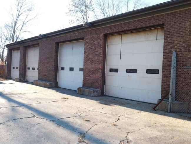
31 Longview Rd
02-00105-0000-00003
ADDITIONAL LOTS: 2,4
Sfr
Sussex
X
New Jersey
34037C0315E
1
2024
0.19 AC
2025
Sussex County
373500
Northern New Jersey
840 SF
Newark, NJ-PA
DEMOGRAPHICS near 31 Longview Rd
1 Mile
3 Mile
5 Mile
2024 Total Population
1,990
16,850
37,940
2029 Population
1,990
17,015
38,339
Pop Growth 2024-2029
0.00%
+ 0.98%
+ 1.05%
Average Age
47
43
43
2024 Total Households
598
6,324
14,236
HH Growth 2024-2029
(0.17%)
+ 1.00%
+ 1.09%
Median Household Inc
$141,015
$114,472
$115,619
Avg Household Size
2.60
2.50
2.60
2024 Avg HH Vehicles
2.00
2.00
2.00
Median Home Value
$418,792
$367,948
$370,988
Median Year Built
1979
1968
1972
Nearby Places
Map Layers
Map Styles
 Street
 Aerial
- Restaurants
- Banks
- Shops
- Fitness
- Groceries
SALE & LEASE HISTORY
LISTING DATE
SALE/LEASE

Sep 24, 2016
For Sale
Nearby Properties
Address
Land Use
TOTAL SIZE
Lot Size
Zoning
Address
Land Use
TOTAL SIZE
Lot Size
Zoning
4.56 AC
T-4
Address
Land Use
TOTAL SIZE
Lot Size
Zoning
47,400 SF
71 AC
SD-4
Address
Land Use
TOTAL SIZE
Lot Size
Zoning
12,504 SF
3.14 AC
SD-3
Address
Land Use
TOTAL SIZE
Lot Size
Zoning
Address
Land Use
TOTAL SIZE
Lot Size
Zoning
2.09 AC
T-5
Address
Land Use
TOTAL SIZE
Lot Size
Zoning
20.62 AC
HCMF
Address
Land Use
TOTAL SIZE
Lot Size
Zoning
72,992 SF
4.75 AC
SD-3
Address
Land Use
TOTAL SIZE
Lot Size
Zoning
50,814 SF
8.62 AC
SD-3
Address
Land Use
TOTAL SIZE
Lot Size
Zoning
26,185 SF
552.92 AC
I/A
Address
Land Use
TOTAL SIZE
Lot Size
Zoning
26,611 SF
1.21 AC
T-5+
Address
Land Use
TOTAL SIZE
Lot Size
Zoning
10 AC
RR
Address
Land Use
TOTAL SIZE
Lot Size
Zoning
50,659 SF
9.90 AC
C-2
Address
Land Use
TOTAL SIZE
Lot Size
Zoning
45,532 SF
10.31 AC
R1
Address
Land Use
TOTAL SIZE
Lot Size
Zoning
1,140 SF
1.45 AC
SD-6
Address
Land Use
TOTAL SIZE
Lot Size
Zoning
8.90 AC
HCMF
Address
Land Use
TOTAL SIZE
Lot Size
Zoning
11 AC
SD-6
Address
Land Use
TOTAL SIZE
Lot Size
Zoning
0.56 AC
T-5
Address
Land Use
TOTAL SIZE
Lot Size
Zoning
58,607 SF
26.13 AC
RR
Address
Land Use
TOTAL SIZE
Lot Size
Zoning
14,866 SF
2.09 AC
T-5
Address
Land Use
TOTAL SIZE
Lot Size
Zoning
76,409 SF
29.80 AC
R2
Address
Land Use
TOTAL SIZE
Lot Size
Zoning
Address
Land Use
TOTAL SIZE
Lot Size
Zoning
1.91 AC
SD-3
Address
Land Use
TOTAL SIZE
Lot Size
Zoning
3,280 SF
17.30 AC
MF
Address
Land Use
TOTAL SIZE
Lot Size
Zoning
11,843 SF
9.68 AC
RR
Address
Land Use
TOTAL SIZE
Lot Size
Zoning
35,884 SF
4.73 AC
C-2
Address
Land Use
TOTAL SIZE
Lot Size
Zoning
51,292 SF
4.11 AC
SD-3
Address
Land Use
TOTAL SIZE
Lot Size
Zoning
83,930 SF
7.43 AC
T-3
Address
Land Use
TOTAL SIZE
Lot Size
Zoning
8.09 AC
HCMF
Address
Land Use
TOTAL SIZE
Lot Size
Zoning
38,004 SF
3.08 AC
R2
Address
Land Use
TOTAL SIZE
Lot Size
Zoning
528 SF
10.85 AC
RR
The World's #1 Commercial Real Estate Marketplace
Connect with us
© 2025 CoStar Group
The information above has been obtained from sources believed reliable. While we do not doubt its accuracy we have not verified it and make no guarantee, warranty or representation about it. It is your responsibility to independently confirm its accuracy and completeness. Any projections, opinions, assumptions, or estimates used are for example only and do not represent the current or future performance of the property. The value of this transaction to you depends on tax and other factors which should be evaluated by your tax, financial, and legal advisors. You and your advisors should conduct a careful, independent investigation of the property to determine to your satisfaction the suitability of the property for your needs.