Property Record
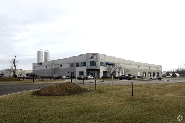
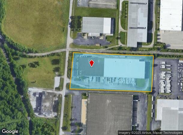
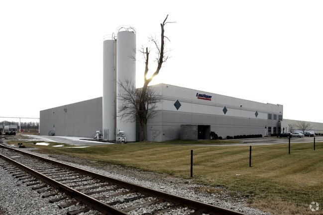
8331 Cane Run Rd, Louisville, KY 40258
NEARBY LISTINGS FOR SALE OR LEASE
Property Detail
8331 Cane Run Rd
281801430000
Riverport
Warehouse
7.044 AC+-
X
Jefferson
21111C0087F
Kentucky
2025
7.04 AC
2025
W Outlying Jefferson Cnty
012703
Louisville
51,756 SF
Louisville-Jefferson County, KY-IN
DEMOGRAPHICS near 8331 Cane Run Rd
1 Mile
3 Mile
5 Mile
2024 Total Population
2,290
37,543
84,844
2029 Population
2,259
36,915
83,727
Pop Growth 2024-2029
(1.35%)
(1.67%)
(1.32%)
Average Age
39
40
40
2024 Total Households
882
15,010
34,214
HH Growth 2024-2029
(1.25%)
(1.71%)
(1.35%)
Median Household Inc
$71,465
$59,980
$56,449
Avg Household Size
2.50
2.40
2.40
2024 Avg HH Vehicles
2.00
2.00
2.00
Median Home Value
$143,703
$159,490
$166,978
Median Year Built
1968
1966
1968
Nearby Places
Map Layers
Map Styles
 Street
 Aerial
- Restaurants
- Banks
- Shops
- Fitness
- Groceries
PUBLIC TRANSPORTATION
AIRPORT
Louisville Muhammad Ali International
DRIVE
WALK
Distance
Louisville Muhammad Ali International
23 min
12.4 mi
Nearby Properties
Address
Land Use
TOTAL SIZE
Lot Size
Zoning
Address
Land Use
TOTAL SIZE
Lot Size
Zoning
505,160 SF
34.92 AC
EZ1-ENTERP
Address
Land Use
TOTAL SIZE
Lot Size
Zoning
330,000 SF
21.31 AC
EZ1-ENTERP
Address
Land Use
TOTAL SIZE
Lot Size
Zoning
241,462 SF
25.28 AC
EZ1-ENTERP
Address
Land Use
TOTAL SIZE
Lot Size
Zoning
225,000 SF
21.28 AC
EZ1-ENTERP
Address
Land Use
TOTAL SIZE
Lot Size
Zoning
556,859 SF
29.19 AC
EZ1-ENTERP
Address
Land Use
TOTAL SIZE
Lot Size
Zoning
488,952 SF
32.29 AC
EZ1-ENTERP
Address
Land Use
TOTAL SIZE
Lot Size
Zoning
230,424 SF
27.05 AC
EZ1-ENTERP
Address
Land Use
TOTAL SIZE
Lot Size
Zoning
210,898 SF
16.09 AC
EZ1-ENTERP
Address
Land Use
TOTAL SIZE
Lot Size
Zoning
24.92 AC
EZ1-ENTERP
Address
Land Use
TOTAL SIZE
Lot Size
Zoning
26.79 AC
R4-RESIDEN
Address
Land Use
TOTAL SIZE
Lot Size
Zoning
16.14 AC
Address
Land Use
TOTAL SIZE
Lot Size
Zoning
427,337 SF
50.32 AC
EZ1-ENTERP
Address
Land Use
TOTAL SIZE
Lot Size
Zoning
519,508 SF
25.18 AC
EZ1-ENTERP
Address
Land Use
TOTAL SIZE
Lot Size
Zoning
Address
Land Use
TOTAL SIZE
Lot Size
Zoning
23.42 AC
R1-RESIDEN
Address
Land Use
TOTAL SIZE
Lot Size
Zoning
418,872 SF
19.81 AC
EZ1-ENTERP
Address
Land Use
TOTAL SIZE
Lot Size
Zoning
2,880 SF
17.14 AC
R6-RESIDEN
Address
Land Use
TOTAL SIZE
Lot Size
Zoning
8.70 AC
R6-RESIDEN
Address
Land Use
TOTAL SIZE
Lot Size
Zoning
17,072 SF
13.53 AC
R5A-RESIDE
Address
Land Use
TOTAL SIZE
Lot Size
Zoning
21.41 AC
R5A-RESIDE
Address
Land Use
TOTAL SIZE
Lot Size
Zoning
380,389 SF
31.06 AC
EZ1-ENTERP
Address
Land Use
TOTAL SIZE
Lot Size
Zoning
327,654 SF
16.40 AC
EZ1-ENTERP
Address
Land Use
TOTAL SIZE
Lot Size
Zoning
310,552 SF
24 AC
EZ1-ENTERP
Address
Land Use
TOTAL SIZE
Lot Size
Zoning
275,048 SF
17.62 AC
EZ1-ENTERP
Address
Land Use
TOTAL SIZE
Lot Size
Zoning
280,000 SF
30 AC
EZ1-ENTERP
Address
Land Use
TOTAL SIZE
Lot Size
Zoning
325,600 SF
17.15 AC
EZ1-ENTERP
Address
Land Use
TOTAL SIZE
Lot Size
Zoning
267,600 SF
28.63 AC
EZ1-ENTERP
Address
Land Use
TOTAL SIZE
Lot Size
Zoning
19,032 SF
5.88 AC
C1-COMMERC
Address
Land Use
TOTAL SIZE
Lot Size
Zoning
169,360 SF
14.52 AC
EZ1-ENTERP
Address
Land Use
TOTAL SIZE
Lot Size
Zoning
300,000 SF
18.27 AC
EZ1-ENTERP
The World's #1 Commercial Real Estate Marketplace
Connect with us
© 2026 CoStar Group
The information above has been obtained from sources believed reliable. While we do not doubt its accuracy we have not verified it and make no guarantee, warranty or representation about it. It is your responsibility to independently confirm its accuracy and completeness. Any projections, opinions, assumptions, or estimates used are for example only and do not represent the current or future performance of the property. The value of this transaction to you depends on tax and other factors which should be evaluated by your tax, financial, and legal advisors. You and your advisors should conduct a careful, independent investigation of the property to determine to your satisfaction the suitability of the property for your needs.