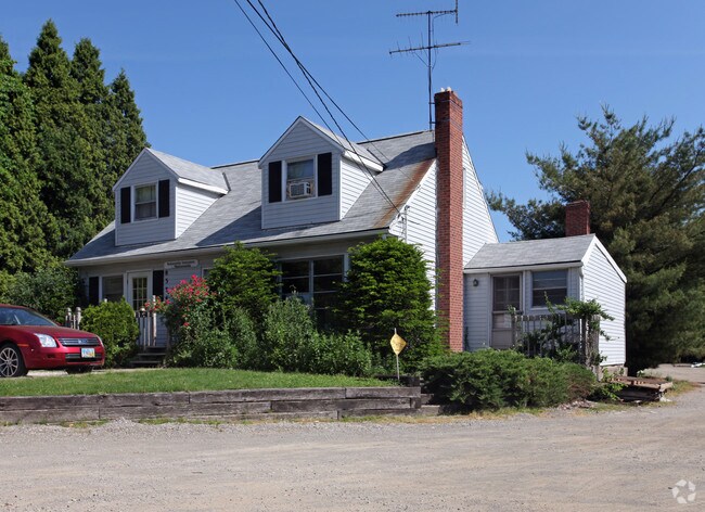
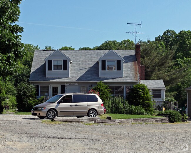
Property Record
8334 Washington St, Chagrin Falls, OH 44023
NEARBY LISTINGS FOR SALE OR LEASE
Property Detail
8334 Washington St
02-250500
LOTS 25 & 26 TR 1
Publicstorage
Geauga
X
Ohio
39055C0211D
25-26
2024
3.27 AC
2024
Geauga County
311700
Cleveland
1,690 SF
Cleveland-Elyria, OH
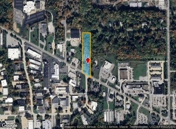
DEMOGRAPHICS near 8334 Washington St
1 Mile
3 Mile
5 Mile
2024 Total Population
2,736
20,732
39,261
2029 Population
2,723
20,775
39,070
Pop Growth 2024-2029
(0.48%)
+ 0.21%
(0.49%)
Average Age
50
46
45
2024 Total Households
833
7,960
14,782
HH Growth 2024-2029
(0.60%)
+ 0.08%
(0.58%)
Median Household Inc
$150,318
$122,795
$124,286
Avg Household Size
2.60
2.50
2.60
2024 Avg HH Vehicles
2.00
2.00
2.00
Median Home Value
$442,973
$397,752
$394,890
Median Year Built
1979
1973
1974
Nearby Places
Map Layers
Map Styles
 Street
 Aerial
- Restaurants
- Banks
- Shops
- Fitness
- Groceries
PUBLIC TRANSPORTATION
AIRPORT
Cleveland-Hopkins International
DRIVE
WALK
Distance
Cleveland-Hopkins International
46 min
31.3 mi
Akron-Canton Regional
DRIVE
WALK
Distance
Akron-Canton Regional
66 min
49.0 mi
Nearby Properties
Address
Land Use
TOTAL SIZE
Lot Size
Zoning
Address
Land Use
TOTAL SIZE
Lot Size
Zoning
7,531 SF
85.32 AC
R3A
Address
Land Use
TOTAL SIZE
Lot Size
Zoning
227,389 SF
27.75 AC
R5A
Address
Land Use
TOTAL SIZE
Lot Size
Zoning
225,206 SF
55.30 AC
PI
Address
Land Use
TOTAL SIZE
Lot Size
Zoning
79,668 SF
14 AC
R5A
Address
Land Use
TOTAL SIZE
Lot Size
Zoning
18,614 SF
45.79 AC
R3A
Address
Land Use
TOTAL SIZE
Lot Size
Zoning
100,601 SF
40.70 AC
R5A
Address
Land Use
TOTAL SIZE
Lot Size
Zoning
2,620 SF
15.81 AC
R5A
Address
Land Use
TOTAL SIZE
Lot Size
Zoning
120,010 SF
11.92 AC
CB
Address
Land Use
TOTAL SIZE
Lot Size
Zoning
3,124 SF
60.91 AC
R3A
Address
Land Use
TOTAL SIZE
Lot Size
Zoning
93,610 SF
4.45 AC
RL
Address
Land Use
TOTAL SIZE
Lot Size
Zoning
77,296 SF
3.33 AC
RB
Address
Land Use
TOTAL SIZE
Lot Size
Zoning
67,861 SF
24.84 AC
R1A
Address
Land Use
TOTAL SIZE
Lot Size
Zoning
30,295 SF
7.12 AC
R5A
Address
Land Use
TOTAL SIZE
Lot Size
Zoning
86,896 SF
1.55 AC
PI
Address
Land Use
TOTAL SIZE
Lot Size
Zoning
58,075 SF
10.63 AC
PI
Address
Land Use
TOTAL SIZE
Lot Size
Zoning
125,740 SF
33.72 AC
RL
Address
Land Use
TOTAL SIZE
Lot Size
Zoning
36,827 SF
6.54 AC
R5A
Address
Land Use
TOTAL SIZE
Lot Size
Zoning
43,221 SF
14.17 AC
LIR
Address
Land Use
TOTAL SIZE
Lot Size
Zoning
34,354 SF
1.04 AC
PI
Address
Land Use
TOTAL SIZE
Lot Size
Zoning
51,653 SF
5.76 AC
CB
Address
Land Use
TOTAL SIZE
Lot Size
Zoning
56,518 SF
5.86 AC
RMF-10
Address
Land Use
TOTAL SIZE
Lot Size
Zoning
73.85 AC
C
Address
Land Use
TOTAL SIZE
Lot Size
Zoning
21,960 SF
0.42 AC
CS
Address
Land Use
TOTAL SIZE
Lot Size
Zoning
68,022 SF
3 AC
R3A
Address
Land Use
TOTAL SIZE
Lot Size
Zoning
15,098 SF
1.32 AC
PI
Address
Land Use
TOTAL SIZE
Lot Size
Zoning
38,845 SF
8.84 AC
B3
Address
Land Use
TOTAL SIZE
Lot Size
Zoning
65,956 SF
1.17 AC
RB
Address
Land Use
TOTAL SIZE
Lot Size
Zoning
6,798 SF
0.33 AC
R1-50
Address
Land Use
TOTAL SIZE
Lot Size
Zoning
45,366 SF
3.10 AC
RL
Address
Land Use
TOTAL SIZE
Lot Size
Zoning
35,911 SF
6.50 AC
CB
The World's #1 Commercial Real Estate Marketplace
Connect with us
© 2025 CoStar Group
The information above has been obtained from sources believed reliable. While we do not doubt its accuracy we have not verified it and make no guarantee, warranty or representation about it. It is your responsibility to independently confirm its accuracy and completeness. Any projections, opinions, assumptions, or estimates used are for example only and do not represent the current or future performance of the property. The value of this transaction to you depends on tax and other factors which should be evaluated by your tax, financial, and legal advisors. You and your advisors should conduct a careful, independent investigation of the property to determine to your satisfaction the suitability of the property for your needs.