Property Record
8338 Spring Cypress Rd, Spring, TX 77379
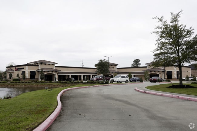


Property Detail
8338 Spring Cypress Rd
1315000010001
PT RES A BLK 1 (POLLUTION CONTROL*1315000010003) EASTLOCH CROSSING
Medicalbuilding
HARRIS
B and X Area of moderate flood hazard, usually the area between the limits of the 100-year and 500-year floods.
Texas
2024
2.30 AC
2025
Northwest Outlier
554804
Houston
17,304 SF
Houston-Pasadena-The Woodlands, TX
NEARBY LISTINGS FOR SALE OR LEASE
DEMOGRAPHICS near 8338 Spring Cypress Rd
1 mile
3 mile
5 mile
2025 Total Population
8,497
98,712
260,488
2030 Population
8,999
104,993
277,199
Pop Growth 2025-2030
+ 5.91%
+ 6.36%
+ 6.42%
Average Age
41
38
38
2025 Total Households
2,855
32,954
92,037
HH Growth 2025-2030
+ 6.20%
+ 6.62%
+ 6.59%
Median Household Inc
$133,961
$108,561
$97,910
Avg Household Size
2.90
3.00
2.80
2025 Avg HH Vehicles
2.00
2.00
2.00
Median Home Value
$380,334
$348,526
$335,159
Median Year Built
1997
2002
2000
Nearby Places
Map Layers
Map Styles
 Street
 Aerial
Transit
 Traffic
 Biking
Places
Listings with unknown addresses are not visible on the map
- Restaurants
- Banks
- Shops
- Fitness
- Groceries
PUBLIC TRANSPORTATION
AIRPORT
George Bush Intcntl/Houston
Drive
Walk
Distance
George Bush Intcntl/Houston
30 min
20.7 mi
Freight Ports
Port of Houston
Drive
Walk
Distance
Port of Houston
50 min
31.8 mi
SALE & LEASE HISTORY
LISTING DATE
SALE/LEASE

Sep 28, 2016
For Lease
Oct 24, 2016
For Lease
Oct 06, 2022
For Lease
May 17, 2022
For Lease
Jul 05, 2017
For Lease
Nearby Properties
Address
Land Use
TOTAL SIZE
Lot Size
Zoning
Address
Land Use
TOTAL SIZE
Lot Size
Zoning
341,895 SF
17.53 AC
Address
Land Use
TOTAL SIZE
Lot Size
Zoning
507,035 SF
24.90 AC
Address
Land Use
TOTAL SIZE
Lot Size
Zoning
398,856 SF
12.76 AC
Address
Land Use
TOTAL SIZE
Lot Size
Zoning
322,733 SF
18.40 AC
Address
Land Use
TOTAL SIZE
Lot Size
Zoning
332,688 SF
24.57 AC
Address
Land Use
TOTAL SIZE
Lot Size
Zoning
294,931 SF
10.94 AC
Address
Land Use
TOTAL SIZE
Lot Size
Zoning
262,163 SF
8.63 AC
Address
Land Use
TOTAL SIZE
Lot Size
Zoning
249,950 SF
15.92 AC
Address
Land Use
TOTAL SIZE
Lot Size
Zoning
256,761 SF
8.78 AC
Address
Land Use
TOTAL SIZE
Lot Size
Zoning
267,082 SF
11.13 AC
Address
Land Use
TOTAL SIZE
Lot Size
Zoning
393,751 SF
17.08 AC
Address
Land Use
TOTAL SIZE
Lot Size
Zoning
371,761 SF
12.71 AC
Address
Land Use
TOTAL SIZE
Lot Size
Zoning
80,004 SF
4.41 AC
Address
Land Use
TOTAL SIZE
Lot Size
Zoning
348,658 SF
16.72 AC
Address
Land Use
TOTAL SIZE
Lot Size
Zoning
148,450 SF
18.26 AC
Address
Land Use
TOTAL SIZE
Lot Size
Zoning
222,479 SF
4.82 AC
Address
Land Use
TOTAL SIZE
Lot Size
Zoning
177,104 SF
14.30 AC
Address
Land Use
TOTAL SIZE
Lot Size
Zoning
127,570 SF
33.51 AC
Address
Land Use
TOTAL SIZE
Lot Size
Zoning
145,051 SF
6.10 AC
Address
Land Use
TOTAL SIZE
Lot Size
Zoning
214,862 SF
14.92 AC
Address
Land Use
TOTAL SIZE
Lot Size
Zoning
106,618 SF
12.48 AC
Address
Land Use
TOTAL SIZE
Lot Size
Zoning
223,873 SF
16.55 AC
Address
Land Use
TOTAL SIZE
Lot Size
Zoning
102,710 SF
14.90 AC
Address
Land Use
TOTAL SIZE
Lot Size
Zoning
224,669 SF
15.40 AC
Address
Land Use
TOTAL SIZE
Lot Size
Zoning
72,858 SF
7.25 AC
Address
Land Use
TOTAL SIZE
Lot Size
Zoning
135,586 SF
21.45 AC
Address
Land Use
TOTAL SIZE
Lot Size
Zoning
148,611 SF
5.84 AC
Address
Land Use
TOTAL SIZE
Lot Size
Zoning
215,011 SF
12.16 AC
Address
Land Use
TOTAL SIZE
Lot Size
Zoning
56,710 SF
4.51 AC
Address
Land Use
TOTAL SIZE
Lot Size
Zoning
152,390 SF
5.56 AC
The World's #1 Commercial Real Estate Marketplace
Connect with us
© 2026 CoStar Group
The information above has been obtained from sources believed reliable. While we do not doubt its accuracy we have not verified it and make no guarantee, warranty or representation about it. It is your responsibility to independently confirm its accuracy and completeness. Any projections, opinions, assumptions, or estimates used are for example only and do not represent the current or future performance of the property. The value of this transaction to you depends on tax and other factors which should be evaluated by your tax, financial, and legal advisors. You and your advisors should conduct a careful, independent investigation of the property to determine to your satisfaction the suitability of the property for your needs.