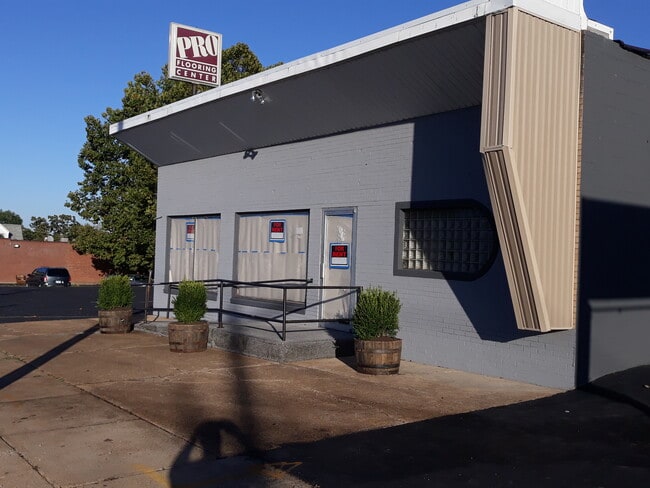
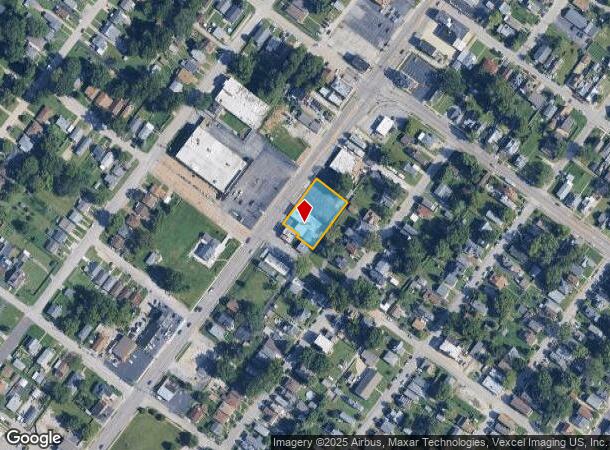
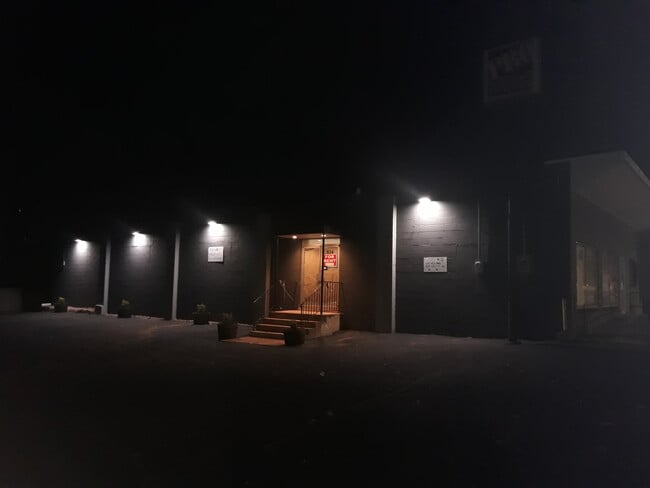
Property Record
834 Lemay Ferry Rd, Saint Louis, MO 63125
Current Lease Availabilities
NEARBY LISTINGS FOR SALE OR LEASE
Property Detail
834 Lemay Ferry Rd
St. Louis, MO-IL
Bismark Heights
27H-64-2111
BISMARK HEIGHTS BLK 1 LOTS 3 THRU 8 & LOT PT 2 27H640991 6 7 83 X
Storebuilding
St. Louis
X
Missouri
17133C0020F
3-8,2
2024
0.48 AC
2025
South County
220200
St. Louis
5,550 SF
DEMOGRAPHICS near 834 Lemay Ferry Rd
1 Mile
3 Mile
5 Mile
2024 Total Population
12,359
88,420
235,964
2029 Population
12,119
84,791
225,163
Pop Growth 2024-2029
(1.94%)
(4.10%)
(4.58%)
Average Age
41
42
41
2024 Total Households
5,054
39,680
106,797
HH Growth 2024-2029
(2.02%)
(4.22%)
(4.74%)
Median Household Inc
$54,490
$58,184
$60,605
Avg Household Size
2.30
2.20
2.10
2024 Avg HH Vehicles
2.00
2.00
2.00
Median Home Value
$129,216
$162,207
$187,163
Median Year Built
1950
1954
1953
Nearby Places
Map Layers
Map Styles
 Street
 Aerial
- Restaurants
- Banks
- Shops
- Fitness
- Groceries
PUBLIC TRANSPORTATION
COMMUTER RAIL
Shrewsbury-Lansdowne (Shrewsbury-Lansdowne I-44 Emerson Park - St. Louis MetroLink (MetroLink))
DRIVE
WALK
Distance
Shrewsbury-Lansdowne (Shrewsbury-Lansdowne I-44 Emerson Park - St. Louis MetroLink (MetroLink))
12 min
5.6 mi
Sunnen (Shrewsbury-Lansdowne I-44 Emerson Park - St. Louis MetroLink (MetroLink))
DRIVE
WALK
Distance
Sunnen (Shrewsbury-Lansdowne I-44 Emerson Park - St. Louis MetroLink (MetroLink))
16 min
7.2 mi
AIRPORT
St Louis Lambert International
DRIVE
WALK
Distance
St Louis Lambert International
33 min
19.3 mi
Scott AFB/Midamerica St Louis
DRIVE
WALK
Distance
Scott AFB/Midamerica St Louis
51 min
33.6 mi
Freight Ports
Port Milwaukee
DRIVE
WALK
Distance
Port Milwaukee
430 min
377.9 mi
Nearby Properties
Address
Land Use
TOTAL SIZE
Lot Size
Zoning
Address
Land Use
TOTAL SIZE
Lot Size
Zoning
0.92 AC
A
Address
Land Use
TOTAL SIZE
Lot Size
Zoning
5.61 AC
A
Address
Land Use
TOTAL SIZE
Lot Size
Zoning
327,966 SF
56.80 AC
FPC8
Address
Land Use
TOTAL SIZE
Lot Size
Zoning
275,354 SF
72.71 AC
FPM2
Address
Land Use
TOTAL SIZE
Lot Size
Zoning
177.77 AC
A
Address
Land Use
TOTAL SIZE
Lot Size
Zoning
124,890 SF
11.91 AC
J
Address
Land Use
TOTAL SIZE
Lot Size
Zoning
3,835 SF
29.77 AC
R5
Address
Land Use
TOTAL SIZE
Lot Size
Zoning
391,268 SF
132.29 AC
R4
Address
Land Use
TOTAL SIZE
Lot Size
Zoning
40.60 AC
R4
Address
Land Use
TOTAL SIZE
Lot Size
Zoning
90,185 SF
407.16 AC
P5
Address
Land Use
TOTAL SIZE
Lot Size
Zoning
22.44 AC
A
Address
Land Use
TOTAL SIZE
Lot Size
Zoning
142,800 SF
13.38 AC
106PL1
Address
Land Use
TOTAL SIZE
Lot Size
Zoning
216,121 SF
20.04 AC
C-8
Address
Land Use
TOTAL SIZE
Lot Size
Zoning
386,377 SF
21.34 AC
R7
Address
Land Use
TOTAL SIZE
Lot Size
Zoning
150,982 SF
18.74 AC
C-8
Address
Land Use
TOTAL SIZE
Lot Size
Zoning
261,362 SF
17.19 AC
R6
Address
Land Use
TOTAL SIZE
Lot Size
Zoning
185,035 SF
8.94 AC
106PL1
Address
Land Use
TOTAL SIZE
Lot Size
Zoning
20.27 AC
R5
Address
Land Use
TOTAL SIZE
Lot Size
Zoning
38.59 AC
NU
Address
Land Use
TOTAL SIZE
Lot Size
Zoning
137,432 SF
9.18 AC
C3
Address
Land Use
TOTAL SIZE
Lot Size
Zoning
119,473 SF
8.65 AC
106PL1
Address
Land Use
TOTAL SIZE
Lot Size
Zoning
50.67 AC
A
Address
Land Use
TOTAL SIZE
Lot Size
Zoning
12.37 AC
R4
Address
Land Use
TOTAL SIZE
Lot Size
Zoning
17.93 AC
R5
Address
Land Use
TOTAL SIZE
Lot Size
Zoning
183,917 SF
12.89 AC
R6A
Address
Land Use
TOTAL SIZE
Lot Size
Zoning
267,886 SF
27.34 AC
R6
Address
Land Use
TOTAL SIZE
Lot Size
Zoning
121,875 SF
6.99 AC
106PL1
Address
Land Use
TOTAL SIZE
Lot Size
Zoning
69,340 SF
5.37 AC
Address
Land Use
TOTAL SIZE
Lot Size
Zoning
219,361 SF
9.36 AC
M1
Address
Land Use
TOTAL SIZE
Lot Size
Zoning
5.57 AC
R1
The World's #1 Commercial Real Estate Marketplace
Connect with us
© 2025 CoStar Group
The information above has been obtained from sources believed reliable. While we do not doubt its accuracy we have not verified it and make no guarantee, warranty or representation about it. It is your responsibility to independently confirm its accuracy and completeness. Any projections, opinions, assumptions, or estimates used are for example only and do not represent the current or future performance of the property. The value of this transaction to you depends on tax and other factors which should be evaluated by your tax, financial, and legal advisors. You and your advisors should conduct a careful, independent investigation of the property to determine to your satisfaction the suitability of the property for your needs.