Property Record
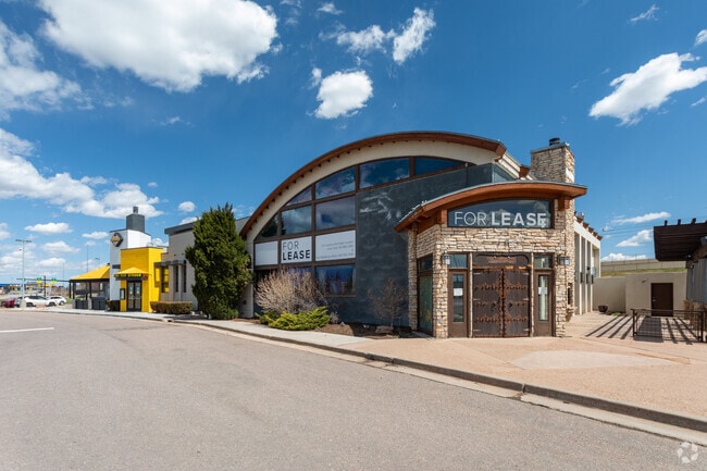
8345 Park Meadows Center Dr, Lone Tree, CO 80124


Property Detail
8345 Park Meadows Center Dr
Denver-Aurora-Centennial, CO
LOT 17A PARK MEADOWS TOWN CENTER 1-A 3RD AMD LLA 4.83 AM/L
2231-031-08-002
Douglas
Commercialnec
Colorado
B and X Area of moderate flood hazard, usually the area between the limits of the 100-year and 500-year floods.
17a
2023
4.83 AC
2025
South
014116
Denver
24,897 SF
NEARBY LISTINGS FOR SALE OR LEASE
DEMOGRAPHICS near 8345 Park Meadows Center Dr
1 mile
3 mile
5 mile
2025 Total Population
8,599
76,661
220,623
2030 Population
9,203
80,239
230,057
Pop Growth 2025-2030
+ 7.02%
+ 4.67%
+ 4.28%
Average Age
36
40
40
2025 Total Households
4,551
32,950
87,460
HH Growth 2025-2030
+ 7.43%
+ 5.22%
+ 4.50%
Median Household Inc
$109,442
$117,851
$126,687
Avg Household Size
1.90
2.30
2.50
2025 Avg HH Vehicles
1.00
2.00
2.00
Median Home Value
$571,538
$749,515
$745,308
Median Year Built
2010
1996
1996
Nearby Places
Map Layers
Map Styles
 Street
 Aerial
Layers
 Traffic
 Biking
Places
Listings with unknown addresses are not visible on the map
- Restaurants
- Banks
- Shops
- Fitness
- Groceries
PUBLIC TRANSPORTATION
TRANSIT/SUBWAY
County Line (E Line - Denver Regional Transportation District Light Rail (TheRide), F Line - Denver Regional Transportation District Light Rail (TheRide), G Line - Denver Regional Transportation District Light Rail (TheRide))
Drive
Walk
Distance
County Line (E Line - Denver Regional Transportation District Light Rail (TheRide), F Line - Denver Regional Transportation District Light Rail (TheRide), G Line - Denver Regional Transportation District Light Rail (TheRide))
1 min
5 min
0.2 mi
AIRPORT
Denver International
Drive
Walk
Distance
Denver International
39 min
31.0 mi
Nearby Properties
Address
Land Use
TOTAL SIZE
Lot Size
Zoning
Address
Land Use
TOTAL SIZE
Lot Size
Zoning
709,725 SF
15.21 AC
Address
Land Use
TOTAL SIZE
Lot Size
Zoning
709,725 SF
29.14 AC
Address
Land Use
TOTAL SIZE
Lot Size
Zoning
805,440 SF
28.65 AC
Address
Land Use
TOTAL SIZE
Lot Size
Zoning
344,259 SF
5.18 AC
Address
Land Use
TOTAL SIZE
Lot Size
Zoning
92,346 SF
4.22 AC
Address
Land Use
TOTAL SIZE
Lot Size
Zoning
313,812 SF
5.24 AC
GMC
Address
Land Use
TOTAL SIZE
Lot Size
Zoning
260,667 SF
19.72 AC
Address
Land Use
TOTAL SIZE
Lot Size
Zoning
637,459 SF
4.94 AC
AMU
Address
Land Use
TOTAL SIZE
Lot Size
Zoning
207,637 SF
28.17 AC
PDU
Address
Land Use
TOTAL SIZE
Lot Size
Zoning
252,760 SF
3.63 AC
Address
Land Use
TOTAL SIZE
Lot Size
Zoning
1,630,979 SF
32.01 AC
Address
Land Use
TOTAL SIZE
Lot Size
Zoning
959,756 SF
5.52 AC
PUD
Address
Land Use
TOTAL SIZE
Lot Size
Zoning
1,210,850 SF
13.65 AC
AMU
Address
Land Use
TOTAL SIZE
Lot Size
Zoning
29,070 SF
308.89 AC
Address
Land Use
TOTAL SIZE
Lot Size
Zoning
305,198 SF
34.41 AC
PUD
Address
Land Use
TOTAL SIZE
Lot Size
Zoning
186,993 SF
16.22 AC
Address
Land Use
TOTAL SIZE
Lot Size
Zoning
284,862 SF
23.37 AC
PUD
Address
Land Use
TOTAL SIZE
Lot Size
Zoning
246,768 SF
12.37 AC
PUD
Address
Land Use
TOTAL SIZE
Lot Size
Zoning
621,565 SF
32.64 AC
PDU
Address
Land Use
TOTAL SIZE
Lot Size
Zoning
162,758 SF
11.21 AC
Address
Land Use
TOTAL SIZE
Lot Size
Zoning
247,689 SF
26.15 AC
AMU
Address
Land Use
TOTAL SIZE
Lot Size
Zoning
650,416 SF
33.37 AC
LI
Address
Land Use
TOTAL SIZE
Lot Size
Zoning
139,291 SF
8.63 AC
AMU
Address
Land Use
TOTAL SIZE
Lot Size
Zoning
332,114 SF
3.24 AC
GTC
Address
Land Use
TOTAL SIZE
Lot Size
Zoning
546,774 SF
8.81 AC
PUD
Address
Land Use
TOTAL SIZE
Lot Size
Zoning
216,853 SF
5.42 AC
PUD
Address
Land Use
TOTAL SIZE
Lot Size
Zoning
224,978 SF
18.99 AC
Address
Land Use
TOTAL SIZE
Lot Size
Zoning
395,438 SF
6.49 AC
AMU
Address
Land Use
TOTAL SIZE
Lot Size
Zoning
163,443 SF
14.39 AC
Address
Land Use
TOTAL SIZE
Lot Size
Zoning
231,715 SF
5.58 AC
The World's #1 Commercial Real Estate Marketplace
Connect with us
© 2026 CoStar Group
The information above has been obtained from sources believed reliable. While we do not doubt its accuracy we have not verified it and make no guarantee, warranty or representation about it. It is your responsibility to independently confirm its accuracy and completeness. Any projections, opinions, assumptions, or estimates used are for example only and do not represent the current or future performance of the property. The value of this transaction to you depends on tax and other factors which should be evaluated by your tax, financial, and legal advisors. You and your advisors should conduct a careful, independent investigation of the property to determine to your satisfaction the suitability of the property for your needs.