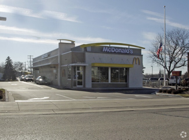
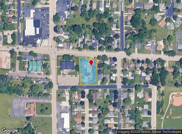
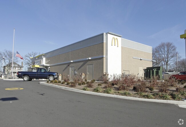
Property Record
835 15Th Ave, Union Grove, WI 53182
NEARBY LISTINGS FOR SALE OR LEASE
-
-
View all Union Grove listings for sale on LoopNet.com
Property Detail
835 15Th Ave
Racine, WI
PT NW1/4 CSM 3085 VOL 10 PG 45 LOT 1 PT FROM 186032132075030 & 186032132075020 IN 2013 FOR 2014 ROLL **TOTAL ACRES** 0.98 ***
186-032132075031
Racine
Commercialnec
Wisconsin
X
1
55059C0041D
0.98 AC
2024
Racine East
2024
Milwaukee/Madison
001801
DEMOGRAPHICS near 835 15Th Ave
1 Mile
3 Mile
5 Mile
2024 Total Population
4,933
7,712
11,912
2029 Population
4,959
7,708
11,862
Pop Growth 2024-2029
+ 0.53%
(0.05%)
(0.42%)
Average Age
40
41
42
2024 Total Households
1,980
2,768
4,429
HH Growth 2024-2029
+ 0.51%
(0.04%)
(0.43%)
Median Household Inc
$89,775
$90,387
$91,150
Avg Household Size
2.40
2.50
2.50
2024 Avg HH Vehicles
2.00
2.00
2.00
Median Home Value
$276,164
$298,022
$320,156
Median Year Built
1971
1973
1972
Nearby Places
Map Layers
Map Styles
 Street
 Aerial
- Restaurants
- Banks
- Shops
- Fitness
- Groceries
PUBLIC TRANSPORTATION
COMMUTER RAIL
Sturtevant Amtrak Station (Hiawatha Service - Amtrak)
DRIVE
WALK
Distance
Sturtevant Amtrak Station (Hiawatha Service - Amtrak)
15 min
8.8 mi
AIRPORT
General Mitchell International
DRIVE
WALK
Distance
General Mitchell International
32 min
24.7 mi
Freight Ports
Port Milwaukee
DRIVE
WALK
Distance
Port Milwaukee
37 min
28.6 mi
Nearby Properties
Address
Land Use
TOTAL SIZE
Lot Size
Zoning
Address
Land Use
TOTAL SIZE
Lot Size
Zoning
7.12 AC
Address
Land Use
TOTAL SIZE
Lot Size
Zoning
4.15 AC
Address
Land Use
TOTAL SIZE
Lot Size
Zoning
3.04 AC
Address
Land Use
TOTAL SIZE
Lot Size
Zoning
5.54 AC
Address
Land Use
TOTAL SIZE
Lot Size
Zoning
0.05 AC
RM
Address
Land Use
TOTAL SIZE
Lot Size
Zoning
6.23 AC
I2
Address
Land Use
TOTAL SIZE
Lot Size
Zoning
20.02 AC
C1
Address
Land Use
TOTAL SIZE
Lot Size
Zoning
5.03 AC
P1
Address
Land Use
TOTAL SIZE
Lot Size
Zoning
8.38 AC
Address
Land Use
TOTAL SIZE
Lot Size
Zoning
8.38 AC
Address
Land Use
TOTAL SIZE
Lot Size
Zoning
76.91 AC
Address
Land Use
TOTAL SIZE
Lot Size
Zoning
0.80 AC
Address
Land Use
TOTAL SIZE
Lot Size
Zoning
4.55 AC
Address
Land Use
TOTAL SIZE
Lot Size
Zoning
4.61 AC
I2
Address
Land Use
TOTAL SIZE
Lot Size
Zoning
Address
Land Use
TOTAL SIZE
Lot Size
Zoning
12.12 AC
C1
Address
Land Use
TOTAL SIZE
Lot Size
Zoning
2.73 AC
C2
Address
Land Use
TOTAL SIZE
Lot Size
Zoning
30.53 AC
Address
Land Use
TOTAL SIZE
Lot Size
Zoning
151.16 AC
Address
Land Use
TOTAL SIZE
Lot Size
Zoning
0.07 AC
RM
Address
Land Use
TOTAL SIZE
Lot Size
Zoning
4.33 AC
I2
Address
Land Use
TOTAL SIZE
Lot Size
Zoning
0.07 AC
RM
Address
Land Use
TOTAL SIZE
Lot Size
Zoning
4.65 AC
MH
Address
Land Use
TOTAL SIZE
Lot Size
Zoning
0.29 AC
C1
Address
Land Use
TOTAL SIZE
Lot Size
Zoning
Address
Land Use
TOTAL SIZE
Lot Size
Zoning
2.32 AC
Address
Land Use
TOTAL SIZE
Lot Size
Zoning
0.06 AC
RM
Address
Land Use
TOTAL SIZE
Lot Size
Zoning
31.28 AC
Address
Land Use
TOTAL SIZE
Lot Size
Zoning
3.91 AC
The World's #1 Commercial Real Estate Marketplace
Connect with us
© 2026 CoStar Group
The information above has been obtained from sources believed reliable. While we do not doubt its accuracy we have not verified it and make no guarantee, warranty or representation about it. It is your responsibility to independently confirm its accuracy and completeness. Any projections, opinions, assumptions, or estimates used are for example only and do not represent the current or future performance of the property. The value of this transaction to you depends on tax and other factors which should be evaluated by your tax, financial, and legal advisors. You and your advisors should conduct a careful, independent investigation of the property to determine to your satisfaction the suitability of the property for your needs.