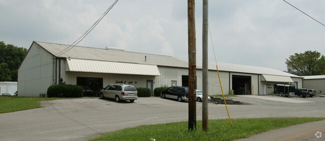
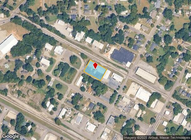
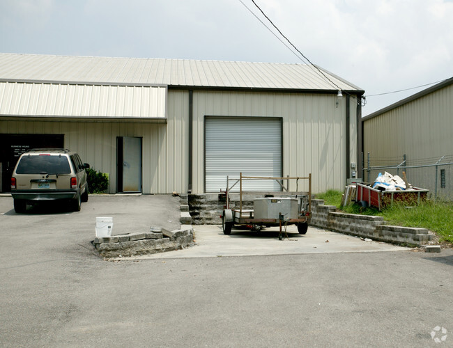
Property Record
8350 Side Trak, Leeds, AL 35094
NEARBY LISTINGS FOR SALE OR LEASE
Property Detail
8350 Side Trak
Birmingham-Hoover, AL
Leeds
25-00-16-4-018-001.001
FRACTIONAL LOTS 22 & 23 & ALL OF LOTS 24 THRU 30 BLK 9-A LEEDS 10/21 ALSO FRACTIONAL LOTS 22 & 23 BLK 9 MRS I D ROBERTSON ADD TO LEEDS 8/25
Warehouse
Jefferson
X
Alabama
01115C0341H
22
2023
0.65 AC
2024
Trussville
011003
Birmingham
11,505 SF
DEMOGRAPHICS near 8350 Side Trak
1 Mile
3 Mile
5 Mile
2024 Total Population
4,004
13,851
26,911
2029 Population
4,010
13,966
27,455
Pop Growth 2024-2029
+ 0.15%
+ 0.83%
+ 2.02%
Average Age
40
40
40
2024 Total Households
1,676
5,618
10,579
HH Growth 2024-2029
+ 0.12%
+ 0.75%
+ 2.00%
Median Household Inc
$58,722
$59,199
$63,460
Avg Household Size
2.30
2.40
2.50
2024 Avg HH Vehicles
2.00
2.00
2.00
Median Home Value
$150,663
$176,461
$188,962
Median Year Built
1972
1986
1992
Nearby Places
Map Layers
Map Styles
 Street
 Aerial
- Restaurants
- Banks
- Shops
- Fitness
- Groceries
PUBLIC TRANSPORTATION
AIRPORT
Birmingham-Shuttlesworth International
DRIVE
WALK
Distance
Birmingham-Shuttlesworth International
24 min
14.9 mi
Nearby Properties
Address
Land Use
TOTAL SIZE
Lot Size
Zoning
Address
Land Use
TOTAL SIZE
Lot Size
Zoning
146,749 SF
23.99 AC
B2
Address
Land Use
TOTAL SIZE
Lot Size
Zoning
52,828 SF
12.70 AC
B2
Address
Land Use
TOTAL SIZE
Lot Size
Zoning
28,666 SF
4.41 AC
B2
Address
Land Use
TOTAL SIZE
Lot Size
Zoning
15.90 AC
Address
Land Use
TOTAL SIZE
Lot Size
Zoning
123,425 SF
15.80 AC
Address
Land Use
TOTAL SIZE
Lot Size
Zoning
51,801 SF
7.45 AC
Address
Land Use
TOTAL SIZE
Lot Size
Zoning
57,399 SF
2.49 AC
Address
Land Use
TOTAL SIZE
Lot Size
Zoning
59,487 SF
9.20 AC
B2-R
Address
Land Use
TOTAL SIZE
Lot Size
Zoning
46,031 SF
8.30 AC
Address
Land Use
TOTAL SIZE
Lot Size
Zoning
82,025 SF
Address
Land Use
TOTAL SIZE
Lot Size
Zoning
184,068 SF
62 AC
M2
Address
Land Use
TOTAL SIZE
Lot Size
Zoning
243,530 SF
29 AC
M2
Address
Land Use
TOTAL SIZE
Lot Size
Zoning
77,822 SF
6.12 AC
R-3
Address
Land Use
TOTAL SIZE
Lot Size
Zoning
139,086 SF
15 AC
M2
Address
Land Use
TOTAL SIZE
Lot Size
Zoning
18,128 SF
48 AC
Address
Land Use
TOTAL SIZE
Lot Size
Zoning
6,000 SF
8.30 AC
Address
Land Use
TOTAL SIZE
Lot Size
Zoning
29,580 SF
5.74 AC
Address
Land Use
TOTAL SIZE
Lot Size
Zoning
122,300 SF
5.70 AC
M2-I
Address
Land Use
TOTAL SIZE
Lot Size
Zoning
80,643 SF
4.22 AC
R3
Address
Land Use
TOTAL SIZE
Lot Size
Zoning
82,256 SF
6.60 AC
B-2
Address
Land Use
TOTAL SIZE
Lot Size
Zoning
113,550 SF
10 AC
M-2
Address
Land Use
TOTAL SIZE
Lot Size
Zoning
141,610 SF
4.40 AC
M1-R
Address
Land Use
TOTAL SIZE
Lot Size
Zoning
6.66 AC
Address
Land Use
TOTAL SIZE
Lot Size
Zoning
35,483 SF
1.39 AC
Address
Land Use
TOTAL SIZE
Lot Size
Zoning
33,227 SF
3.50 AC
R2
Address
Land Use
TOTAL SIZE
Lot Size
Zoning
8.20 AC
The World's #1 Commercial Real Estate Marketplace
Connect with us
© 2025 CoStar Group
The information above has been obtained from sources believed reliable. While we do not doubt its accuracy we have not verified it and make no guarantee, warranty or representation about it. It is your responsibility to independently confirm its accuracy and completeness. Any projections, opinions, assumptions, or estimates used are for example only and do not represent the current or future performance of the property. The value of this transaction to you depends on tax and other factors which should be evaluated by your tax, financial, and legal advisors. You and your advisors should conduct a careful, independent investigation of the property to determine to your satisfaction the suitability of the property for your needs.