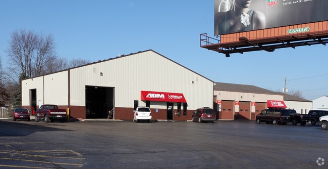
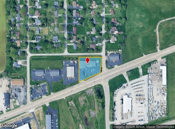
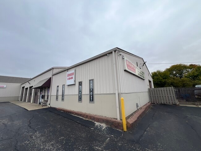
Property Record
8350 W Washington St, Indianapolis, IN 46231
Current Lease Availabilities
NEARBY LISTINGS FOR SALE OR LEASE
Property Detail
8350 W Washington St
Indianapolis-Carmel-Anderson, IN
44', SW IRR 332.55' TO BEG 1.137AC.
49-12-16-134-004.000-900
Marion
Autorepair
Indiana
2023
2
2024
1.14 AC
342000
Speedway
9,960 SF
Indianapolis
DEMOGRAPHICS near 8350 W Washington St
1 Mile
3 Mile
5 Mile
2024 Total Population
3,578
33,025
143,354
2029 Population
3,489
33,566
147,738
Pop Growth 2024-2029
(2.49%)
+ 1.64%
+ 3.06%
Average Age
36
37
37
2024 Total Households
1,184
12,408
54,430
HH Growth 2024-2029
(2.62%)
+ 1.53%
+ 2.95%
Median Household Inc
$59,912
$60,485
$61,334
Avg Household Size
3.00
2.60
2.60
2024 Avg HH Vehicles
2.00
2.00
2.00
Median Home Value
$170,165
$162,663
$166,007
Median Year Built
1995
1983
1983
Nearby Places
- Restaurants
- Banks
- Shops
- Fitness
- Groceries
PUBLIC TRANSPORTATION
COMMUTER RAIL
Indianapolis (Cardinal - Amtrak)
DRIVE
WALK
Distance
Indianapolis (Cardinal - Amtrak)
15 min
8.9 mi
AIRPORT
Indianapolis International
DRIVE
WALK
Distance
Indianapolis International
14 min
4.8 mi
Freight Ports
Port of Toledo
DRIVE
WALK
Distance
Port of Toledo
285 min
233.8 mi
Nearby Properties
Address
Land Use
TOTAL SIZE
Lot Size
Zoning
Address
Land Use
TOTAL SIZE
Lot Size
Zoning
1,099,200 SF
68.67 AC
Address
Land Use
TOTAL SIZE
Lot Size
Zoning
1,200,420 SF
68.50 AC
Address
Land Use
TOTAL SIZE
Lot Size
Zoning
939,854 SF
54.08 AC
Address
Land Use
TOTAL SIZE
Lot Size
Zoning
1,340,481 SF
63.99 AC
ZO01
Address
Land Use
TOTAL SIZE
Lot Size
Zoning
1,144,135 SF
61.59 AC
Address
Land Use
TOTAL SIZE
Lot Size
Zoning
796,988 SF
48.51 AC
Address
Land Use
TOTAL SIZE
Lot Size
Zoning
925,740 SF
82.23 AC
Address
Land Use
TOTAL SIZE
Lot Size
Zoning
950,625 SF
58.11 AC
Address
Land Use
TOTAL SIZE
Lot Size
Zoning
52.77 AC
Address
Land Use
TOTAL SIZE
Lot Size
Zoning
41.50 AC
Address
Land Use
TOTAL SIZE
Lot Size
Zoning
811,536 SF
42.04 AC
Address
Land Use
TOTAL SIZE
Lot Size
Zoning
9,728 SF
23.10 AC
Address
Land Use
TOTAL SIZE
Lot Size
Zoning
813,054 SF
45.32 AC
Address
Land Use
TOTAL SIZE
Lot Size
Zoning
770,712 SF
56.53 AC
Address
Land Use
TOTAL SIZE
Lot Size
Zoning
629,200 SF
39.74 AC
Address
Land Use
TOTAL SIZE
Lot Size
Zoning
706,250 SF
50.53 AC
Address
Land Use
TOTAL SIZE
Lot Size
Zoning
702,000 SF
42.11 AC
Address
Land Use
TOTAL SIZE
Lot Size
Zoning
64.63 AC
Address
Land Use
TOTAL SIZE
Lot Size
Zoning
702,000 SF
36.88 AC
Address
Land Use
TOTAL SIZE
Lot Size
Zoning
720,000 SF
39.03 AC
Address
Land Use
TOTAL SIZE
Lot Size
Zoning
595,938 SF
35.31 AC
Address
Land Use
TOTAL SIZE
Lot Size
Zoning
51,884 SF
14.73 AC
Address
Land Use
TOTAL SIZE
Lot Size
Zoning
594,848 SF
52.03 AC
Address
Land Use
TOTAL SIZE
Lot Size
Zoning
18,072 SF
29.73 AC
Address
Land Use
TOTAL SIZE
Lot Size
Zoning
28.66 AC
Address
Land Use
TOTAL SIZE
Lot Size
Zoning
17,816 SF
21.41 AC
Address
Land Use
TOTAL SIZE
Lot Size
Zoning
37.04 AC
Address
Land Use
TOTAL SIZE
Lot Size
Zoning
500,192 SF
33.15 AC
Address
Land Use
TOTAL SIZE
Lot Size
Zoning
228 SF
8.15 AC
Address
Land Use
TOTAL SIZE
Lot Size
Zoning
1,413,414 SF
115.43 AC
ZO01
The World's #1 Commercial Real Estate Marketplace
Connect with us
© 2025 CoStar Group
The information above has been obtained from sources believed reliable. While we do not doubt its accuracy we have not verified it and make no guarantee, warranty or representation about it. It is your responsibility to independently confirm its accuracy and completeness. Any projections, opinions, assumptions, or estimates used are for example only and do not represent the current or future performance of the property. The value of this transaction to you depends on tax and other factors which should be evaluated by your tax, financial, and legal advisors. You and your advisors should conduct a careful, independent investigation of the property to determine to your satisfaction the suitability of the property for your needs.