Property Record
8345 Collins Rd, Fort Mill, SC 29707

NEARBY LISTINGS FOR SALE OR LEASE
-
-
View all Fort Mill listings for sale on LoopNet.com
Property Detail
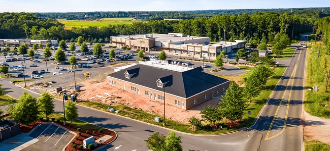
8345 Collins Rd
0013-00-018.08
GODDARD SCHOOL
Commercialnec
Lancaster
X
South Carolina
45057C0078E
outparc
2024
0.65 AC
2024
Lancaster County
011206
Charlotte
10,922 SF
Charlotte-Concord-Gastonia, NC-SC
DEMOGRAPHICS near 8345 Collins Rd
1 Mile
3 Mile
5 Mile
2024 Total Population
3,044
28,043
85,866
2029 Population
3,670
33,556
100,046
Pop Growth 2024-2029
+ 20.57%
+ 19.66%
+ 16.51%
Average Age
49
45
40
2024 Total Households
1,384
11,242
30,580
HH Growth 2024-2029
+ 20.45%
+ 19.97%
+ 17.15%
Median Household Inc
$85,679
$103,874
$117,186
Avg Household Size
2.20
2.50
2.80
2024 Avg HH Vehicles
2.00
2.00
2.00
Median Home Value
$341,150
$382,505
$396,397
Median Year Built
2010
2010
2009
Nearby Places
Map Layers
Map Styles
 Street
 Aerial
- Restaurants
- Banks
- Shops
- Fitness
- Groceries
PUBLIC TRANSPORTATION
AIRPORT
Charlotte/Douglas International
DRIVE
WALK
Distance
Charlotte/Douglas International
36 min
21.7 mi
Freight Ports
North Charleston Terminal
DRIVE
WALK
Distance
North Charleston Terminal
216 min
182.9 mi
SALE & LEASE HISTORY
LISTING DATE
SALE/LEASE

Jul 14, 2020
For Sale
Nearby Properties
Address
Land Use
TOTAL SIZE
Lot Size
Zoning
Address
Land Use
TOTAL SIZE
Lot Size
Zoning
149,109 SF
21.87 AC
INS
Address
Land Use
TOTAL SIZE
Lot Size
Zoning
93,098 SF
25.09 AC
R-40 UNION
Address
Land Use
TOTAL SIZE
Lot Size
Zoning
50,462 SF
15.68 AC
Address
Land Use
TOTAL SIZE
Lot Size
Zoning
95,726 SF
49.65 AC
INS
Address
Land Use
TOTAL SIZE
Lot Size
Zoning
40,516 SF
55.66 AC
INS
Address
Land Use
TOTAL SIZE
Lot Size
Zoning
2.65 AC
R-40 MARVI
Address
Land Use
TOTAL SIZE
Lot Size
Zoning
3.21 AC
R-40 MARVI
Address
Land Use
TOTAL SIZE
Lot Size
Zoning
83.98 AC
GB
Address
Land Use
TOTAL SIZE
Lot Size
Zoning
1,724 SF
43.33 AC
INS
Address
Land Use
TOTAL SIZE
Lot Size
Zoning
2.30 AC
R-40 MARVI
Address
Land Use
TOTAL SIZE
Lot Size
Zoning
1,184 SF
38.39 AC
Address
Land Use
TOTAL SIZE
Lot Size
Zoning
35,779 SF
12.77 AC
INS
Address
Land Use
TOTAL SIZE
Lot Size
Zoning
15,440 SF
2.62 AC
INS
Address
Land Use
TOTAL SIZE
Lot Size
Zoning
61.22 AC
R-40 UNION
Address
Land Use
TOTAL SIZE
Lot Size
Zoning
467.55 AC
RUD
Address
Land Use
TOTAL SIZE
Lot Size
Zoning
6,323 SF
20.89 AC
Address
Land Use
TOTAL SIZE
Lot Size
Zoning
7,258 SF
19 AC
PDD
Address
Land Use
TOTAL SIZE
Lot Size
Zoning
10,620 SF
2.68 AC
INS
Address
Land Use
TOTAL SIZE
Lot Size
Zoning
21.35 AC
MX
Address
Land Use
TOTAL SIZE
Lot Size
Zoning
2,244 SF
6.90 AC
INS
Address
Land Use
TOTAL SIZE
Lot Size
Zoning
15,486 SF
3 AC
INS
Address
Land Use
TOTAL SIZE
Lot Size
Zoning
0.65 AC
R-40 UNION
Address
Land Use
TOTAL SIZE
Lot Size
Zoning
65 AC
INS
Address
Land Use
TOTAL SIZE
Lot Size
Zoning
0.70 AC
R-40 UNION
Address
Land Use
TOTAL SIZE
Lot Size
Zoning
282.58 AC
RUD
Address
Land Use
TOTAL SIZE
Lot Size
Zoning
0.93 AC
R-40 UNION
Address
Land Use
TOTAL SIZE
Lot Size
Zoning
8,895 SF
13.02 AC
LDR
Address
Land Use
TOTAL SIZE
Lot Size
Zoning
10,275 SF
2 AC
INS
Address
Land Use
TOTAL SIZE
Lot Size
Zoning
4,500 SF
15 AC
INS
Address
Land Use
TOTAL SIZE
Lot Size
Zoning
0.74 AC
R-40 UNION
The World's #1 Commercial Real Estate Marketplace
Connect with us
© 2025 CoStar Group
The information above has been obtained from sources believed reliable. While we do not doubt its accuracy we have not verified it and make no guarantee, warranty or representation about it. It is your responsibility to independently confirm its accuracy and completeness. Any projections, opinions, assumptions, or estimates used are for example only and do not represent the current or future performance of the property. The value of this transaction to you depends on tax and other factors which should be evaluated by your tax, financial, and legal advisors. You and your advisors should conduct a careful, independent investigation of the property to determine to your satisfaction the suitability of the property for your needs.