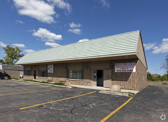
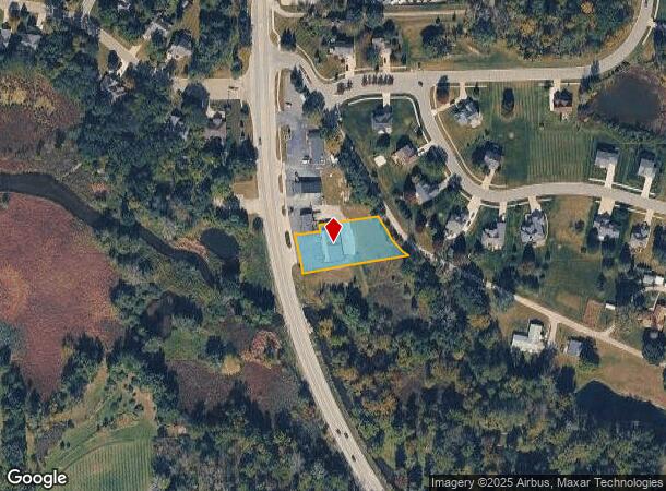
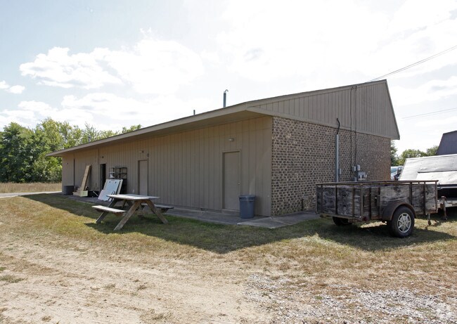
Property Record
8359 S State Rd, Goodrich, MI 48438
Current Lease Availabilities
NEARBY LISTINGS FOR SALE OR LEASE
Property Detail
8359 S State Rd
02-22-400-038
Ft From Sw Cor Of Hawes Sub
Commercialnec
A PARCEL OF LAND BEG S 301.45 FT & S 30 DEG 13 MIN 28 SEC E 816.18 FT & N 64 DEG 50 MIN 41 SEC W 116.17 FT FROM SW COR OF
X
Genesee
26049C0342D
Michigan
2024
0.58 AC
2025
Flint
013402
Detroit
2,880 SF
Flint, MI
DEMOGRAPHICS near 8359 S State Rd
1 Mile
3 Mile
5 Mile
2024 Total Population
2,132
6,047
20,685
2029 Population
2,060
5,855
20,212
Pop Growth 2024-2029
(3.38%)
(3.18%)
(2.29%)
Average Age
41
42
43
2024 Total Households
753
2,144
7,766
HH Growth 2024-2029
(3.45%)
(3.17%)
(2.16%)
Median Household Inc
$100,205
$105,263
$96,218
Avg Household Size
2.80
2.80
2.60
2024 Avg HH Vehicles
2.00
2.00
2.00
Median Home Value
$268,382
$294,623
$295,218
Median Year Built
1990
1983
1987
Nearby Places
Map Layers
Map Styles
 Street
 Aerial
- Restaurants
- Banks
- Shops
- Fitness
- Groceries
PUBLIC TRANSPORTATION
AIRPORT
Bishop International
DRIVE
WALK
Distance
Bishop International
39 min
24.6 mi
Nearby Properties
Address
Land Use
TOTAL SIZE
Lot Size
Zoning
Address
Land Use
TOTAL SIZE
Lot Size
Zoning
58,215 SF
7.99 AC
C-2
Address
Land Use
TOTAL SIZE
Lot Size
Zoning
12,760 SF
16 AC
VILLAG
Address
Land Use
TOTAL SIZE
Lot Size
Zoning
27.50 AC
REC
Address
Land Use
TOTAL SIZE
Lot Size
Zoning
28,288 SF
4.98 AC
VILLAG
Address
Land Use
TOTAL SIZE
Lot Size
Zoning
74,450 SF
13.20 AC
M-1
Address
Land Use
TOTAL SIZE
Lot Size
Zoning
319.43 AC
REC
Address
Land Use
TOTAL SIZE
Lot Size
Zoning
54,720 SF
34.70 AC
VILLAG
Address
Land Use
TOTAL SIZE
Lot Size
Zoning
27,733 SF
4.56 AC
M-1
Address
Land Use
TOTAL SIZE
Lot Size
Zoning
24,311 SF
10 AC
VILLAG
Address
Land Use
TOTAL SIZE
Lot Size
Zoning
43,036 SF
24.96 AC
M-1
Address
Land Use
TOTAL SIZE
Lot Size
Zoning
12,958 SF
1.30 AC
VILLAG
Address
Land Use
TOTAL SIZE
Lot Size
Zoning
12,202 SF
0.83 AC
VILLAG
Address
Land Use
TOTAL SIZE
Lot Size
Zoning
12,696 SF
110.42 AC
VILLAG
Address
Land Use
TOTAL SIZE
Lot Size
Zoning
5,292 SF
0.73 AC
VILLAG
Address
Land Use
TOTAL SIZE
Lot Size
Zoning
5.23 AC
RA
Address
Land Use
TOTAL SIZE
Lot Size
Zoning
9,840 SF
1.21 AC
VILLAG
Address
Land Use
TOTAL SIZE
Lot Size
Zoning
2,227 SF
20.44 AC
AR
Address
Land Use
TOTAL SIZE
Lot Size
Zoning
1,792 SF
153.33 AC
RA
Address
Land Use
TOTAL SIZE
Lot Size
Zoning
17,642 SF
1.67 AC
VILLAG
Address
Land Use
TOTAL SIZE
Lot Size
Zoning
12,057 SF
0.86 AC
VILLAG
Address
Land Use
TOTAL SIZE
Lot Size
Zoning
22,076 SF
5.06 AC
VILLAG
Address
Land Use
TOTAL SIZE
Lot Size
Zoning
6,000 SF
0.85 AC
VILLAG
Address
Land Use
TOTAL SIZE
Lot Size
Zoning
3,096 SF
4.68 AC
VILLAG
Address
Land Use
TOTAL SIZE
Lot Size
Zoning
4,960 SF
0.40 AC
VILLAG
Address
Land Use
TOTAL SIZE
Lot Size
Zoning
2,470 SF
113 AC
RA
Address
Land Use
TOTAL SIZE
Lot Size
Zoning
4,430 SF
103 AC
RA
Address
Land Use
TOTAL SIZE
Lot Size
Zoning
3,421 SF
2.14 AC
VILLAG
Address
Land Use
TOTAL SIZE
Lot Size
Zoning
3,682 SF
0.32 AC
VILLAG
Address
Land Use
TOTAL SIZE
Lot Size
Zoning
2,903 SF
0.99 AC
VILLAG
Address
Land Use
TOTAL SIZE
Lot Size
Zoning
6,080 SF
6.44 AC
C-3
The World's #1 Commercial Real Estate Marketplace
Connect with us
© 2026 CoStar Group
The information above has been obtained from sources believed reliable. While we do not doubt its accuracy we have not verified it and make no guarantee, warranty or representation about it. It is your responsibility to independently confirm its accuracy and completeness. Any projections, opinions, assumptions, or estimates used are for example only and do not represent the current or future performance of the property. The value of this transaction to you depends on tax and other factors which should be evaluated by your tax, financial, and legal advisors. You and your advisors should conduct a careful, independent investigation of the property to determine to your satisfaction the suitability of the property for your needs.