Property Record
836 State Rd, North Adams, MA 01247
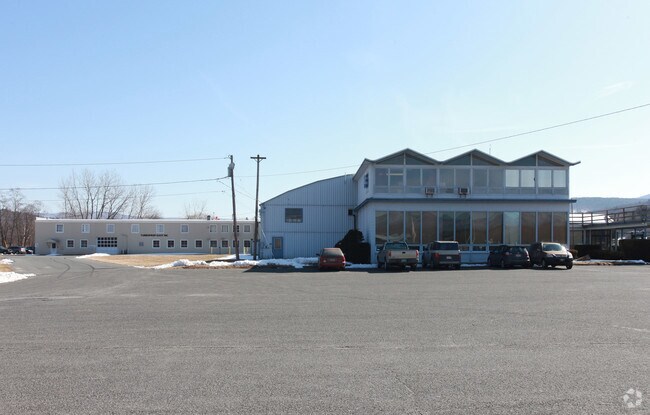

Property Detail
836 State Rd
Pittsfield, MA
Berkshire
NADA-000142-000000-000001
Massachusetts
Governmentalpublicusegeneral
1
0
132 AC
2025
Massachusetts North/West Area
921500
Other Market Areas
3,205 SF
NEARBY LISTINGS FOR SALE OR LEASE
-
-
View all North Adams listings for sale on LoopNet.com
DEMOGRAPHICS near 836 State Rd
1 mile
3 mile
5 mile
2025 Total Population
2,267
16,291
26,168
2030 Population
2,238
16,585
26,664
Pop Growth 2025-2030
(1.28%)
+ 1.80%
+ 1.90%
Average Age
44
42
43
2025 Total Households
972
6,154
10,496
HH Growth 2025-2030
(1.23%)
+ 1.28%
+ 1.53%
Median Household Inc
$56,839
$67,662
$67,997
Avg Household Size
2.20
2.10
2.10
2025 Avg HH Vehicles
2.00
2.00
2.00
Median Home Value
$246,987
$287,463
$276,542
Median Year Built
1951
1949
1953
Nearby Places
Map Layers
Map Styles
 Street
 Aerial
Layers
 Traffic
 Biking
Places
Listings with unknown addresses are not visible on the map
- Restaurants
- Banks
- Shops
- Fitness
- Groceries
Nearby Properties
Address
Land Use
TOTAL SIZE
Lot Size
Zoning
Address
Land Use
TOTAL SIZE
Lot Size
Zoning
370 AC
Address
Land Use
TOTAL SIZE
Lot Size
Zoning
17.72 AC
VB
Address
Land Use
TOTAL SIZE
Lot Size
Zoning
3,770 SF
134 AC
GR
Address
Land Use
TOTAL SIZE
Lot Size
Zoning
283,398 SF
14.50 AC
GR
Address
Land Use
TOTAL SIZE
Lot Size
Zoning
22.53 AC
Address
Land Use
TOTAL SIZE
Lot Size
Zoning
4.98 AC
GR
Address
Land Use
TOTAL SIZE
Lot Size
Zoning
61,182 SF
3.86 AC
GR
Address
Land Use
TOTAL SIZE
Lot Size
Zoning
91,474 SF
8.75 AC
PB
Address
Land Use
TOTAL SIZE
Lot Size
Zoning
1.21 AC
Address
Land Use
TOTAL SIZE
Lot Size
Zoning
603,161 SF
11.31 AC
Address
Land Use
TOTAL SIZE
Lot Size
Zoning
5.24 AC
GR
Address
Land Use
TOTAL SIZE
Lot Size
Zoning
79,263 SF
3.78 AC
Address
Land Use
TOTAL SIZE
Lot Size
Zoning
37,254 SF
14.16 AC
GR
Address
Land Use
TOTAL SIZE
Lot Size
Zoning
160 AC
Address
Land Use
TOTAL SIZE
Lot Size
Zoning
4.30 AC
GR
Address
Land Use
TOTAL SIZE
Lot Size
Zoning
114,992 SF
5.95 AC
Address
Land Use
TOTAL SIZE
Lot Size
Zoning
79,084 SF
1.38 AC
Address
Land Use
TOTAL SIZE
Lot Size
Zoning
64,956 SF
6.79 AC
Address
Land Use
TOTAL SIZE
Lot Size
Zoning
62,745 SF
3.40 AC
PB
Address
Land Use
TOTAL SIZE
Lot Size
Zoning
4.40 AC
Address
Land Use
TOTAL SIZE
Lot Size
Zoning
2,295.68 AC
RR1
Address
Land Use
TOTAL SIZE
Lot Size
Zoning
36,843 SF
114 AC
GR
Address
Land Use
TOTAL SIZE
Lot Size
Zoning
32,036 SF
2.62 AC
Address
Land Use
TOTAL SIZE
Lot Size
Zoning
142,868 SF
11 AC
Address
Land Use
TOTAL SIZE
Lot Size
Zoning
21,369 SF
0.58 AC
Address
Land Use
TOTAL SIZE
Lot Size
Zoning
81,415 SF
4.73 AC
Address
Land Use
TOTAL SIZE
Lot Size
Zoning
10,224 SF
510 AC
Address
Land Use
TOTAL SIZE
Lot Size
Zoning
17 AC
GR
Address
Land Use
TOTAL SIZE
Lot Size
Zoning
117,566 SF
10 AC
The World's #1 Commercial Real Estate Marketplace
Connect with us
© 2026 CoStar Group
The information above has been obtained from sources believed reliable. While we do not doubt its accuracy we have not verified it and make no guarantee, warranty or representation about it. It is your responsibility to independently confirm its accuracy and completeness. Any projections, opinions, assumptions, or estimates used are for example only and do not represent the current or future performance of the property. The value of this transaction to you depends on tax and other factors which should be evaluated by your tax, financial, and legal advisors. You and your advisors should conduct a careful, independent investigation of the property to determine to your satisfaction the suitability of the property for your needs.