Property Record
836 Upward Rd, Flat Rock, NC 28731
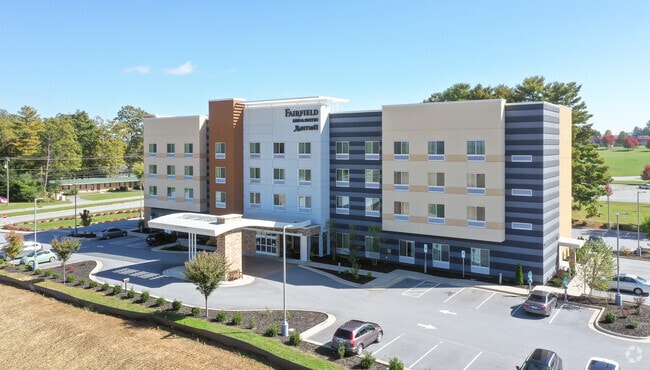

Property Detail
836 Upward Rd
9587599809
HENDERSON
Drycleanerlaundryservice
North Carolina
10004263~C
9809
B and X Area of moderate flood hazard, usually the area between the limits of the 100-year and 500-year floods.
1.93 AC
2025
North Carolina West/Cherokee Area
2025
Asheville
930201
Asheville, NC
53,319 SF
NEARBY LISTINGS FOR SALE OR LEASE
-
-
View all Flat Rock listings for sale on LoopNet.com
DEMOGRAPHICS near 836 Upward Rd
1 mile
3 mile
5 mile
2025 Total Population
3,156
18,325
46,093
2030 Population
3,308
19,044
47,845
Pop Growth 2025-2030
+ 4.82%
+ 3.92%
+ 3.80%
Average Age
43
44
45
2025 Total Households
1,237
7,412
19,833
HH Growth 2025-2030
+ 5.01%
+ 4.05%
+ 3.93%
Median Household Inc
$52,422
$53,993
$55,567
Avg Household Size
2.50
2.40
2.20
2025 Avg HH Vehicles
2.00
2.00
2.00
Median Home Value
$287,499
$293,824
$334,462
Median Year Built
1993
1988
1986
Nearby Places
Map Layers
Map Styles
 Street
 Aerial
Layers
 Traffic
 Biking
Places
Listings with unknown addresses are not visible on the map
- Restaurants
- Banks
- Shops
- Fitness
- Groceries
PUBLIC TRANSPORTATION
AIRPORT
Asheville Regional
Drive
Walk
Distance
Asheville Regional
18 min
13.8 mi
Greenville Spartanburg International
Drive
Walk
Distance
Greenville Spartanburg International
57 min
38.2 mi
Nearby Properties
Address
Land Use
TOTAL SIZE
Lot Size
Zoning
Address
Land Use
TOTAL SIZE
Lot Size
Zoning
5,625 SF
15.53 AC
10007593~P
Address
Land Use
TOTAL SIZE
Lot Size
Zoning
29,233 SF
83.09 AC
10005104~O
Address
Land Use
TOTAL SIZE
Lot Size
Zoning
88,500 SF
50.24 AC
9906531~R-
Address
Land Use
TOTAL SIZE
Lot Size
Zoning
12,309 SF
6.52 AC
10005105~O
Address
Land Use
TOTAL SIZE
Lot Size
Zoning
44,485 SF
38.89 AC
9906409~OI
Address
Land Use
TOTAL SIZE
Lot Size
Zoning
18.65 AC
10006780~I
Address
Land Use
TOTAL SIZE
Lot Size
Zoning
70,145 SF
31.16 AC
201578~CC
Address
Land Use
TOTAL SIZE
Lot Size
Zoning
70,136 SF
3.33 AC
10000154~O
Address
Land Use
TOTAL SIZE
Lot Size
Zoning
88,754 SF
4 AC
1003459~OI
Address
Land Use
TOTAL SIZE
Lot Size
Zoning
97,368 SF
6.66 AC
1000569~PI
Address
Land Use
TOTAL SIZE
Lot Size
Zoning
516,587 SF
116.84 AC
9928729~I
Address
Land Use
TOTAL SIZE
Lot Size
Zoning
73,500 SF
16.40 AC
10010073~I
Address
Land Use
TOTAL SIZE
Lot Size
Zoning
51,166 SF
5.43 AC
9962201~R1
Address
Land Use
TOTAL SIZE
Lot Size
Zoning
11.77 AC
10009504~I
Address
Land Use
TOTAL SIZE
Lot Size
Zoning
9.06 AC
10009502~I
Address
Land Use
TOTAL SIZE
Lot Size
Zoning
228,704 SF
10.68 AC
9949735~RC
Address
Land Use
TOTAL SIZE
Lot Size
Zoning
90,495 SF
15.65 AC
10005991~P
Address
Land Use
TOTAL SIZE
Lot Size
Zoning
46,712 SF
2.12 AC
1016840~PC
Address
Land Use
TOTAL SIZE
Lot Size
Zoning
10,548 SF
7.98 AC
10003171~P
Address
Land Use
TOTAL SIZE
Lot Size
Zoning
62,091 SF
12.15 AC
9967364~RC
Address
Land Use
TOTAL SIZE
Lot Size
Zoning
45,665 SF
2.86 AC
1011085~C-
Address
Land Use
TOTAL SIZE
Lot Size
Zoning
80,361 SF
3.49 AC
10012676~P
Address
Land Use
TOTAL SIZE
Lot Size
Zoning
49,870 SF
9.84 AC
OI
Address
Land Use
TOTAL SIZE
Lot Size
Zoning
25,750 SF
22.64 AC
200817~CC
Address
Land Use
TOTAL SIZE
Lot Size
Zoning
169,200 SF
9.95 AC
9957916~I-
Address
Land Use
TOTAL SIZE
Lot Size
Zoning
11,398 SF
23.75 AC
10010923~R
Address
Land Use
TOTAL SIZE
Lot Size
Zoning
63,847 SF
5.50 AC
1013639~PR
Address
Land Use
TOTAL SIZE
Lot Size
Zoning
33,942 SF
6.38 AC
1013951~RC
Address
Land Use
TOTAL SIZE
Lot Size
Zoning
35,927 SF
4.48 AC
10012678~P
The World's #1 Commercial Real Estate Marketplace
Connect with us
© 2026 CoStar Group
The information above has been obtained from sources believed reliable. While we do not doubt its accuracy we have not verified it and make no guarantee, warranty or representation about it. It is your responsibility to independently confirm its accuracy and completeness. Any projections, opinions, assumptions, or estimates used are for example only and do not represent the current or future performance of the property. The value of this transaction to you depends on tax and other factors which should be evaluated by your tax, financial, and legal advisors. You and your advisors should conduct a careful, independent investigation of the property to determine to your satisfaction the suitability of the property for your needs.