Property Record
8365 N Rampart Range Rd, Littleton, CO 80125


NEARBY LISTINGS FOR SALE OR LEASE
-
-
View all Littleton listings for sale on LoopNet.com
Property Detail
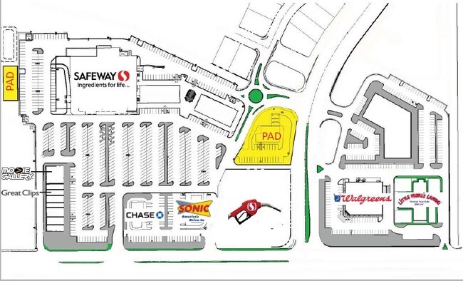
8365 N Rampart Range Rd
Denver-Aurora-Lakewood, CO
Chatfield Farms
2227-354-07-149
LOT 117E CHATFIELD FARMS FILING 1-A 2ND AMD 1.34 AM/L
Commercialnec
Douglas
X
Colorado
08059C0525F
117e
2024
1.34 AC
2025
Outlying Douglas County
014203
Denver
2,186 SF
DEMOGRAPHICS near 8365 N Rampart Range Rd
1 Mile
3 Mile
5 Mile
2024 Total Population
5,630
13,972
29,429
2029 Population
6,375
16,079
33,063
Pop Growth 2024-2029
+ 13.23%
+ 15.08%
+ 12.35%
Average Age
38
41
40
2024 Total Households
1,886
4,899
9,979
HH Growth 2024-2029
+ 13.31%
+ 15.11%
+ 12.45%
Median Household Inc
$142,582
$154,849
$149,957
Avg Household Size
2.90
2.80
2.90
2024 Avg HH Vehicles
2.00
2.00
2.00
Median Home Value
$518,382
$691,556
$694,114
Median Year Built
2000
2003
1998
Nearby Places
Map Layers
Map Styles
 Street
 Aerial
- Restaurants
- Banks
- Shops
- Fitness
- Groceries
Nearby Properties
Address
Land Use
TOTAL SIZE
Lot Size
Zoning
Address
Land Use
TOTAL SIZE
Lot Size
Zoning
3,653,632 SF
3,741.05 AC
I2
Address
Land Use
TOTAL SIZE
Lot Size
Zoning
252,254 SF
257.37 AC
A1
Address
Land Use
TOTAL SIZE
Lot Size
Zoning
355,500 SF
12.30 AC
Address
Land Use
TOTAL SIZE
Lot Size
Zoning
325.96 AC
Address
Land Use
TOTAL SIZE
Lot Size
Zoning
68,751 SF
9.42 AC
PDU
Address
Land Use
TOTAL SIZE
Lot Size
Zoning
41,351 SF
3.41 AC
PDU
Address
Land Use
TOTAL SIZE
Lot Size
Zoning
53,448 SF
7.30 AC
PDU
Address
Land Use
TOTAL SIZE
Lot Size
Zoning
30,296 SF
2.50 AC
Address
Land Use
TOTAL SIZE
Lot Size
Zoning
216,197 SF
464.15 AC
I2
Address
Land Use
TOTAL SIZE
Lot Size
Zoning
29,205 SF
7.59 AC
Address
Land Use
TOTAL SIZE
Lot Size
Zoning
12.51 AC
Address
Land Use
TOTAL SIZE
Lot Size
Zoning
63.30 AC
A2
Address
Land Use
TOTAL SIZE
Lot Size
Zoning
200 AC
A2
Address
Land Use
TOTAL SIZE
Lot Size
Zoning
1 SF
16.70 AC
PDNU
Address
Land Use
TOTAL SIZE
Lot Size
Zoning
44,203 SF
4.76 AC
PDU
Address
Land Use
TOTAL SIZE
Lot Size
Zoning
57,879 SF
2.83 AC
PDU
Address
Land Use
TOTAL SIZE
Lot Size
Zoning
39,580 SF
5 AC
I2
Address
Land Use
TOTAL SIZE
Lot Size
Zoning
14,364 SF
1.83 AC
PDU
Address
Land Use
TOTAL SIZE
Lot Size
Zoning
1,310 SF
586.88 AC
OS
Address
Land Use
TOTAL SIZE
Lot Size
Zoning
673 SF
163.14 AC
PDU
Address
Land Use
TOTAL SIZE
Lot Size
Zoning
18,094 SF
2.91 AC
PDU
Address
Land Use
TOTAL SIZE
Lot Size
Zoning
29,949 SF
79.43 AC
GI
Address
Land Use
TOTAL SIZE
Lot Size
Zoning
14,446 SF
0.93 AC
Address
Land Use
TOTAL SIZE
Lot Size
Zoning
6,540 SF
2.25 AC
Address
Land Use
TOTAL SIZE
Lot Size
Zoning
8,525 SF
1.30 AC
PDU
Address
Land Use
TOTAL SIZE
Lot Size
Zoning
2,400 SF
9.77 AC
0180
Address
Land Use
TOTAL SIZE
Lot Size
Zoning
4,544 SF
0.83 AC
Address
Land Use
TOTAL SIZE
Lot Size
Zoning
179.70 AC
A1
The World's #1 Commercial Real Estate Marketplace
Connect with us
© 2026 CoStar Group
The information above has been obtained from sources believed reliable. While we do not doubt its accuracy we have not verified it and make no guarantee, warranty or representation about it. It is your responsibility to independently confirm its accuracy and completeness. Any projections, opinions, assumptions, or estimates used are for example only and do not represent the current or future performance of the property. The value of this transaction to you depends on tax and other factors which should be evaluated by your tax, financial, and legal advisors. You and your advisors should conduct a careful, independent investigation of the property to determine to your satisfaction the suitability of the property for your needs.