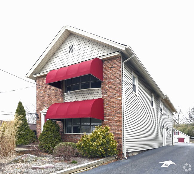
Property Record
837 Broad St, Shrewsbury, NJ 07702
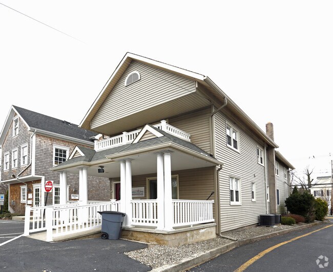

NEARBY LISTINGS FOR SALE OR LEASE
Property Detail
837 Broad St
44-00040-0000-00003
FACILITY NAME: CLINIC
Officebuilding
Monmouth
X
New Jersey
34025C0183G
3
0
0.20 AC
2025
Eastern Monmouth
812300
Northern New Jersey
2,052 SF
New York-Jersey City-White Plains, NY-NJ
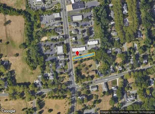
DEMOGRAPHICS near 837 Broad St
1 Mile
3 Mile
5 Mile
2024 Total Population
7,107
61,200
148,433
2029 Population
7,069
60,571
147,780
Pop Growth 2024-2029
(0.53%)
(1.03%)
(0.44%)
Average Age
43
42
42
2024 Total Households
2,691
23,833
56,743
HH Growth 2024-2029
(0.63%)
(1.30%)
(0.55%)
Median Household Inc
$123,071
$116,464
$106,752
Avg Household Size
2.50
2.50
2.50
2024 Avg HH Vehicles
2.00
2.00
2.00
Median Home Value
$644,944
$587,885
$617,166
Median Year Built
1959
1966
1970
Nearby Places
Map Layers
Map Styles
 Street
 Aerial
- Restaurants
- Banks
- Shops
- Fitness
- Groceries
PUBLIC TRANSPORTATION
COMMUTER RAIL
Little Silver (North Jersey Coast Line - NJ Transit Commuter Rail (NJ Transit))
DRIVE
WALK
Distance
Little Silver (North Jersey Coast Line - NJ Transit Commuter Rail (NJ Transit))
3 min
1.2 mi
Red Bank (North Jersey Coast Line - NJ Transit Commuter Rail (NJ Transit))
DRIVE
WALK
Distance
Red Bank (North Jersey Coast Line - NJ Transit Commuter Rail (NJ Transit))
4 min
2.1 mi
AIRPORT
Newark Liberty International
DRIVE
WALK
Distance
Newark Liberty International
52 min
42.0 mi
Freight Ports
New York Container Terminal
DRIVE
WALK
Distance
New York Container Terminal
46 min
34.1 mi
Nearby Properties
Address
Land Use
TOTAL SIZE
Lot Size
Zoning
Address
Land Use
TOTAL SIZE
Lot Size
Zoning
221.56 AC
P1
Address
Land Use
TOTAL SIZE
Lot Size
Zoning
427,320 SF
5.58 AC
MS
Address
Land Use
TOTAL SIZE
Lot Size
Zoning
Address
Land Use
TOTAL SIZE
Lot Size
Zoning
136.40 AC
B2
Address
Land Use
TOTAL SIZE
Lot Size
Zoning
22,877 SF
10.35 AC
IC
Address
Land Use
TOTAL SIZE
Lot Size
Zoning
84,653 SF
20.79 AC
B-2
Address
Land Use
TOTAL SIZE
Lot Size
Zoning
293,262 SF
28.40 AC
HC
Address
Land Use
TOTAL SIZE
Lot Size
Zoning
24.45 AC
R10A
Address
Land Use
TOTAL SIZE
Lot Size
Zoning
199,680 SF
44 SF
MU08
Address
Land Use
TOTAL SIZE
Lot Size
Zoning
14,818 SF
5.27 AC
CCD2
Address
Land Use
TOTAL SIZE
Lot Size
Zoning
1.92 AC
WD
Address
Land Use
TOTAL SIZE
Lot Size
Zoning
251,314 SF
53.63 AC
R-1A
Address
Land Use
TOTAL SIZE
Lot Size
Zoning
35.98 AC
R10A
Address
Land Use
TOTAL SIZE
Lot Size
Zoning
178,315 SF
24.54 AC
3713
Address
Land Use
TOTAL SIZE
Lot Size
Zoning
154,970 SF
1.83 AC
BR-1
Address
Land Use
TOTAL SIZE
Lot Size
Zoning
75,046 SF
6.06 AC
BP
Address
Land Use
TOTAL SIZE
Lot Size
Zoning
27 AC
R10A
Address
Land Use
TOTAL SIZE
Lot Size
Zoning
181,867 SF
31.90 AC
RA
Address
Land Use
TOTAL SIZE
Lot Size
Zoning
77.36 AC
B2
Address
Land Use
TOTAL SIZE
Lot Size
Zoning
40.82 AC
I
Address
Land Use
TOTAL SIZE
Lot Size
Zoning
12,269 SF
3.60 AC
B-3
Address
Land Use
TOTAL SIZE
Lot Size
Zoning
2,166 SF
77.43 AC
PB
Address
Land Use
TOTAL SIZE
Lot Size
Zoning
97,572 SF
2.57 AC
MU08
Address
Land Use
TOTAL SIZE
Lot Size
Zoning
201,791 SF
10.50 AC
BP
Address
Land Use
TOTAL SIZE
Lot Size
Zoning
14.99 AC
R10A
Address
Land Use
TOTAL SIZE
Lot Size
Zoning
108,629 SF
12.05 AC
HC
Address
Land Use
TOTAL SIZE
Lot Size
Zoning
91,564 SF
2.45 AC
BR-1
Address
Land Use
TOTAL SIZE
Lot Size
Zoning
14.73 AC
MF08
Address
Land Use
TOTAL SIZE
Lot Size
Zoning
98,400 SF
6 AC
RA
Address
Land Use
TOTAL SIZE
Lot Size
Zoning
83.83 AC
BR-1
The World's #1 Commercial Real Estate Marketplace
Connect with us
© 2025 CoStar Group
The information above has been obtained from sources believed reliable. While we do not doubt its accuracy we have not verified it and make no guarantee, warranty or representation about it. It is your responsibility to independently confirm its accuracy and completeness. Any projections, opinions, assumptions, or estimates used are for example only and do not represent the current or future performance of the property. The value of this transaction to you depends on tax and other factors which should be evaluated by your tax, financial, and legal advisors. You and your advisors should conduct a careful, independent investigation of the property to determine to your satisfaction the suitability of the property for your needs.