Property Record
837 N Main St, Rockford, IL 61103

NEARBY LISTINGS FOR SALE OR LEASE
-
-
View all Rockford listings for sale on LoopNet.com
Property Detail
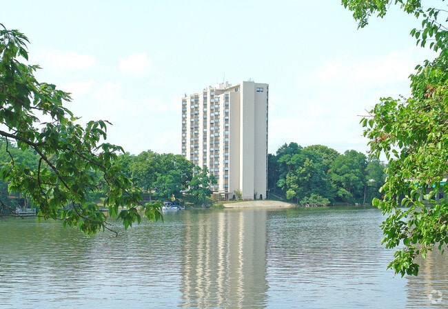
837 N Main St
Rockford, IL
John Fishers
11-23-179-002
ASSESSORS PLAT SEC 14 & 23-44-1 46-308EXC TR AA 2 & 3 ALL N 133.67 FT LOT 11 & S 24 1/2 FT LOT 012 ACRES: 1.32
Commercialnec
Winnebago
AE
Illinois
17201C0264E
11
2024
1.32 AC
2024
Coronado Haskell
002900
Chicago
111,700 SF
DEMOGRAPHICS near 837 N Main St
1 Mile
3 Mile
5 Mile
2024 Total Population
14,634
95,532
166,057
2029 Population
14,665
94,888
164,428
Pop Growth 2024-2029
+ 0.21%
(0.67%)
(0.98%)
Average Age
38
38
39
2024 Total Households
6,546
38,497
67,072
HH Growth 2024-2029
(0.09%)
(0.79%)
(1.05%)
Median Household Inc
$27,544
$40,308
$45,512
Avg Household Size
2.10
2.40
2.40
2024 Avg HH Vehicles
1.00
1.00
2.00
Median Home Value
$86,971
$81,783
$103,659
Median Year Built
1947
1953
1960
Nearby Places
Map Layers
Map Styles
 Street
 Aerial
- Restaurants
- Banks
- Shops
- Fitness
- Groceries
PUBLIC TRANSPORTATION
AIRPORT
Chicago/Rockford International
DRIVE
WALK
Distance
Chicago/Rockford International
19 min
9.3 mi
Freight Ports
Port Milwaukee
DRIVE
WALK
Distance
Port Milwaukee
114 min
93.5 mi
Nearby Properties
Address
Land Use
TOTAL SIZE
Lot Size
Zoning
Address
Land Use
TOTAL SIZE
Lot Size
Zoning
256,236 SF
29.33 AC
R3
Address
Land Use
TOTAL SIZE
Lot Size
Zoning
216,540 SF
22 AC
C3
Address
Land Use
TOTAL SIZE
Lot Size
Zoning
201,507 SF
C4
Address
Land Use
TOTAL SIZE
Lot Size
Zoning
106,145 SF
8.54 AC
R3
Address
Land Use
TOTAL SIZE
Lot Size
Zoning
13,308 SF
19.30 AC
I2
Address
Land Use
TOTAL SIZE
Lot Size
Zoning
676,780 SF
32.88 AC
IG
Address
Land Use
TOTAL SIZE
Lot Size
Zoning
119,560 SF
2.89 AC
R1
Address
Land Use
TOTAL SIZE
Lot Size
Zoning
115,095 SF
0.25 AC
C4
Address
Land Use
TOTAL SIZE
Lot Size
Zoning
117,360 SF
1.52 AC
R4
Address
Land Use
TOTAL SIZE
Lot Size
Zoning
111,491 SF
0.32 AC
C4
Address
Land Use
TOTAL SIZE
Lot Size
Zoning
151,517 SF
7.52 AC
R3
Address
Land Use
TOTAL SIZE
Lot Size
Zoning
373,791 SF
25.40 AC
IL
Address
Land Use
TOTAL SIZE
Lot Size
Zoning
79,318 SF
1.55 AC
C4
Address
Land Use
TOTAL SIZE
Lot Size
Zoning
58,526 SF
134.42 AC
RE
Address
Land Use
TOTAL SIZE
Lot Size
Zoning
192,575 SF
46.19 AC
I1
Address
Land Use
TOTAL SIZE
Lot Size
Zoning
238,884 SF
15.96 AC
R3
Address
Land Use
TOTAL SIZE
Lot Size
Zoning
645,384 SF
25.22 AC
I1
Address
Land Use
TOTAL SIZE
Lot Size
Zoning
57,888 SF
12.37 AC
R2
Address
Land Use
TOTAL SIZE
Lot Size
Zoning
79,700 SF
7.15 AC
C2
Address
Land Use
TOTAL SIZE
Lot Size
Zoning
243,057 SF
21.38 AC
C2
Address
Land Use
TOTAL SIZE
Lot Size
Zoning
60,479 SF
117 AC
R1
Address
Land Use
TOTAL SIZE
Lot Size
Zoning
113,175 SF
5 AC
R3
Address
Land Use
TOTAL SIZE
Lot Size
Zoning
2,975 SF
5.42 AC
I2
Address
Land Use
TOTAL SIZE
Lot Size
Zoning
44,213 SF
12.04 AC
R2
Address
Land Use
TOTAL SIZE
Lot Size
Zoning
150,426 SF
9.25 AC
C3
Address
Land Use
TOTAL SIZE
Lot Size
Zoning
108,233 SF
0.34 AC
C4
Address
Land Use
TOTAL SIZE
Lot Size
Zoning
158,754 SF
0.91 AC
C4
Address
Land Use
TOTAL SIZE
Lot Size
Zoning
39,184 SF
3.10 AC
C2
Address
Land Use
TOTAL SIZE
Lot Size
Zoning
77,936 SF
1.71 AC
C4
Address
Land Use
TOTAL SIZE
Lot Size
Zoning
83,110 SF
5.30 AC
R3
The World's #1 Commercial Real Estate Marketplace
Connect with us
© 2025 CoStar Group
The information above has been obtained from sources believed reliable. While we do not doubt its accuracy we have not verified it and make no guarantee, warranty or representation about it. It is your responsibility to independently confirm its accuracy and completeness. Any projections, opinions, assumptions, or estimates used are for example only and do not represent the current or future performance of the property. The value of this transaction to you depends on tax and other factors which should be evaluated by your tax, financial, and legal advisors. You and your advisors should conduct a careful, independent investigation of the property to determine to your satisfaction the suitability of the property for your needs.