Property Record
8385 Penner Ave, De Soto, KS 66018
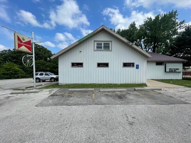

Property Detail
8385 Penner Ave
AF221228-2001
28-12-22 PT NW1/4 NE1/4 SW1/4 BG 90 N SE CR E 1/2 1/4 1/4 1/4 N 74.95 NW 213 SW 173.27 E 323.44 TO POB & BG INTRC C/L HWY NO 10 & E/L 1/4 1/4 1/4 S 220 N 213 NE 265 TO POB .7493 ACS M/L DEC 354
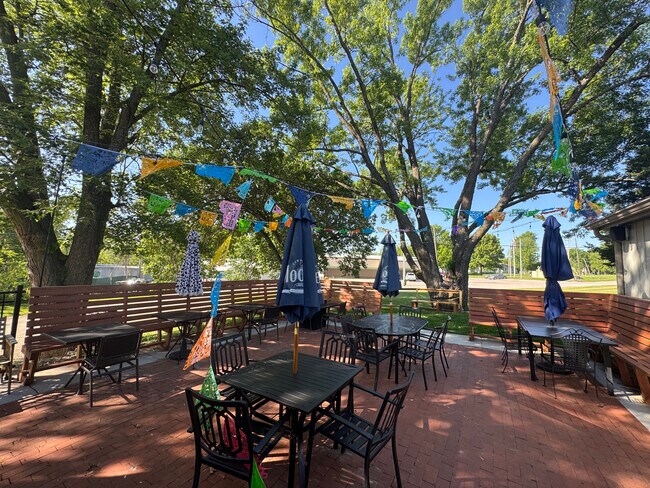
Bartavern
JOHNSON
R-H
Kansas
B and X Area of moderate flood hazard, usually the area between the limits of the 100-year and 500-year floods.
0.95 AC
2024
Northwest Johnson County
2025
Kansas City
052701
Kansas City, MO-KS
4,350 SF
NEARBY LISTINGS FOR SALE OR LEASE
DEMOGRAPHICS near 8385 Penner Ave
1 mile
3 mile
5 mile
2025 Total Population
4,052
7,326
11,156
2030 Population
4,264
7,697
11,653
Pop Growth 2025-2030
+ 5.23%
+ 5.06%
+ 4.46%
Average Age
39
41
42
2025 Total Households
1,474
2,729
4,135
HH Growth 2025-2030
+ 5.43%
+ 5.20%
+ 4.57%
Median Household Inc
$86,449
$99,117
$104,459
Avg Household Size
2.70
2.70
2.70
2025 Avg HH Vehicles
2.00
2.00
2.00
Median Home Value
$343,750
$432,947
$468,736
Median Year Built
1986
1990
1992
Nearby Places
Map Layers
Map Styles
 Street
 Aerial
Layers
 Traffic
 Biking
Places
Listings with unknown addresses are not visible on the map
- Restaurants
- Banks
- Shops
- Fitness
- Groceries
PUBLIC TRANSPORTATION
AIRPORT
Kansas City International
Drive
Walk
Distance
Kansas City International
58 min
48.6 mi
SALE & LEASE HISTORY
LISTING DATE
SALE/LEASE

Sep 24, 2016
For Sale
Nov 12, 2025
For Lease
May 08, 2018
For Sale
Jun 20, 2023
For Sale
Apr 26, 2019
For Sale
Nearby Properties
Address
Land Use
TOTAL SIZE
Lot Size
Zoning
Address
Land Use
TOTAL SIZE
Lot Size
Zoning
4,833,391 SF
260.48 AC
M-1
Address
Land Use
TOTAL SIZE
Lot Size
Zoning
261,124 SF
28.29 AC
O-I
Address
Land Use
TOTAL SIZE
Lot Size
Zoning
17,561 SF
6.91 AC
M-1
Address
Land Use
TOTAL SIZE
Lot Size
Zoning
186,690 SF
30.21 AC
O-I
Address
Land Use
TOTAL SIZE
Lot Size
Zoning
86,459 SF
17.20 AC
O-I
Address
Land Use
TOTAL SIZE
Lot Size
Zoning
3,416 SF
3.20 AC
M-1
Address
Land Use
TOTAL SIZE
Lot Size
Zoning
57,788 SF
4.65 AC
O-I
Address
Land Use
TOTAL SIZE
Lot Size
Zoning
436,551 SF
52.90 AC
M-1
Address
Land Use
TOTAL SIZE
Lot Size
Zoning
27,212 SF
236.64 AC
Address
Land Use
TOTAL SIZE
Lot Size
Zoning
298,974 SF
146 AC
M-1
Address
Land Use
TOTAL SIZE
Lot Size
Zoning
35,725 SF
9.52 AC
R-0
Address
Land Use
TOTAL SIZE
Lot Size
Zoning
116,622 SF
164.92 AC
M-1
Address
Land Use
TOTAL SIZE
Lot Size
Zoning
2 AC
RUR
Address
Land Use
TOTAL SIZE
Lot Size
Zoning
158.57 AC
RUR
Address
Land Use
TOTAL SIZE
Lot Size
Zoning
41.84 AC
M-1
Address
Land Use
TOTAL SIZE
Lot Size
Zoning
392 SF
37.18 AC
Address
Land Use
TOTAL SIZE
Lot Size
Zoning
133,668 SF
11.62 AC
M-2
Address
Land Use
TOTAL SIZE
Lot Size
Zoning
1,206 SF
29.82 AC
Address
Land Use
TOTAL SIZE
Lot Size
Zoning
99,750 SF
3.40 AC
M-2
Address
Land Use
TOTAL SIZE
Lot Size
Zoning
18,000 SF
3.31 AC
M-1
Address
Land Use
TOTAL SIZE
Lot Size
Zoning
5,000 SF
20.03 AC
RUR
Address
Land Use
TOTAL SIZE
Lot Size
Zoning
7,320 SF
0.64 AC
C-2
Address
Land Use
TOTAL SIZE
Lot Size
Zoning
7,625 SF
4.54 AC
R-0
Address
Land Use
TOTAL SIZE
Lot Size
Zoning
37,081 SF
5.46 AC
M-1
Address
Land Use
TOTAL SIZE
Lot Size
Zoning
10,620 SF
5.85 AC
R-1
Address
Land Use
TOTAL SIZE
Lot Size
Zoning
12,231 SF
0.82 AC
P-D
Address
Land Use
TOTAL SIZE
Lot Size
Zoning
16,086 SF
2.61 AC
C-2
Address
Land Use
TOTAL SIZE
Lot Size
Zoning
77,519 SF
15.20 AC
M-1
Address
Land Use
TOTAL SIZE
Lot Size
Zoning
19.57 AC
O-I
Address
Land Use
TOTAL SIZE
Lot Size
Zoning
46,024 SF
3.64 AC
M-1
The World's #1 Commercial Real Estate Marketplace
Connect with us
© 2026 CoStar Group
The information above has been obtained from sources believed reliable. While we do not doubt its accuracy we have not verified it and make no guarantee, warranty or representation about it. It is your responsibility to independently confirm its accuracy and completeness. Any projections, opinions, assumptions, or estimates used are for example only and do not represent the current or future performance of the property. The value of this transaction to you depends on tax and other factors which should be evaluated by your tax, financial, and legal advisors. You and your advisors should conduct a careful, independent investigation of the property to determine to your satisfaction the suitability of the property for your needs.