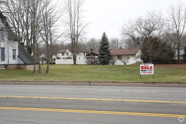
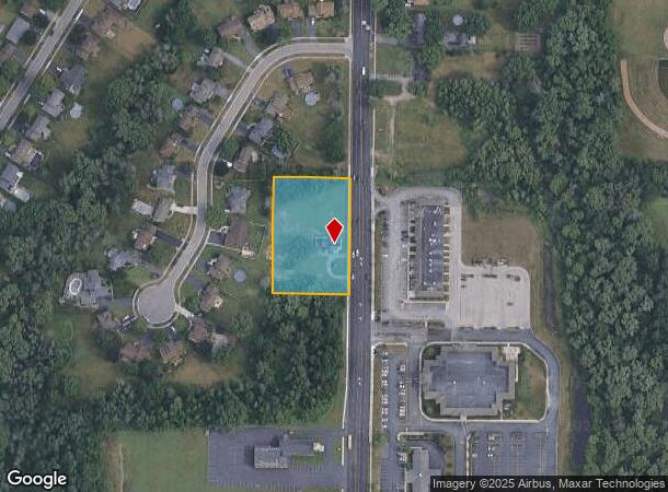
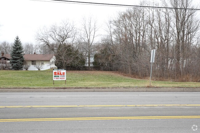
Property Record
839 Long Pond Rd, Rochester, NY 14612
NEARBY LISTINGS FOR SALE OR LEASE
Property Detail
839 Long Pond Rd
Rochester, NY
Mill Seat Tract
262800-059-010-0002-038-000
Monroe
Sfr
New York
X
1.40 AC
36055C0177G
Northwest
2,362 SF
Rochester
DEMOGRAPHICS near 839 Long Pond Rd
1 Mile
3 Mile
5 Mile
2024 Total Population
8,894
67,435
138,122
2029 Population
8,837
66,517
136,322
Pop Growth 2024-2029
(0.64%)
(1.36%)
(1.30%)
Average Age
46
44
42
2024 Total Households
3,948
28,368
59,223
HH Growth 2024-2029
(0.71%)
(1.47%)
(1.38%)
Median Household Inc
$71,471
$72,809
$65,243
Avg Household Size
2.20
2.30
2.30
2024 Avg HH Vehicles
2.00
2.00
2.00
Median Home Value
$192,505
$165,121
$155,228
Median Year Built
1982
1975
1966
Nearby Places
Map Layers
Map Styles
 Street
 Aerial
- Restaurants
- Banks
- Shops
- Fitness
- Groceries
PUBLIC TRANSPORTATION
COMMUTER RAIL
DRIVE
WALK
Distance
15 min
9.0 mi
AIRPORT
Frederick Douglass/Greater Rochester International
DRIVE
WALK
Distance
Frederick Douglass/Greater Rochester International
18 min
10.9 mi
SALE & LEASE HISTORY
LISTING DATE
SALE/LEASE

May 18, 2017
For Sale
Feb 02, 2017
For Sale
Nearby Properties
Address
Land Use
TOTAL SIZE
Lot Size
Zoning
Address
Land Use
TOTAL SIZE
Lot Size
Zoning
18,831 SF
70.63 AC
Address
Land Use
TOTAL SIZE
Lot Size
Zoning
Address
Land Use
TOTAL SIZE
Lot Size
Zoning
352,001 SF
76.90 AC
Address
Land Use
TOTAL SIZE
Lot Size
Zoning
330,700 SF
66.90 AC
Address
Land Use
TOTAL SIZE
Lot Size
Zoning
65,000 SF
5.10 AC
Address
Land Use
TOTAL SIZE
Lot Size
Zoning
37,487 SF
47.63 AC
Address
Land Use
TOTAL SIZE
Lot Size
Zoning
4,728 SF
34.54 AC
03 - MULTI
Address
Land Use
TOTAL SIZE
Lot Size
Zoning
225,793 SF
32.60 AC
Address
Land Use
TOTAL SIZE
Lot Size
Zoning
227,808 SF
69.10 AC
Address
Land Use
TOTAL SIZE
Lot Size
Zoning
3,710 SF
30.20 AC
05 - COMME
Address
Land Use
TOTAL SIZE
Lot Size
Zoning
Address
Land Use
TOTAL SIZE
Lot Size
Zoning
116,394 SF
28.72 AC
05 - COMME
Address
Land Use
TOTAL SIZE
Lot Size
Zoning
145,943 SF
16.15 AC
05 - COMME
Address
Land Use
TOTAL SIZE
Lot Size
Zoning
3,348 SF
31.29 AC
07 - MIXED
Address
Land Use
TOTAL SIZE
Lot Size
Zoning
14,800 SF
14.91 AC
05 - COMME
Address
Land Use
TOTAL SIZE
Lot Size
Zoning
136,148 SF
12.53 AC
Address
Land Use
TOTAL SIZE
Lot Size
Zoning
15,762 SF
17.38 AC
05 - COMME
Address
Land Use
TOTAL SIZE
Lot Size
Zoning
0.84 AC
Address
Land Use
TOTAL SIZE
Lot Size
Zoning
99,308 SF
6.80 AC
05 - COMME
Address
Land Use
TOTAL SIZE
Lot Size
Zoning
9,661 SF
19.62 AC
05 - COMME
Address
Land Use
TOTAL SIZE
Lot Size
Zoning
129,096 SF
5.02 AC
05 - COMME
Address
Land Use
TOTAL SIZE
Lot Size
Zoning
4,540 SF
14.65 AC
Address
Land Use
TOTAL SIZE
Lot Size
Zoning
146,800 SF
16.88 AC
05 - COMME
Address
Land Use
TOTAL SIZE
Lot Size
Zoning
108,401 SF
67.82 AC
05 - COMME
Address
Land Use
TOTAL SIZE
Lot Size
Zoning
Address
Land Use
TOTAL SIZE
Lot Size
Zoning
7,120 SF
23.10 AC
Address
Land Use
TOTAL SIZE
Lot Size
Zoning
Address
Land Use
TOTAL SIZE
Lot Size
Zoning
6,150 SF
2.10 AC
02 - SINGL
Address
Land Use
TOTAL SIZE
Lot Size
Zoning
65,962 SF
19.71 AC
Address
Land Use
TOTAL SIZE
Lot Size
Zoning
2,572 SF
26.40 AC
The World's #1 Commercial Real Estate Marketplace
Connect with us
© 2025 CoStar Group
The information above has been obtained from sources believed reliable. While we do not doubt its accuracy we have not verified it and make no guarantee, warranty or representation about it. It is your responsibility to independently confirm its accuracy and completeness. Any projections, opinions, assumptions, or estimates used are for example only and do not represent the current or future performance of the property. The value of this transaction to you depends on tax and other factors which should be evaluated by your tax, financial, and legal advisors. You and your advisors should conduct a careful, independent investigation of the property to determine to your satisfaction the suitability of the property for your needs.