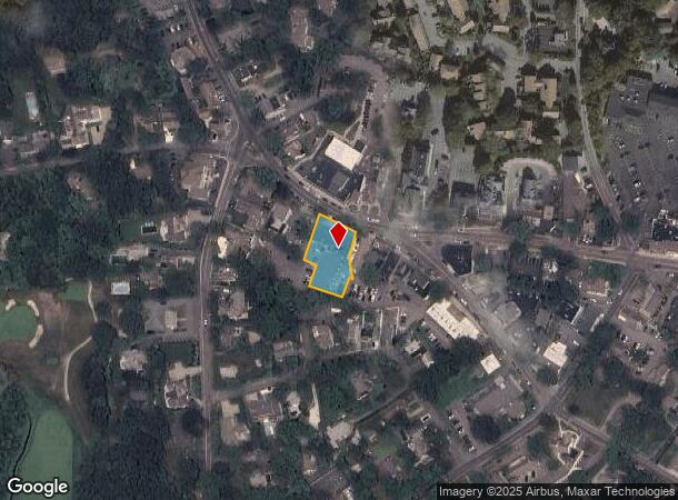
Property Record
839 Main St, Osterville, MA 02655

NEARBY LISTINGS FOR SALE OR LEASE
Property Detail
839 Main St
OSTE-000117-000000-000103
Barnstable
Commercialnec
Massachusetts
X
103
25001C0544J
0.44 AC
2020
Cape Cod
2025
Other Market Areas
013002
Barnstable Town, MA
16,358 SF
DEMOGRAPHICS near 839 Main St
1 Mile
3 Mile
5 Mile
2024 Total Population
2,366
13,656
41,709
2029 Population
2,587
14,098
42,462
Pop Growth 2024-2029
+ 9.34%
+ 3.24%
+ 1.81%
Average Age
53
50
47
2024 Total Households
1,162
5,947
17,317
HH Growth 2024-2029
+ 9.12%
+ 3.28%
+ 1.74%
Median Household Inc
$108,846
$107,640
$91,620
Avg Household Size
2.00
2.20
2.30
2024 Avg HH Vehicles
2.00
2.00
2.00
Median Home Value
$875,916
$570,131
$472,748
Median Year Built
1980
1978
1980
Nearby Places
Map Layers
Map Styles
 Street
 Aerial
- Restaurants
- Banks
- Shops
- Fitness
- Groceries
PUBLIC TRANSPORTATION
COMMUTER RAIL
DRIVE
WALK
Distance
14 min
7.2 mi
AIRPORT
Martha's Vineyard
DRIVE
WALK
Distance
Martha's Vineyard
97 min
34.5 mi
Freight Ports
Port of New Bedford Harbor
DRIVE
WALK
Distance
Port of New Bedford Harbor
67 min
46.9 mi
SALE & LEASE HISTORY
LISTING DATE
SALE/LEASE

Nov 24, 2020
For Lease
Nearby Properties
Address
Land Use
TOTAL SIZE
Lot Size
Zoning
Address
Land Use
TOTAL SIZE
Lot Size
Zoning
Address
Land Use
TOTAL SIZE
Lot Size
Zoning
3.28 AC
RF
Address
Land Use
TOTAL SIZE
Lot Size
Zoning
79,282 SF
43.70 AC
RC;BA
Address
Land Use
TOTAL SIZE
Lot Size
Zoning
2.84 AC
RF
Address
Land Use
TOTAL SIZE
Lot Size
Zoning
6.44 AC
RF
Address
Land Use
TOTAL SIZE
Lot Size
Zoning
6,460 SF
9 AC
RF
Address
Land Use
TOTAL SIZE
Lot Size
Zoning
6,423 SF
4.15 AC
RF
Address
Land Use
TOTAL SIZE
Lot Size
Zoning
4.66 AC
R
Address
Land Use
TOTAL SIZE
Lot Size
Zoning
4.62 AC
1
Address
Land Use
TOTAL SIZE
Lot Size
Zoning
600 SF
14.90 AC
Address
Land Use
TOTAL SIZE
Lot Size
Zoning
9,002 SF
4.41 AC
RF
Address
Land Use
TOTAL SIZE
Lot Size
Zoning
2.72 AC
1
Address
Land Use
TOTAL SIZE
Lot Size
Zoning
3,524 SF
10.70 AC
RD;RC
Address
Land Use
TOTAL SIZE
Lot Size
Zoning
73,621 SF
9.91 AC
RC;HB
Address
Land Use
TOTAL SIZE
Lot Size
Zoning
2.64 AC
1
Address
Land Use
TOTAL SIZE
Lot Size
Zoning
6,095 SF
2.26 AC
1
Address
Land Use
TOTAL SIZE
Lot Size
Zoning
5.46 AC
RF
Address
Land Use
TOTAL SIZE
Lot Size
Zoning
2.33 AC
1
Address
Land Use
TOTAL SIZE
Lot Size
Zoning
8,879 SF
1.33 AC
R
Address
Land Use
TOTAL SIZE
Lot Size
Zoning
Address
Land Use
TOTAL SIZE
Lot Size
Zoning
1.23 AC
RF
Address
Land Use
TOTAL SIZE
Lot Size
Zoning
50,212 SF
13.50 AC
Address
Land Use
TOTAL SIZE
Lot Size
Zoning
4,020 SF
2 AC
RF
Address
Land Use
TOTAL SIZE
Lot Size
Zoning
9,162 SF
3.11 AC
RF
Address
Land Use
TOTAL SIZE
Lot Size
Zoning
1.34 AC
RF
Address
Land Use
TOTAL SIZE
Lot Size
Zoning
3.92 AC
R
Address
Land Use
TOTAL SIZE
Lot Size
Zoning
7,528 SF
2.20 AC
RF
Address
Land Use
TOTAL SIZE
Lot Size
Zoning
2.32 AC
RF
Address
Land Use
TOTAL SIZE
Lot Size
Zoning
0.26 AC
RF
Address
Land Use
TOTAL SIZE
Lot Size
Zoning
1.52 AC
RF;RF-
The World's #1 Commercial Real Estate Marketplace
Connect with us
© 2026 CoStar Group
The information above has been obtained from sources believed reliable. While we do not doubt its accuracy we have not verified it and make no guarantee, warranty or representation about it. It is your responsibility to independently confirm its accuracy and completeness. Any projections, opinions, assumptions, or estimates used are for example only and do not represent the current or future performance of the property. The value of this transaction to you depends on tax and other factors which should be evaluated by your tax, financial, and legal advisors. You and your advisors should conduct a careful, independent investigation of the property to determine to your satisfaction the suitability of the property for your needs.