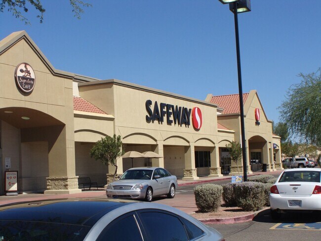
Property Record
8390 W Cactus Rd, Peoria, AZ 85381

Current Lease Availabilities
Property Detail
8390 W Cactus Rd
200-79-965
SAFEWAY STORE NO 1841 83RD AVE AND CACTUS ROAD MCR 572-14
Regionalshoppingcenterormallwithanchorstore
Maricopa
C-C
Arizona
C and X Area of minimal flood hazard, usually depicted on FIRMs as above the 500-year flood level.
2
2025
1.06 AC
2025
Glendale
071517
Phoenix
12,390 SF
Phoenix-Mesa-Chandler, AZ
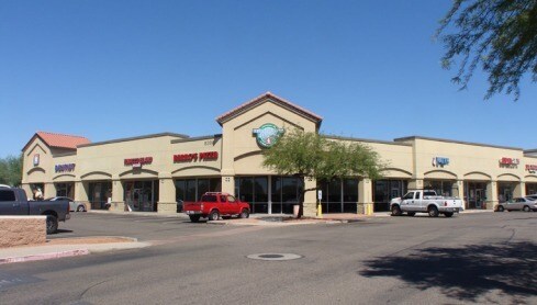
NEARBY LISTINGS FOR SALE OR LEASE
-
-
No Photo
-
-
-
-
-
-
View all Peoria listings for lease on LoopNet.com
DEMOGRAPHICS near 8390 W Cactus Rd
1 mile
3 mile
5 mile
2025 Total Population
16,871
115,853
331,634
2030 Population
17,256
119,859
344,287
Pop Growth 2025-2030
+ 2.28%
+ 3.46%
+ 3.82%
Average Age
38
45
43
2025 Total Households
5,729
46,622
129,983
HH Growth 2025-2030
+ 2.22%
+ 3.62%
+ 3.94%
Median Household Inc
$85,137
$71,806
$70,412
Avg Household Size
2.80
2.40
2.40
2025 Avg HH Vehicles
2.00
2.00
2.00
Median Home Value
$378,571
$358,560
$368,149
Median Year Built
1991
1985
1985
Nearby Places
Map Layers
Map Styles
 Street
 Aerial
Layers
 Traffic
 Biking
Places
Listings with unknown addresses are not visible on the map
- Restaurants
- Banks
- Shops
- Fitness
- Groceries
PUBLIC TRANSPORTATION
AIRPORT
Phoenix Sky Harbor International
Drive
Walk
Distance
Phoenix Sky Harbor International
35 min
20.5 mi
Freight Ports
Port of San Diego
Drive
Walk
Distance
Port of San Diego
395 min
354.3 mi
Nearby Properties
Address
Land Use
TOTAL SIZE
Lot Size
Zoning
Address
Land Use
TOTAL SIZE
Lot Size
Zoning
81,100 SF
9.48 AC
PAD
Address
Land Use
TOTAL SIZE
Lot Size
Zoning
15.17 AC
Address
Land Use
TOTAL SIZE
Lot Size
Zoning
1,010,365 SF
29.94 AC
C2
Address
Land Use
TOTAL SIZE
Lot Size
Zoning
238,942 SF
36.87 AC
R1-8
Address
Land Use
TOTAL SIZE
Lot Size
Zoning
926 SF
37.32 AC
I-1
Address
Land Use
TOTAL SIZE
Lot Size
Zoning
1,113,127 SF
48.24 AC
C2
Address
Land Use
TOTAL SIZE
Lot Size
Zoning
19.95 AC
AG
Address
Land Use
TOTAL SIZE
Lot Size
Zoning
359,639 SF
16.29 AC
PAD
Address
Land Use
TOTAL SIZE
Lot Size
Zoning
303,051 SF
9.11 AC
AG
Address
Land Use
TOTAL SIZE
Lot Size
Zoning
307,822 SF
26.49 AC
PAD
Address
Land Use
TOTAL SIZE
Lot Size
Zoning
348,803 SF
15.91 AC
PAD
Address
Land Use
TOTAL SIZE
Lot Size
Zoning
547,083 SF
10.94 AC
C-C
Address
Land Use
TOTAL SIZE
Lot Size
Zoning
353,859 SF
11.71 AC
PAD
Address
Land Use
TOTAL SIZE
Lot Size
Zoning
366,400 SF
19.99 AC
PAD
Address
Land Use
TOTAL SIZE
Lot Size
Zoning
318,282 SF
15.23 AC
PAD
Address
Land Use
TOTAL SIZE
Lot Size
Zoning
240,863 SF
35.55 AC
Address
Land Use
TOTAL SIZE
Lot Size
Zoning
325,529 SF
10.85 AC
PAD
Address
Land Use
TOTAL SIZE
Lot Size
Zoning
245,400 SF
22.90 AC
PAD
Address
Land Use
TOTAL SIZE
Lot Size
Zoning
115,027 SF
14.46 AC
R-8
Address
Land Use
TOTAL SIZE
Lot Size
Zoning
131,380 SF
25.55 AC
R-6
Address
Land Use
TOTAL SIZE
Lot Size
Zoning
150,002 SF
10.91 AC
C-C
Address
Land Use
TOTAL SIZE
Lot Size
Zoning
90,148 SF
6.13 AC
R-6
Address
Land Use
TOTAL SIZE
Lot Size
Zoning
319,723 SF
10.79 AC
PAD
Address
Land Use
TOTAL SIZE
Lot Size
Zoning
86,343 SF
13.52 AC
M-M
Address
Land Use
TOTAL SIZE
Lot Size
Zoning
210,605 SF
6.76 AC
PAD
Address
Land Use
TOTAL SIZE
Lot Size
Zoning
163,814 SF
15.31 AC
PAD
Address
Land Use
TOTAL SIZE
Lot Size
Zoning
82,688 SF
18.70 AC
PAD
Address
Land Use
TOTAL SIZE
Lot Size
Zoning
230,076 SF
14.03 AC
PAD
Address
Land Use
TOTAL SIZE
Lot Size
Zoning
301,213 SF
18.86 AC
PAD
Address
Land Use
TOTAL SIZE
Lot Size
Zoning
166,014 SF
16.41 AC
PAD
The World's #1 Commercial Real Estate Marketplace
Connect with us
© 2026 CoStar Group
The information above has been obtained from sources believed reliable. While we do not doubt its accuracy we have not verified it and make no guarantee, warranty or representation about it. It is your responsibility to independently confirm its accuracy and completeness. Any projections, opinions, assumptions, or estimates used are for example only and do not represent the current or future performance of the property. The value of this transaction to you depends on tax and other factors which should be evaluated by your tax, financial, and legal advisors. You and your advisors should conduct a careful, independent investigation of the property to determine to your satisfaction the suitability of the property for your needs.