Property Record
8395 Gasparilla Rd, Port Charlotte, FL 33981


NEARBY LISTINGS FOR SALE OR LEASE
-
-
View all Port Charlotte listings for sale on LoopNet.com
Property Detail
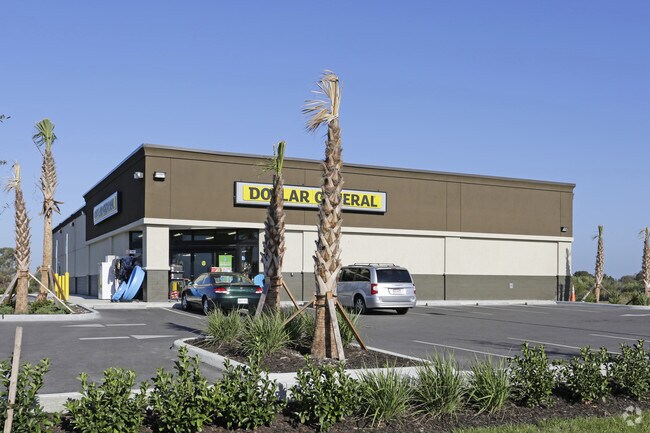
8395 Gasparilla Rd
Punta Gorda, FL
Rotonda Lakes
412117401002
ROTONDA LAKES UN 2 BLK 5 A PORTION OF LOTS 1 & 8 DESC AS COMM AT SW COR LOT 1 TH NE ALG W LN 268.57 FT FOR POB TH CONT NE 155.457 FT SE 289.13 FT TO W ROW GASPARILLA RD TH SW ALG ROW 253.04 FT NW 52 FT NE 88 FT NW 233.68 FT TO POB 1.16 AC. M/L 1500/5
Commercialacreage
Charlotte
AE
Florida
12015C0211G
1,8
2024
1.16 AC
2025
Charlotte County
030102
Southwest Florida
DEMOGRAPHICS near 8395 Gasparilla Rd
1 Mile
3 Mile
5 Mile
2024 Total Population
1,647
23,780
43,773
2029 Population
2,046
29,191
53,311
Pop Growth 2024-2029
+ 24.23%
+ 22.75%
+ 21.79%
Average Age
55
56
56
2024 Total Households
738
10,940
20,621
HH Growth 2024-2029
+ 24.39%
+ 22.96%
+ 21.99%
Median Household Inc
$65,427
$68,031
$61,618
Avg Household Size
2.20
2.20
2.10
2024 Avg HH Vehicles
2.00
2.00
2.00
Median Home Value
$333,401
$312,336
$279,757
Median Year Built
2006
2003
1998
Nearby Places
Map Layers
Map Styles
 Street
 Aerial
- Restaurants
- Banks
- Shops
- Fitness
- Groceries
PUBLIC TRANSPORTATION
AIRPORT
Punta Gorda
DRIVE
WALK
Distance
Punta Gorda
40 min
22.7 mi
SALE & LEASE HISTORY
LISTING DATE
SALE/LEASE

Sep 24, 2016
For Sale
Nearby Properties
Address
Land Use
TOTAL SIZE
Lot Size
Zoning
Address
Land Use
TOTAL SIZE
Lot Size
Zoning
99,840 SF
7.60 AC
IG
Address
Land Use
TOTAL SIZE
Lot Size
Zoning
67,466 SF
16.30 AC
CG
Address
Land Use
TOTAL SIZE
Lot Size
Zoning
27.65 AC
RMF15
Address
Land Use
TOTAL SIZE
Lot Size
Zoning
108,048 SF
14.84 AC
CG
Address
Land Use
TOTAL SIZE
Lot Size
Zoning
1,200 SF
29.50 AC
CG
Address
Land Use
TOTAL SIZE
Lot Size
Zoning
2,016 SF
315.56 AC
PD
Address
Land Use
TOTAL SIZE
Lot Size
Zoning
100,910 SF
22.85 AC
RSF3.5
Address
Land Use
TOTAL SIZE
Lot Size
Zoning
34.11 AC
CG
Address
Land Use
TOTAL SIZE
Lot Size
Zoning
20.12 AC
CG
Address
Land Use
TOTAL SIZE
Lot Size
Zoning
11,718 SF
0.15 AC
WDR4*
Address
Land Use
TOTAL SIZE
Lot Size
Zoning
38.14 AC
IG
Address
Land Use
TOTAL SIZE
Lot Size
Zoning
12,300 SF
5.02 AC
IG
Address
Land Use
TOTAL SIZE
Lot Size
Zoning
0.20 AC
RSF3.5
Address
Land Use
TOTAL SIZE
Lot Size
Zoning
6,476 SF
17.26 AC
II
Address
Land Use
TOTAL SIZE
Lot Size
Zoning
4,776 SF
20 AC
II
Address
Land Use
TOTAL SIZE
Lot Size
Zoning
560 SF
10.23 AC
IG
Address
Land Use
TOTAL SIZE
Lot Size
Zoning
16.53 AC
CG
Address
Land Use
TOTAL SIZE
Lot Size
Zoning
20,650 SF
1.61 AC
CG
Address
Land Use
TOTAL SIZE
Lot Size
Zoning
8,510 SF
2.25 AC
CG
Address
Land Use
TOTAL SIZE
Lot Size
Zoning
5,222 SF
85.60 AC
RMF10
Address
Land Use
TOTAL SIZE
Lot Size
Zoning
1,430 SF
5.98 AC
CG
Address
Land Use
TOTAL SIZE
Lot Size
Zoning
3,864 SF
2 AC
CG
Address
Land Use
TOTAL SIZE
Lot Size
Zoning
12,907 SF
165.69 AC
RSF5
Address
Land Use
TOTAL SIZE
Lot Size
Zoning
18,599 SF
1.96 AC
IG
Address
Land Use
TOTAL SIZE
Lot Size
Zoning
576 SF
5 AC
II
Address
Land Use
TOTAL SIZE
Lot Size
Zoning
11,550 SF
1.18 AC
CG
Address
Land Use
TOTAL SIZE
Lot Size
Zoning
10.88 AC
CG
Address
Land Use
TOTAL SIZE
Lot Size
Zoning
11,708 SF
9.99 AC
II
Address
Land Use
TOTAL SIZE
Lot Size
Zoning
3,767 SF
88.50 AC
RSF2
The World's #1 Commercial Real Estate Marketplace
Connect with us
© 2026 CoStar Group
The information above has been obtained from sources believed reliable. While we do not doubt its accuracy we have not verified it and make no guarantee, warranty or representation about it. It is your responsibility to independently confirm its accuracy and completeness. Any projections, opinions, assumptions, or estimates used are for example only and do not represent the current or future performance of the property. The value of this transaction to you depends on tax and other factors which should be evaluated by your tax, financial, and legal advisors. You and your advisors should conduct a careful, independent investigation of the property to determine to your satisfaction the suitability of the property for your needs.