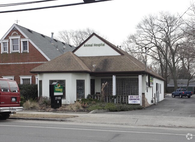
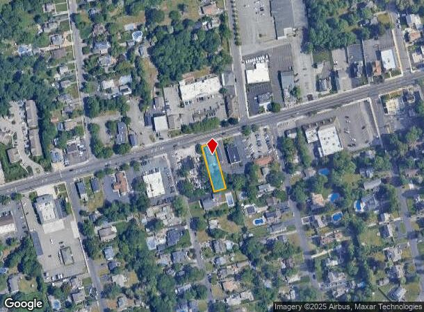
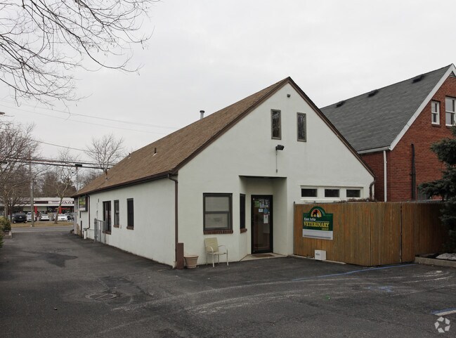
Property Record
84 E Main St, East Islip, NY 11730
NEARBY LISTINGS FOR SALE OR LEASE
Property Detail
84 E Main St
Nassau County-Suffolk County, NY
Connettquott Corporation
0500-373-00-01-00-070-000
X2225292Y185386 N062N00000000
Kennel
Suffolk
X
New York
36103C0881H
100
0
0.23 AC
2024
Southwestern Suffolk
147502
Long Island (New York)
DEMOGRAPHICS near 84 E Main St
1 Mile
3 Mile
5 Mile
2024 Total Population
12,512
60,515
172,285
2029 Population
12,345
59,271
167,968
Pop Growth 2024-2029
(1.33%)
(2.06%)
(2.51%)
Average Age
42
41
39
2024 Total Households
4,273
20,196
51,998
HH Growth 2024-2029
(1.64%)
(2.09%)
(2.42%)
Median Household Inc
$128,029
$121,462
$111,987
Avg Household Size
2.80
2.90
3.10
2024 Avg HH Vehicles
2.00
2.00
2.00
Median Home Value
$550,408
$468,891
$440,870
Median Year Built
1958
1965
1965
Nearby Places
- Restaurants
- Banks
- Shops
- Fitness
- Groceries
PUBLIC TRANSPORTATION
COMMUTER RAIL
Great River Station (Montauk Branch - Long Island Rail Road)
DRIVE
WALK
Distance
Great River Station (Montauk Branch - Long Island Rail Road)
3 min
1.4 mi
Islip Station (Montauk Branch - Long Island Rail Road)
DRIVE
WALK
Distance
Islip Station (Montauk Branch - Long Island Rail Road)
3 min
1.6 mi
AIRPORT
Long Island MacArthur
DRIVE
WALK
Distance
Long Island MacArthur
16 min
8.9 mi
John F Kennedy International
DRIVE
WALK
Distance
John F Kennedy International
50 min
36.6 mi
Freight Ports
NY - Red Hook Container Terminal
DRIVE
WALK
Distance
NY - Red Hook Container Terminal
71 min
48.1 mi
Nearby Properties
Address
Land Use
TOTAL SIZE
Lot Size
Zoning
Address
Land Use
TOTAL SIZE
Lot Size
Zoning
1,941.51 AC
AAA
Address
Land Use
TOTAL SIZE
Lot Size
Zoning
2,057.30 AC
AAA
Address
Land Use
TOTAL SIZE
Lot Size
Zoning
18.89 AC
Address
Land Use
TOTAL SIZE
Lot Size
Zoning
57.30 AC
IND1
Address
Land Use
TOTAL SIZE
Lot Size
Zoning
334.30 AC
AAA
Address
Land Use
TOTAL SIZE
Lot Size
Zoning
17.70 AC
A
Address
Land Use
TOTAL SIZE
Lot Size
Zoning
465.70 AC
AAA
Address
Land Use
TOTAL SIZE
Lot Size
Zoning
83.41 AC
Address
Land Use
TOTAL SIZE
Lot Size
Zoning
33.30 AC
A
Address
Land Use
TOTAL SIZE
Lot Size
Zoning
216.20 AC
AAA
Address
Land Use
TOTAL SIZE
Lot Size
Zoning
339.70 AC
AAA
Address
Land Use
TOTAL SIZE
Lot Size
Zoning
41 AC
PDDGROI
Address
Land Use
TOTAL SIZE
Lot Size
Zoning
15.46 AC
PDDEC
Address
Land Use
TOTAL SIZE
Lot Size
Zoning
15.60 AC
BUS3
Address
Land Use
TOTAL SIZE
Lot Size
Zoning
17.51 AC
Address
Land Use
TOTAL SIZE
Lot Size
Zoning
19.86 AC
C
Address
Land Use
TOTAL SIZE
Lot Size
Zoning
10.90 AC
B
Address
Land Use
TOTAL SIZE
Lot Size
Zoning
Address
Land Use
TOTAL SIZE
Lot Size
Zoning
19.04 AC
BUS1
Address
Land Use
TOTAL SIZE
Lot Size
Zoning
66 AC
AAA
Address
Land Use
TOTAL SIZE
Lot Size
Zoning
11.05 AC
PDDOFF
Address
Land Use
TOTAL SIZE
Lot Size
Zoning
16 AC
PDDRI
Address
Land Use
TOTAL SIZE
Lot Size
Zoning
Address
Land Use
TOTAL SIZE
Lot Size
Zoning
46.60 AC
A
Address
Land Use
TOTAL SIZE
Lot Size
Zoning
7.70 AC
A
Address
Land Use
TOTAL SIZE
Lot Size
Zoning
10.38 AC
BUS1
Address
Land Use
TOTAL SIZE
Lot Size
Zoning
20 AC
PDDRI
Address
Land Use
TOTAL SIZE
Lot Size
Zoning
9.68 AC
PDDSC
Address
Land Use
TOTAL SIZE
Lot Size
Zoning
9.79 AC
PDDRS
Address
Land Use
TOTAL SIZE
Lot Size
Zoning
14.73 AC
A
The World's #1 Commercial Real Estate Marketplace
Connect with us
© 2025 CoStar Group
The information above has been obtained from sources believed reliable. While we do not doubt its accuracy we have not verified it and make no guarantee, warranty or representation about it. It is your responsibility to independently confirm its accuracy and completeness. Any projections, opinions, assumptions, or estimates used are for example only and do not represent the current or future performance of the property. The value of this transaction to you depends on tax and other factors which should be evaluated by your tax, financial, and legal advisors. You and your advisors should conduct a careful, independent investigation of the property to determine to your satisfaction the suitability of the property for your needs.