Property Record
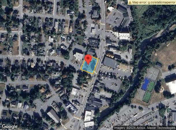
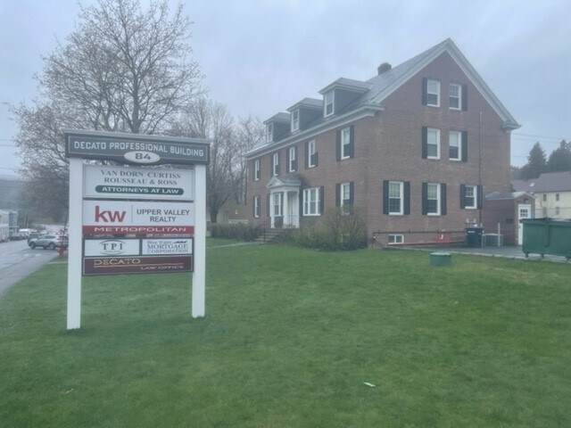
84 Hanover St, Lebanon, NH 03766

NEARBY LISTINGS FOR SALE OR LEASE
Property Detail
84 Hanover St
Officebuilding
Grafton
X
New Hampshire
33009C0894E
0.42 AC
2024
Concord/New Hampshire North Area
2024
Other Market Areas
961802
Claremont-Lebanon, NH-VT
5,383 SF
LBAN-000091-000210
DEMOGRAPHICS near 84 Hanover St
1 Mile
3 Mile
5 Mile
2024 Total Population
5,125
12,652
30,689
2029 Population
5,343
13,379
31,936
Pop Growth 2024-2029
+ 4.25%
+ 5.75%
+ 4.06%
Average Age
42
42
40
2024 Total Households
2,534
6,110
12,909
HH Growth 2024-2029
+ 4.03%
+ 5.60%
+ 4.20%
Median Household Inc
$90,121
$90,167
$90,539
Avg Household Size
1.90
2.00
2.10
2024 Avg HH Vehicles
2.00
2.00
2.00
Median Home Value
$264,366
$301,606
$318,205
Median Year Built
1963
1981
1978
Nearby Places
Map Layers
Map Styles
 Street
 Aerial
- Restaurants
- Banks
- Shops
- Fitness
- Groceries
PUBLIC TRANSPORTATION
COMMUTER RAIL
White River Junction Amtrak Station (Vermonter - Amtrak)
DRIVE
WALK
Distance
White River Junction Amtrak Station (Vermonter - Amtrak)
11 min
5.3 mi
Freight Ports
Portland, ME
DRIVE
WALK
Distance
Portland, ME
193 min
163.0 mi
SALE & LEASE HISTORY
LISTING DATE
SALE/LEASE

Jul 07, 2022
For Sale
Aug 10, 2022
For Lease
Nearby Properties
Address
Land Use
TOTAL SIZE
Lot Size
Zoning
Address
Land Use
TOTAL SIZE
Lot Size
Zoning
163,845 SF
MC
Address
Land Use
TOTAL SIZE
Lot Size
Zoning
3,136 SF
53.32 AC
R1
Address
Land Use
TOTAL SIZE
Lot Size
Zoning
137,168 SF
11.39 AC
GC
Address
Land Use
TOTAL SIZE
Lot Size
Zoning
3.76 AC
GC
Address
Land Use
TOTAL SIZE
Lot Size
Zoning
1,315 SF
16.35 AC
RL3
Address
Land Use
TOTAL SIZE
Lot Size
Zoning
356.40 AC
RL3
Address
Land Use
TOTAL SIZE
Lot Size
Zoning
191,951 SF
17.70 AC
R1
Address
Land Use
TOTAL SIZE
Lot Size
Zoning
86.78 AC
IC
Address
Land Use
TOTAL SIZE
Lot Size
Zoning
18.38 AC
R3
Address
Land Use
TOTAL SIZE
Lot Size
Zoning
202,868 SF
5.74 AC
LD
Address
Land Use
TOTAL SIZE
Lot Size
Zoning
10.20 AC
R3
Address
Land Use
TOTAL SIZE
Lot Size
Zoning
106,069 SF
19.42 AC
R3
Address
Land Use
TOTAL SIZE
Lot Size
Zoning
23.33 AC
R3
Address
Land Use
TOTAL SIZE
Lot Size
Zoning
37.58 AC
R3
Address
Land Use
TOTAL SIZE
Lot Size
Zoning
169.73 AC
MC
Address
Land Use
TOTAL SIZE
Lot Size
Zoning
128,514 SF
11.10 AC
R1
Address
Land Use
TOTAL SIZE
Lot Size
Zoning
146,472 SF
23.24 AC
INDL
Address
Land Use
TOTAL SIZE
Lot Size
Zoning
81,160 SF
2.61 AC
INDL
Address
Land Use
TOTAL SIZE
Lot Size
Zoning
116.22 AC
MC
Address
Land Use
TOTAL SIZE
Lot Size
Zoning
78,986 SF
3.71 AC
INDL
Address
Land Use
TOTAL SIZE
Lot Size
Zoning
75,077 SF
8.97 AC
INDL
Address
Land Use
TOTAL SIZE
Lot Size
Zoning
11.38 AC
MC
Address
Land Use
TOTAL SIZE
Lot Size
Zoning
10.74 AC
INDL
Address
Land Use
TOTAL SIZE
Lot Size
Zoning
74,917 SF
7.97 AC
INDL
Address
Land Use
TOTAL SIZE
Lot Size
Zoning
26.70 AC
INDL
Address
Land Use
TOTAL SIZE
Lot Size
Zoning
54.48 AC
R3
Address
Land Use
TOTAL SIZE
Lot Size
Zoning
13,876 SF
32.10 AC
BM
Address
Land Use
TOTAL SIZE
Lot Size
Zoning
49,866 SF
7.42 AC
INDL
Address
Land Use
TOTAL SIZE
Lot Size
Zoning
55,677 SF
2.10 AC
INDL
Address
Land Use
TOTAL SIZE
Lot Size
Zoning
11.23 AC
GC
The World's #1 Commercial Real Estate Marketplace
Connect with us
© 2025 CoStar Group
The information above has been obtained from sources believed reliable. While we do not doubt its accuracy we have not verified it and make no guarantee, warranty or representation about it. It is your responsibility to independently confirm its accuracy and completeness. Any projections, opinions, assumptions, or estimates used are for example only and do not represent the current or future performance of the property. The value of this transaction to you depends on tax and other factors which should be evaluated by your tax, financial, and legal advisors. You and your advisors should conduct a careful, independent investigation of the property to determine to your satisfaction the suitability of the property for your needs.