Property Record
84 N Main St, Windsor, NJ 08561
NEARBY LISTINGS FOR SALE OR LEASE
-
-
View all Windsor listings for sale on LoopNet.com
Property Detail
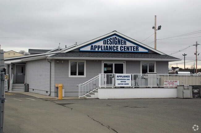
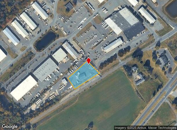
84 N Main St
12-00014-0000-00048
Mercer
Storemultistory
New Jersey
X
48
34021C0252F
1.09 AC
2024
Princeton
2025
Northern New Jersey
004312
Trenton-Princeton, NJ
DEMOGRAPHICS near 84 N Main St
1 mile
3 mile
5 mile
2024 Total Population
790
27,750
83,300
2029 Population
787
27,256
82,086
Pop Growth 2024-2029
(0.38%)
(1.78%)
(1.46%)
Average Age
42
42
42
2024 Total Households
253
9,826
29,801
HH Growth 2024-2029
(0.40%)
(2.05%)
(1.64%)
Median Household Inc
$146,093
$128,506
$129,932
Avg Household Size
3.00
2.80
2.70
2024 Avg HH Vehicles
2.00
2.00
2.00
Median Home Value
$463,888
$441,304
$402,318
Median Year Built
1976
1982
1980
Nearby Places
Map Layers
Map Styles
 Street
 Aerial
Transit
 Traffic
 Biking
Places
Listings with unknown addresses are not visible on the map
- Restaurants
- Banks
- Shops
- Fitness
- Groceries
PUBLIC TRANSPORTATION
COMMUTER RAIL
Hamilton (Northeast Corridor Line - NJ Transit Commuter Rail (NJ Transit))
Drive
Walk
Distance
Hamilton (Northeast Corridor Line - NJ Transit Commuter Rail (NJ Transit))
16 min
7.8 mi
Princeton Junction (Northeast Corridor Line - NJ Transit Commuter Rail (NJ Transit), Princeton Branch - NJ Transit Commuter Rail (NJ Transit))
Drive
Walk
Distance
Princeton Junction (Northeast Corridor Line - NJ Transit Commuter Rail (NJ Transit), Princeton Branch - NJ Transit Commuter Rail (NJ Transit))
16 min
8.0 mi
AIRPORT
Trenton Mercer
Drive
Walk
Distance
Trenton Mercer
30 min
18.4 mi
Freight Ports
Port of Philadelphia
Drive
Walk
Distance
Port of Philadelphia
55 min
40.5 mi
Nearby Properties
Address
Land Use
TOTAL SIZE
Lot Size
Zoning
Address
Land Use
TOTAL SIZE
Lot Size
Zoning
2,448 SF
59.55 AC
RO
Address
Land Use
TOTAL SIZE
Lot Size
Zoning
110.44 AC
OW
Address
Land Use
TOTAL SIZE
Lot Size
Zoning
55.71 AC
PCD
Address
Land Use
TOTAL SIZE
Lot Size
Zoning
318,155 SF
36.28 AC
RO
Address
Land Use
TOTAL SIZE
Lot Size
Zoning
23.13 AC
RR
Address
Land Use
TOTAL SIZE
Lot Size
Zoning
567,798 SF
134.06 AC
RO
Address
Land Use
TOTAL SIZE
Lot Size
Zoning
12.30 AC
R-1
Address
Land Use
TOTAL SIZE
Lot Size
Zoning
37.90 AC
PCD
Address
Land Use
TOTAL SIZE
Lot Size
Zoning
50.05 AC
RR
Address
Land Use
TOTAL SIZE
Lot Size
Zoning
243,700 SF
34.78 AC
HC
Address
Land Use
TOTAL SIZE
Lot Size
Zoning
23.60 AC
R1
Address
Land Use
TOTAL SIZE
Lot Size
Zoning
161,588 SF
28 AC
RO
Address
Land Use
TOTAL SIZE
Lot Size
Zoning
36.99 AC
R-1
Address
Land Use
TOTAL SIZE
Lot Size
Zoning
153,230 SF
12.30 AC
HC
Address
Land Use
TOTAL SIZE
Lot Size
Zoning
26.65 AC
R-2
Address
Land Use
TOTAL SIZE
Lot Size
Zoning
107,069 SF
16.02 AC
HC
Address
Land Use
TOTAL SIZE
Lot Size
Zoning
21.81 AC
RO
Address
Land Use
TOTAL SIZE
Lot Size
Zoning
38.54 AC
OW
Address
Land Use
TOTAL SIZE
Lot Size
Zoning
224,512 SF
15.24 AC
RM
Address
Land Use
TOTAL SIZE
Lot Size
Zoning
14.10 AC
PRRC
Address
Land Use
TOTAL SIZE
Lot Size
Zoning
186,552 SF
10.10 AC
RM
Address
Land Use
TOTAL SIZE
Lot Size
Zoning
189,788 SF
14.52 AC
RM
Address
Land Use
TOTAL SIZE
Lot Size
Zoning
149,897 SF
18.95 AC
HC2
Address
Land Use
TOTAL SIZE
Lot Size
Zoning
7.50 AC
R-4
Address
Land Use
TOTAL SIZE
Lot Size
Zoning
11.30 AC
R-3
Address
Land Use
TOTAL SIZE
Lot Size
Zoning
38,630 SF
11.09 AC
HC2
Address
Land Use
TOTAL SIZE
Lot Size
Zoning
15.62 AC
PCD
Address
Land Use
TOTAL SIZE
Lot Size
Zoning
35.90 AC
RR
Address
Land Use
TOTAL SIZE
Lot Size
Zoning
94,482 SF
19.10 AC
HC2
Address
Land Use
TOTAL SIZE
Lot Size
Zoning
138,409 SF
8.10 AC
RM
The World's #1 Commercial Real Estate Marketplace
Connect with us
© 2026 CoStar Group
The information above has been obtained from sources believed reliable. While we do not doubt its accuracy we have not verified it and make no guarantee, warranty or representation about it. It is your responsibility to independently confirm its accuracy and completeness. Any projections, opinions, assumptions, or estimates used are for example only and do not represent the current or future performance of the property. The value of this transaction to you depends on tax and other factors which should be evaluated by your tax, financial, and legal advisors. You and your advisors should conduct a careful, independent investigation of the property to determine to your satisfaction the suitability of the property for your needs.