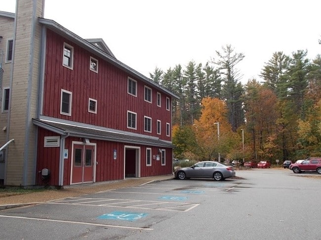
Property Record
84 Silk Farm Rd, Concord, NH 03301

Save to a Folder
{{folder.Name}}
{{folder.ListingIds.length}} Properties
{{folder.ListingIds.length}} Property
Create a New Folder
Property Detail
84 Silk Farm Rd
CNCD-000092-000001-000006
Merrimack
Charitableorganization
New Hampshire
RO
6
B and X Area of moderate flood hazard, usually the area between the limits of the 100-year and 500-year floods.
16.42 AC
0
Concord/New Hampshire North Area
2025
Other Market Areas
032500
Concord, NH
20,217 SF
NEARBY LISTINGS FOR SALE OR LEASE
DEMOGRAPHICS near 84 Silk Farm Rd
1 mile
3 mile
5 mile
2025 Total Population
268
21,252
38,707
2030 Population
270
21,567
39,312
Pop Growth 2025-2030
+ 0.75%
+ 1.48%
+ 1.56%
Average Age
43
43
43
2025 Total Households
98
8,702
15,829
HH Growth 2025-2030
+ 1.02%
+ 1.67%
+ 1.67%
Median Household Inc
$94,530
$96,991
$93,236
Avg Household Size
2.30
2.20
2.30
2025 Avg HH Vehicles
2.00
2.00
2.00
Median Home Value
$447,222
$429,017
$394,633
Median Year Built
1963
1949
1970
Nearby Places
Map Layers
Map Styles
 Street
 Aerial
Layers
 Traffic
 Biking
Places
Listings with unknown addresses are not visible on the map
- Restaurants
- Banks
- Shops
- Fitness
- Groceries
PUBLIC TRANSPORTATION
AIRPORT
Manchester Boston Regional
Drive
Walk
Distance
Manchester Boston Regional
37 min
23.2 mi
Nearby Properties
Address
Land Use
TOTAL SIZE
Lot Size
Zoning
Address
Land Use
TOTAL SIZE
Lot Size
Zoning
181,592 SF
5.53 AC
IS
Address
Land Use
TOTAL SIZE
Lot Size
Zoning
7.22 AC
IS
Address
Land Use
TOTAL SIZE
Lot Size
Zoning
230,929 SF
127 AC
IS
Address
Land Use
TOTAL SIZE
Lot Size
Zoning
161,715 SF
70 AC
CV
Address
Land Use
TOTAL SIZE
Lot Size
Zoning
128.74 AC
IS
Address
Land Use
TOTAL SIZE
Lot Size
Zoning
10.48 AC
IS
Address
Land Use
TOTAL SIZE
Lot Size
Zoning
1.92 AC
IS
Address
Land Use
TOTAL SIZE
Lot Size
Zoning
79,703 SF
2.16 AC
CVP
Address
Land Use
TOTAL SIZE
Lot Size
Zoning
88,452 SF
1.12 AC
IS
Address
Land Use
TOTAL SIZE
Lot Size
Zoning
110 AC
IN
Address
Land Use
TOTAL SIZE
Lot Size
Zoning
75,917 SF
0.30 AC
CBP
Address
Land Use
TOTAL SIZE
Lot Size
Zoning
1.34 AC
CVP
Address
Land Use
TOTAL SIZE
Lot Size
Zoning
25,725 SF
0.22 AC
IS
Address
Land Use
TOTAL SIZE
Lot Size
Zoning
89,791 SF
4.56 AC
IS
Address
Land Use
TOTAL SIZE
Lot Size
Zoning
15.22 AC
OCP
Address
Land Use
TOTAL SIZE
Lot Size
Zoning
81,493 SF
33 AC
CV
Address
Land Use
TOTAL SIZE
Lot Size
Zoning
146,511 SF
19.85 AC
RS
Address
Land Use
TOTAL SIZE
Lot Size
Zoning
11,574 SF
6.57 AC
CV
Address
Land Use
TOTAL SIZE
Lot Size
Zoning
13 AC
IS
Address
Land Use
TOTAL SIZE
Lot Size
Zoning
109,643 SF
128.35 AC
IS
Address
Land Use
TOTAL SIZE
Lot Size
Zoning
76,966 SF
11.15 AC
RS
Address
Land Use
TOTAL SIZE
Lot Size
Zoning
132,828 SF
1.31 AC
CBP
Address
Land Use
TOTAL SIZE
Lot Size
Zoning
106,400 SF
6.41 AC
IS
Address
Land Use
TOTAL SIZE
Lot Size
Zoning
73,655 SF
0.78 AC
CBP
Address
Land Use
TOTAL SIZE
Lot Size
Zoning
64,843 SF
6.60 AC
C
Address
Land Use
TOTAL SIZE
Lot Size
Zoning
73,281 SF
2.80 AC
RD
Address
Land Use
TOTAL SIZE
Lot Size
Zoning
2.32 AC
CVP
Address
Land Use
TOTAL SIZE
Lot Size
Zoning
63,634 SF
0.53 AC
CBP
Address
Land Use
TOTAL SIZE
Lot Size
Zoning
52,497 SF
28 AC
IS
Address
Land Use
TOTAL SIZE
Lot Size
Zoning
3.75 AC
IS
The World's #1 Commercial Real Estate Marketplace
Connect with us
© 2026 CoStar Group
The information above has been obtained from sources believed reliable. While we do not doubt its accuracy we have not verified it and make no guarantee, warranty or representation about it. It is your responsibility to independently confirm its accuracy and completeness. Any projections, opinions, assumptions, or estimates used are for example only and do not represent the current or future performance of the property. The value of this transaction to you depends on tax and other factors which should be evaluated by your tax, financial, and legal advisors. You and your advisors should conduct a careful, independent investigation of the property to determine to your satisfaction the suitability of the property for your needs.