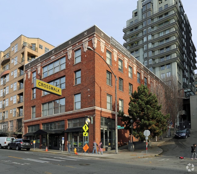
Property Record
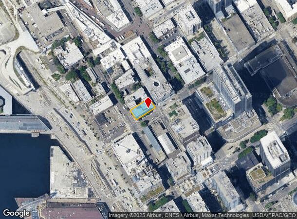
84 Union St, Seattle, WA 98101
NEARBY LISTINGS FOR SALE OR LEASE
Property Detail
84 Union St
Seattle-Tacoma-Bellevue, WA
Dennys A A 4Th Add
197620-0160
DENNYS A A 4TH ADD PLAT BLOCK: F PLAT LOT: 12
Apartment
King
X
Washington
53033C0630G
12
2025
0.17 AC
2024
Pike Place Market
008101
Seattle/Puget Sound
22,918 SF
DEMOGRAPHICS near 84 Union St
1 Mile
3 Mile
5 Mile
2024 Total Population
76,325
252,483
490,886
2029 Population
78,895
258,514
499,598
Pop Growth 2024-2029
+ 3.37%
+ 2.39%
+ 1.77%
Average Age
39
38
38
2024 Total Households
47,907
139,921
245,118
HH Growth 2024-2029
+ 3.40%
+ 2.39%
+ 1.86%
Median Household Inc
$107,104
$111,791
$114,179
Avg Household Size
1.40
1.70
1.90
2024 Avg HH Vehicles
1.00
1.00
1.00
Median Home Value
$876,024
$960,574
$934,645
Median Year Built
2002
1991
1984
Nearby Places
Map Layers
Map Styles
 Street
 Aerial
- Restaurants
- Banks
- Shops
- Fitness
- Groceries
PUBLIC TRANSPORTATION
TRANSIT/SUBWAY
University St Sta AcRd & Tunnel Sta.-BAY A (LINK to Sea-Tac - Central Puget Sound Regional Transit Authority Rail (Link Light Rail/Sounder))
DRIVE
WALK
Distance
University St Sta AcRd & Tunnel Sta.-BAY A (LINK to Sea-Tac - Central Puget Sound Regional Transit Authority Rail (Link Light Rail/Sounder))
2 min
5 min
0.3 mi
University Street (Central Link - Central Puget Sound Regional Transit Authority Rail (Link Light Rail/Sounder))
DRIVE
WALK
Distance
University Street (Central Link - Central Puget Sound Regional Transit Authority Rail (Link Light Rail/Sounder))
2 min
5 min
0.3 mi
Westlake (Central Link - Central Puget Sound Regional Transit Authority Rail (Link Light Rail/Sounder))
DRIVE
WALK
Distance
Westlake (Central Link - Central Puget Sound Regional Transit Authority Rail (Link Light Rail/Sounder))
4 min
8 min
0.4 mi
Westlake Center (Seattle Center Monorail - Seattle Monorail Services (Seattle Monorail))
DRIVE
WALK
Distance
Westlake Center (Seattle Center Monorail - Seattle Monorail Services (Seattle Monorail))
2 min
9 min
0.5 mi
Westlake Hub (South Lake Union Streetcar - Seattle Streetcar)
DRIVE
WALK
Distance
Westlake Hub (South Lake Union Streetcar - Seattle Streetcar)
3 min
10 min
0.5 mi
COMMUTER RAIL
King Street (Seattle) Station (Sounder South Line - Central Puget Sound Regional Transit Authority Rail (Link Light Rail/Sounder))
DRIVE
WALK
Distance
King Street (Seattle) Station (Sounder South Line - Central Puget Sound Regional Transit Authority Rail (Link Light Rail/Sounder))
3 min
19 min
1.0 mi
AIRPORT
Seattle-Tacoma International
DRIVE
WALK
Distance
Seattle-Tacoma International
24 min
14.7 mi
Seattle Paine Field International
DRIVE
WALK
Distance
Seattle Paine Field International
36 min
24.1 mi
SALE & LEASE HISTORY
LISTING DATE
SALE/LEASE

Mar 25, 2024
For Sale
Dec 12, 2024
For Lease
Aug 24, 2022
For Lease
Nearby Properties
Address
Land Use
TOTAL SIZE
Lot Size
Zoning
Address
Land Use
TOTAL SIZE
Lot Size
Zoning
800,000 SF
8.57 AC
SM-UP 95 (
Address
Land Use
TOTAL SIZE
Lot Size
Zoning
2.84 AC
DMC 340/29
Address
Land Use
TOTAL SIZE
Lot Size
Zoning
793,990 SF
30.81 AC
UI U/85
Address
Land Use
TOTAL SIZE
Lot Size
Zoning
946,212 SF
1.58 AC
DMC 340/29
Address
Land Use
TOTAL SIZE
Lot Size
Zoning
686,722 SF
1.26 AC
SM-SLU 240
Address
Land Use
TOTAL SIZE
Lot Size
Zoning
36,864 SF
8.02 AC
SM-UP 95 (
Address
Land Use
TOTAL SIZE
Lot Size
Zoning
992,925 SF
4.28 AC
MIO-240-HR
Address
Land Use
TOTAL SIZE
Lot Size
Zoning
1,526,621 SF
1.36 AC
DOC1 U/450
Address
Land Use
TOTAL SIZE
Lot Size
Zoning
716,128 SF
1.41 AC
SM-SLU 175
Address
Land Use
TOTAL SIZE
Lot Size
Zoning
1,062,251 SF
1.47 AC
DOC2 500/3
Address
Land Use
TOTAL SIZE
Lot Size
Zoning
763,898 SF
2.03 AC
DOC2 500/3
Address
Land Use
TOTAL SIZE
Lot Size
Zoning
1,137,666 SF
2.07 AC
DOC1 U/450
Address
Land Use
TOTAL SIZE
Lot Size
Zoning
7,930 SF
4.14 AC
MIO-240-HR
Address
Land Use
TOTAL SIZE
Lot Size
Zoning
6,379 SF
127.60 AC
MML U/85
Address
Land Use
TOTAL SIZE
Lot Size
Zoning
1,128,575 SF
1.30 AC
DOC1 U/450
Address
Land Use
TOTAL SIZE
Lot Size
Zoning
615,000 SF
0.88 AC
DOC2 500/3
Address
Land Use
TOTAL SIZE
Lot Size
Zoning
861,221 SF
1.30 AC
DMC 340/29
Address
Land Use
TOTAL SIZE
Lot Size
Zoning
565,110 SF
29.11 AC
II U/85
Address
Land Use
TOTAL SIZE
Lot Size
Zoning
377,813 SF
1.65 AC
DOC2 500/3
Address
Land Use
TOTAL SIZE
Lot Size
Zoning
1,011,547 SF
0.35 AC
DOC1 U/450
Address
Land Use
TOTAL SIZE
Lot Size
Zoning
1,478,612 SF
0.80 AC
DOC2 500/3
Address
Land Use
TOTAL SIZE
Lot Size
Zoning
67,235 SF
0.45 AC
DOC2 500/3
Address
Land Use
TOTAL SIZE
Lot Size
Zoning
922,344 SF
1.33 AC
DRC 85-170
Address
Land Use
TOTAL SIZE
Lot Size
Zoning
413,982 SF
0.58 AC
DMC 340/29
Address
Land Use
TOTAL SIZE
Lot Size
Zoning
412,000 SF
1.27 AC
DOC1 U/450
Address
Land Use
TOTAL SIZE
Lot Size
Zoning
943,610 SF
1.24 AC
DOC1 U/450
Address
Land Use
TOTAL SIZE
Lot Size
Zoning
155,795 SF
7.89 AC
SM-UP 95 (
Address
Land Use
TOTAL SIZE
Lot Size
Zoning
411,654 SF
0.59 AC
DMC 240/29
The World's #1 Commercial Real Estate Marketplace
Connect with us
© 2025 CoStar Group
The information above has been obtained from sources believed reliable. While we do not doubt its accuracy we have not verified it and make no guarantee, warranty or representation about it. It is your responsibility to independently confirm its accuracy and completeness. Any projections, opinions, assumptions, or estimates used are for example only and do not represent the current or future performance of the property. The value of this transaction to you depends on tax and other factors which should be evaluated by your tax, financial, and legal advisors. You and your advisors should conduct a careful, independent investigation of the property to determine to your satisfaction the suitability of the property for your needs.