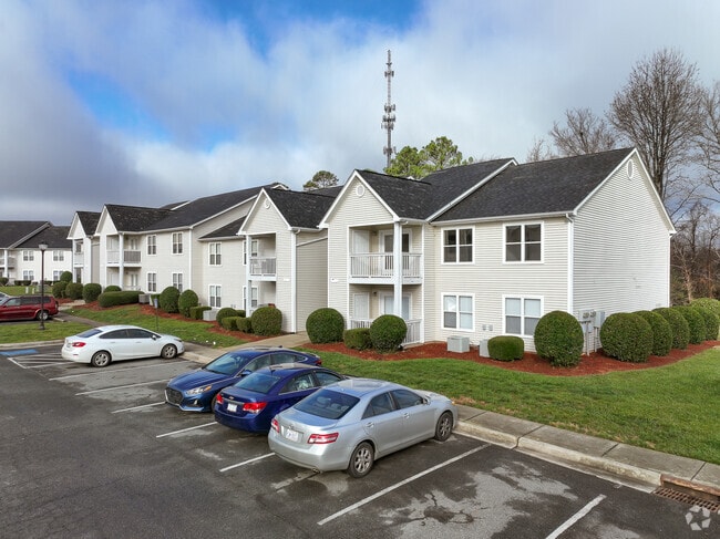
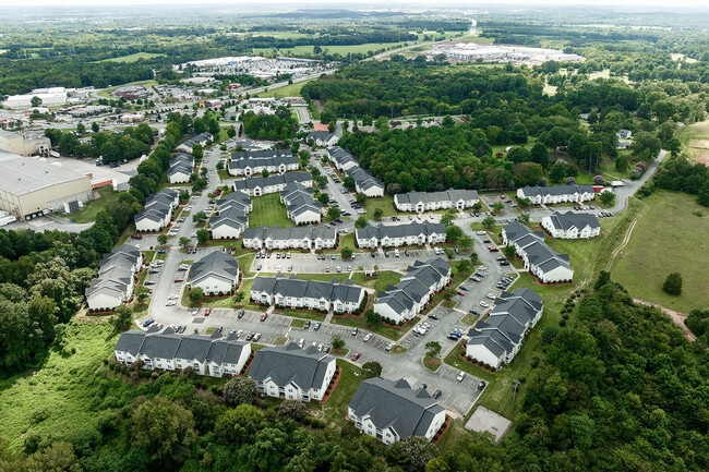
Property Record
840 Devonshire Dr, Concord, NC 28027

Property Detail
840 Devonshire Dr
5610-83-2643-0000
NE SIDE ROCK HILL CHURCH RD
Gardenaptcourtapt5plusunits
CABARRUS
RC
North Carolina
B and X Area of moderate flood hazard, usually the area between the limits of the 100-year and 500-year floods.
24.13 AC
2025
Outlying Cabarrus County
2025
Charlotte
042502
Charlotte-Concord-Gastonia, NC-SC
16,216 SF
NEARBY LISTINGS FOR SALE OR LEASE
DEMOGRAPHICS near 840 Devonshire Dr
1 mile
3 mile
5 mile
2025 Total Population
3,926
55,016
115,430
2030 Population
4,229
58,879
123,361
Pop Growth 2025-2030
+ 7.72%
+ 7.02%
+ 6.87%
Average Age
40
39
39
2025 Total Households
1,512
21,262
43,880
HH Growth 2025-2030
+ 8.00%
+ 7.17%
+ 7.09%
Median Household Inc
$55,922
$65,698
$77,457
Avg Household Size
2.50
2.50
2.60
2025 Avg HH Vehicles
2.00
2.00
2.00
Median Home Value
$220,422
$306,320
$334,837
Median Year Built
1991
1990
1995
Nearby Places
Map Layers
Map Styles
 Street
 Aerial
Layers
 Traffic
 Biking
Places
Listings with unknown addresses are not visible on the map
- Restaurants
- Banks
- Shops
- Fitness
- Groceries
PUBLIC TRANSPORTATION
COMMUTER RAIL
Kannapolis Station (Piedmont - North Carolina by Train (NC Train))
Drive
Walk
Distance
Kannapolis Station (Piedmont - North Carolina by Train (NC Train))
16 min
8.9 mi
AIRPORT
Concord-Padgett Regional
Drive
Walk
Distance
Concord-Padgett Regional
17 min
9.1 mi
Charlotte/Douglas International
Drive
Walk
Distance
Charlotte/Douglas International
43 min
28.0 mi
Freight Ports
Port of Wilmington
Drive
Walk
Distance
Port of Wilmington
253 min
196.6 mi
Nearby Properties
Address
Land Use
TOTAL SIZE
Lot Size
Zoning
Address
Land Use
TOTAL SIZE
Lot Size
Zoning
122,131 SF
415.58 AC
I-2
Address
Land Use
TOTAL SIZE
Lot Size
Zoning
162,854 SF
2.11 AC
CC
Address
Land Use
TOTAL SIZE
Lot Size
Zoning
103,849 SF
3.03 AC
CC
Address
Land Use
TOTAL SIZE
Lot Size
Zoning
23,940 SF
45.03 AC
C-1
Address
Land Use
TOTAL SIZE
Lot Size
Zoning
333,623 SF
108.12 AC
RV
Address
Land Use
TOTAL SIZE
Lot Size
Zoning
495.38 AC
I-2
Address
Land Use
TOTAL SIZE
Lot Size
Zoning
670.09 AC
I-2
Address
Land Use
TOTAL SIZE
Lot Size
Zoning
30,423 SF
20.75 AC
RC
Address
Land Use
TOTAL SIZE
Lot Size
Zoning
163,494 SF
89.85 AC
I-2
Address
Land Use
TOTAL SIZE
Lot Size
Zoning
136,582 SF
24.87 AC
I-2
Address
Land Use
TOTAL SIZE
Lot Size
Zoning
32,872 SF
0.90 AC
CC
Address
Land Use
TOTAL SIZE
Lot Size
Zoning
6,880 SF
18.34 AC
RC
Address
Land Use
TOTAL SIZE
Lot Size
Zoning
203,931 SF
44.99 AC
RM-2
Address
Land Use
TOTAL SIZE
Lot Size
Zoning
310,387 SF
20.66 AC
I-2
Address
Land Use
TOTAL SIZE
Lot Size
Zoning
122,102 SF
4.69 AC
CC
Address
Land Use
TOTAL SIZE
Lot Size
Zoning
38,595 SF
11.71 AC
RC
Address
Land Use
TOTAL SIZE
Lot Size
Zoning
173,459 SF
15.03 AC
O-I
Address
Land Use
TOTAL SIZE
Lot Size
Zoning
7,566 SF
19.98 AC
RC
Address
Land Use
TOTAL SIZE
Lot Size
Zoning
161,202 SF
2.68 AC
CC
Address
Land Use
TOTAL SIZE
Lot Size
Zoning
15,215 SF
30.18 AC
RM-2
Address
Land Use
TOTAL SIZE
Lot Size
Zoning
6,539 SF
173.17 AC
LI
Address
Land Use
TOTAL SIZE
Lot Size
Zoning
15,156 SF
12.54 AC
RC
Address
Land Use
TOTAL SIZE
Lot Size
Zoning
12,480 SF
10.22 AC
RC
Address
Land Use
TOTAL SIZE
Lot Size
Zoning
297,232 SF
31.82 AC
I-2
Address
Land Use
TOTAL SIZE
Lot Size
Zoning
21,714 SF
15.02 AC
RC
Address
Land Use
TOTAL SIZE
Lot Size
Zoning
157,816 SF
40.43 AC
I-2
Address
Land Use
TOTAL SIZE
Lot Size
Zoning
94,924 SF
0.39 AC
CC
Address
Land Use
TOTAL SIZE
Lot Size
Zoning
160,412 SF
39.97 AC
O-I
Address
Land Use
TOTAL SIZE
Lot Size
Zoning
278,980 SF
17.91 AC
I-1
The World's #1 Commercial Real Estate Marketplace
Connect with us
© 2026 CoStar Group
The information above has been obtained from sources believed reliable. While we do not doubt its accuracy we have not verified it and make no guarantee, warranty or representation about it. It is your responsibility to independently confirm its accuracy and completeness. Any projections, opinions, assumptions, or estimates used are for example only and do not represent the current or future performance of the property. The value of this transaction to you depends on tax and other factors which should be evaluated by your tax, financial, and legal advisors. You and your advisors should conduct a careful, independent investigation of the property to determine to your satisfaction the suitability of the property for your needs.