Property Record
840 Harrisville Rd, Colora, MD 21917
NEARBY LISTINGS FOR SALE OR LEASE
Property Detail
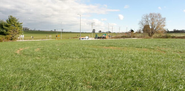
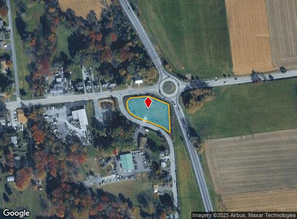
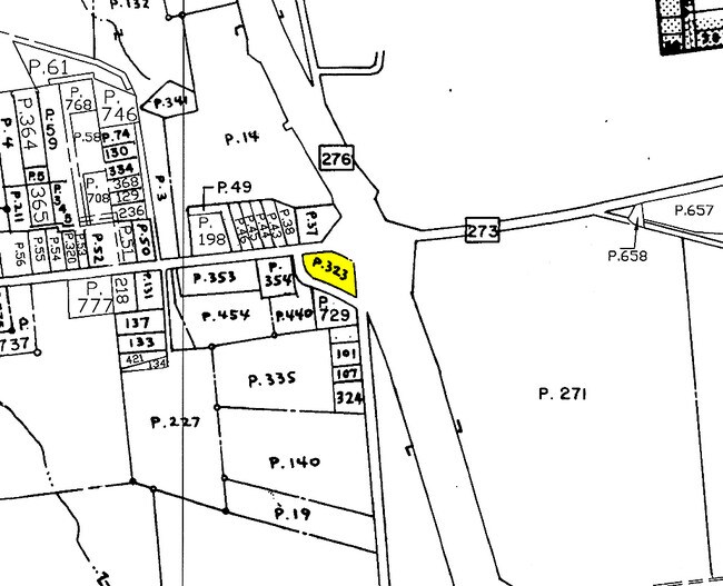
840 Harrisville Rd
06-017576
.8817 840 HARRISVILLE ROAD HARRISVILLE
Commercialacreage
Cecil
X
Maryland
42029C0355G
0.88 AC
2025
Cecil County
2025
Baltimore
031302
Philadelphia-Camden-Wilmington, PA-NJ-DE-MD
DEMOGRAPHICS near 840 Harrisville Rd
1 Mile
3 Mile
5 Mile
2024 Total Population
1,726
8,793
21,186
2029 Population
1,731
8,860
21,460
Pop Growth 2024-2029
+ 0.29%
+ 0.76%
+ 1.29%
Average Age
40
41
41
2024 Total Households
620
3,242
7,718
HH Growth 2024-2029
+ 0.48%
+ 0.80%
+ 1.37%
Median Household Inc
$81,120
$85,577
$82,397
Avg Household Size
2.70
2.70
2.70
2024 Avg HH Vehicles
2.00
2.00
2.00
Median Home Value
$279,735
$291,778
$300,874
Median Year Built
1965
1981
1984
Nearby Places
Map Layers
Map Styles
 Street
 Aerial
- Restaurants
- Banks
- Shops
- Fitness
- Groceries
Nearby Properties
Address
Land Use
TOTAL SIZE
Lot Size
Zoning
Address
Land Use
TOTAL SIZE
Lot Size
Zoning
63,314 SF
17.52 AC
CC
Address
Land Use
TOTAL SIZE
Lot Size
Zoning
12,128 SF
56.42 AC
NAR
Address
Land Use
TOTAL SIZE
Lot Size
Zoning
108,477 SF
10.04 AC
R1
Address
Land Use
TOTAL SIZE
Lot Size
Zoning
66,647 SF
12.05 AC
RR
Address
Land Use
TOTAL SIZE
Lot Size
Zoning
68,310 SF
2.97 AC
L1
Address
Land Use
TOTAL SIZE
Lot Size
Zoning
11,972 SF
7.84 AC
R3
Address
Land Use
TOTAL SIZE
Lot Size
Zoning
14,836 SF
6.45 AC
R1 R3
Address
Land Use
TOTAL SIZE
Lot Size
Zoning
9,107 SF
16.12 AC
CC
Address
Land Use
TOTAL SIZE
Lot Size
Zoning
8,686 SF
370.93 AC
A-1
Address
Land Use
TOTAL SIZE
Lot Size
Zoning
19,965 SF
12.71 AC
RR
Address
Land Use
TOTAL SIZE
Lot Size
Zoning
8,400 SF
15.19 AC
BG
Address
Land Use
TOTAL SIZE
Lot Size
Zoning
12,000 SF
7.02 AC
BG
Address
Land Use
TOTAL SIZE
Lot Size
Zoning
13,064 SF
0.58 AC
CC
Address
Land Use
TOTAL SIZE
Lot Size
Zoning
5,776 SF
7.26 AC
BG
Address
Land Use
TOTAL SIZE
Lot Size
Zoning
103,154 SF
20.10 AC
R1
Address
Land Use
TOTAL SIZE
Lot Size
Zoning
3,706 SF
10 AC
RR
Address
Land Use
TOTAL SIZE
Lot Size
Zoning
7,131 SF
1.70 AC
LI
Address
Land Use
TOTAL SIZE
Lot Size
Zoning
6,000 SF
0.15 AC
CC
Address
Land Use
TOTAL SIZE
Lot Size
Zoning
4,520 SF
2.05 AC
R3
Address
Land Use
TOTAL SIZE
Lot Size
Zoning
5,200 SF
1.91 AC
LC
Address
Land Use
TOTAL SIZE
Lot Size
Zoning
8 AC
R3
Address
Land Use
TOTAL SIZE
Lot Size
Zoning
20.68 AC
MH
Address
Land Use
TOTAL SIZE
Lot Size
Zoning
15,416 SF
1 AC
R3
Address
Land Use
TOTAL SIZE
Lot Size
Zoning
6,080 SF
3.56 AC
NAR
Address
Land Use
TOTAL SIZE
Lot Size
Zoning
9,060 SF
3.99 AC
BG
Address
Land Use
TOTAL SIZE
Lot Size
Zoning
9,600 SF
25.99 AC
BG
Address
Land Use
TOTAL SIZE
Lot Size
Zoning
18,049 SF
5.35 AC
M1
Address
Land Use
TOTAL SIZE
Lot Size
Zoning
6,240 SF
24.52 AC
CC
Address
Land Use
TOTAL SIZE
Lot Size
Zoning
10,640 SF
3.98 AC
BG
Address
Land Use
TOTAL SIZE
Lot Size
Zoning
1,210 SF
1.21 AC
LI
The World's #1 Commercial Real Estate Marketplace
Connect with us
© 2025 CoStar Group
The information above has been obtained from sources believed reliable. While we do not doubt its accuracy we have not verified it and make no guarantee, warranty or representation about it. It is your responsibility to independently confirm its accuracy and completeness. Any projections, opinions, assumptions, or estimates used are for example only and do not represent the current or future performance of the property. The value of this transaction to you depends on tax and other factors which should be evaluated by your tax, financial, and legal advisors. You and your advisors should conduct a careful, independent investigation of the property to determine to your satisfaction the suitability of the property for your needs.