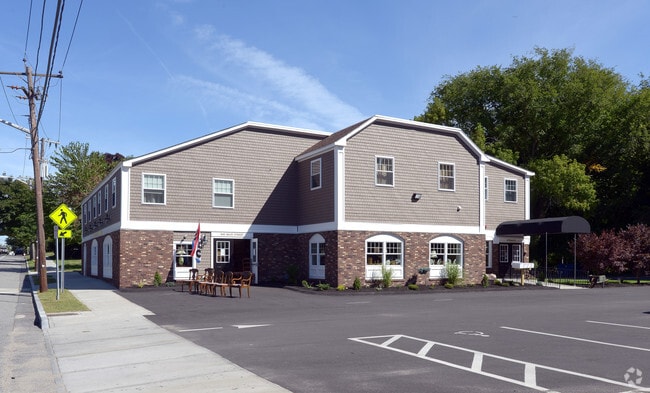
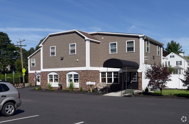
Property Record
840 Main St, Warren, RI 02885

Property Detail
840 Main St
WARR-000015B-000000-000020
Bristol
Commercialofficeresidentialmixeduse
Rhode Island
R10
20
B and X Area of moderate flood hazard, usually the area between the limits of the 100-year and 500-year floods.
0.72 AC
2025
Bristol County
2025
Providence
030602
Providence-Warwick, RI-MA
8,178 SF
NEARBY LISTINGS FOR SALE OR LEASE
DEMOGRAPHICS near 840 Main St
1 mile
3 mile
5 mile
2025 Total Population
8,425
36,350
76,766
2030 Population
8,314
36,198
77,060
Pop Growth 2025-2030
(1.32%)
(0.42%)
+ 0.38%
Average Age
45
44
44
2025 Total Households
3,877
14,583
30,892
HH Growth 2025-2030
(1.47%)
(0.53%)
+ 0.42%
Median Household Inc
$83,384
$108,436
$103,098
Avg Household Size
2.10
2.40
2.40
2025 Avg HH Vehicles
2.00
2.00
2.00
Median Home Value
$470,588
$544,093
$478,384
Median Year Built
1951
1965
1961
Nearby Places
Map Layers
Map Styles
 Street
 Aerial
Layers
 Traffic
 Biking
Places
Listings with unknown addresses are not visible on the map
- Restaurants
- Banks
- Shops
- Fitness
- Groceries
PUBLIC TRANSPORTATION
AIRPORT
Rhode Island Tf Green International
Drive
Walk
Distance
Rhode Island Tf Green International
33 min
19.4 mi
Freight Ports
Port of New Bedford Harbor
Drive
Walk
Distance
Port of New Bedford Harbor
32 min
22.6 mi
SALE & LEASE HISTORY
LISTING DATE
SALE/LEASE

Jul 28, 2025
For Lease
Nearby Properties
Address
Land Use
TOTAL SIZE
Lot Size
Zoning
Address
Land Use
TOTAL SIZE
Lot Size
Zoning
113,253 SF
85.69 AC
HPC
Address
Land Use
TOTAL SIZE
Lot Size
Zoning
367,305 SF
8.23 AC
WF
Address
Land Use
TOTAL SIZE
Lot Size
Zoning
159,363 SF
14.19 AC
R-10
Address
Land Use
TOTAL SIZE
Lot Size
Zoning
17,500 SF
5.92 AC
WF
Address
Land Use
TOTAL SIZE
Lot Size
Zoning
183,710 SF
30.50 AC
RE
Address
Land Use
TOTAL SIZE
Lot Size
Zoning
2.71 AC
B
Address
Land Use
TOTAL SIZE
Lot Size
Zoning
2,080 SF
11.01 AC
R-15
Address
Land Use
TOTAL SIZE
Lot Size
Zoning
18,236 SF
10.24 AC
LB
Address
Land Use
TOTAL SIZE
Lot Size
Zoning
140,460 SF
12.50 AC
R10
Address
Land Use
TOTAL SIZE
Lot Size
Zoning
4.39 AC
B
Address
Land Use
TOTAL SIZE
Lot Size
Zoning
1.97 AC
R10
Address
Land Use
TOTAL SIZE
Lot Size
Zoning
4.40 AC
B
Address
Land Use
TOTAL SIZE
Lot Size
Zoning
138.20 AC
RE
Address
Land Use
TOTAL SIZE
Lot Size
Zoning
218.86 AC
C
Address
Land Use
TOTAL SIZE
Lot Size
Zoning
199,796 SF
9.11 AC
RB
Address
Land Use
TOTAL SIZE
Lot Size
Zoning
63,730 SF
12.97 AC
M
Address
Land Use
TOTAL SIZE
Lot Size
Zoning
31,338 SF
0.95 AC
GI
Address
Land Use
TOTAL SIZE
Lot Size
Zoning
2.88 AC
B
Address
Land Use
TOTAL SIZE
Lot Size
Zoning
19,144 SF
7.29 AC
R40
Address
Land Use
TOTAL SIZE
Lot Size
Zoning
39,150 SF
10.10 AC
C
Address
Land Use
TOTAL SIZE
Lot Size
Zoning
61,332 SF
6.43 AC
R-6
Address
Land Use
TOTAL SIZE
Lot Size
Zoning
31,588 SF
18.21 AC
RE
Address
Land Use
TOTAL SIZE
Lot Size
Zoning
29,058 SF
21.97 AC
R40
Address
Land Use
TOTAL SIZE
Lot Size
Zoning
48,986 SF
10.33 AC
RE
Address
Land Use
TOTAL SIZE
Lot Size
Zoning
4.80 AC
GB
Address
Land Use
TOTAL SIZE
Lot Size
Zoning
19,799 SF
13.36 AC
GI
Address
Land Use
TOTAL SIZE
Lot Size
Zoning
4,398 SF
2.91 AC
R40
Address
Land Use
TOTAL SIZE
Lot Size
Zoning
120,540 SF
6.33 AC
M
Address
Land Use
TOTAL SIZE
Lot Size
Zoning
68,144 SF
7.74 AC
M
Address
Land Use
TOTAL SIZE
Lot Size
Zoning
64,850 SF
11.67 AC
CI
The World's #1 Commercial Real Estate Marketplace
Connect with us
© 2026 CoStar Group
The information above has been obtained from sources believed reliable. While we do not doubt its accuracy we have not verified it and make no guarantee, warranty or representation about it. It is your responsibility to independently confirm its accuracy and completeness. Any projections, opinions, assumptions, or estimates used are for example only and do not represent the current or future performance of the property. The value of this transaction to you depends on tax and other factors which should be evaluated by your tax, financial, and legal advisors. You and your advisors should conduct a careful, independent investigation of the property to determine to your satisfaction the suitability of the property for your needs.