Property Record
840 Riverside Dr, Asheville, NC 28804

NEARBY LISTINGS FOR SALE OR LEASE
Property Detail
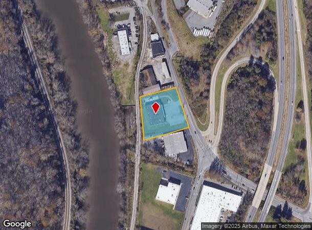
840 Riverside Dr
9639-78-5257-00000
Property/Westinghouse Electric
Warehouse
SUBDIV: BLOCK: LOT: SECTION: PLAT: 0000-0000
AE
Buncombe
3700963900J
North Carolina
0
1.55 AC
2025
North Asheville
001500
Asheville
12,610 SF
Asheville, NC
DEMOGRAPHICS near 840 Riverside Dr
1 Mile
3 Mile
5 Mile
2024 Total Population
5,643
51,615
98,198
2029 Population
5,796
53,531
101,869
Pop Growth 2024-2029
+ 2.71%
+ 3.71%
+ 3.74%
Average Age
37
41
41
2024 Total Households
2,112
22,847
43,445
HH Growth 2024-2029
+ 2.04%
+ 3.28%
+ 3.28%
Median Household Inc
$50,444
$63,367
$62,698
Avg Household Size
2.20
2.10
2.10
2024 Avg HH Vehicles
2.00
2.00
2.00
Median Home Value
$380,461
$419,798
$369,817
Median Year Built
1966
1972
1977
Nearby Places
Map Layers
Map Styles
 Street
 Aerial
- Restaurants
- Banks
- Shops
- Fitness
- Groceries
PUBLIC TRANSPORTATION
AIRPORT
Asheville Regional
DRIVE
WALK
Distance
Asheville Regional
22 min
15.9 mi
Freight Ports
North Charleston Terminal
DRIVE
WALK
Distance
North Charleston Terminal
293 min
259.6 mi
Nearby Properties
Address
Land Use
TOTAL SIZE
Lot Size
Zoning
Address
Land Use
TOTAL SIZE
Lot Size
Zoning
358,342 SF
137.57 AC
RESORT
Address
Land Use
TOTAL SIZE
Lot Size
Zoning
291,240 SF
86.10 AC
INST EXP
Address
Land Use
TOTAL SIZE
Lot Size
Zoning
40,152 SF
2.78 AC
CBD
Address
Land Use
TOTAL SIZE
Lot Size
Zoning
31,034 SF
1.12 AC
CBD
Address
Land Use
TOTAL SIZE
Lot Size
Zoning
94,004 SF
2.74 AC
CBD
Address
Land Use
TOTAL SIZE
Lot Size
Zoning
109,294 SF
16.28 AC
RAD-IND
Address
Land Use
TOTAL SIZE
Lot Size
Zoning
118,000 SF
0.17 AC
CBD
Address
Land Use
TOTAL SIZE
Lot Size
Zoning
47,344 SF
0.71 AC
CBD
Address
Land Use
TOTAL SIZE
Lot Size
Zoning
51,476 SF
5.82 AC
CBD
Address
Land Use
TOTAL SIZE
Lot Size
Zoning
103,525 SF
18.23 AC
SHOPPING
Address
Land Use
TOTAL SIZE
Lot Size
Zoning
78,563 SF
2.88 AC
UP
Address
Land Use
TOTAL SIZE
Lot Size
Zoning
20,352 SF
0.67 AC
CBD
Address
Land Use
TOTAL SIZE
Lot Size
Zoning
47,729 SF
5.50 AC
CBD
Address
Land Use
TOTAL SIZE
Lot Size
Zoning
153,383 SF
10.78 AC
SHOPPING
Address
Land Use
TOTAL SIZE
Lot Size
Zoning
52,336 SF
2.05 AC
CBD
Address
Land Use
TOTAL SIZE
Lot Size
Zoning
59,200 SF
33.49 AC
R-1
Address
Land Use
TOTAL SIZE
Lot Size
Zoning
18,444 SF
0.66 AC
CBD
Address
Land Use
TOTAL SIZE
Lot Size
Zoning
106,436 SF
22.02 AC
PS
Address
Land Use
TOTAL SIZE
Lot Size
Zoning
69,472 SF
0.99 AC
CBD
Address
Land Use
TOTAL SIZE
Lot Size
Zoning
97,263 SF
17.50 AC
INST
Address
Land Use
TOTAL SIZE
Lot Size
Zoning
30,000 SF
8.25 AC
INST
Address
Land Use
TOTAL SIZE
Lot Size
Zoning
114,700 SF
8.91 AC
RM16
Address
Land Use
TOTAL SIZE
Lot Size
Zoning
80,319 SF
CBD
Address
Land Use
TOTAL SIZE
Lot Size
Zoning
53,842 SF
8.08 AC
RM16
Address
Land Use
TOTAL SIZE
Lot Size
Zoning
68,767 SF
9.19 AC
UP
Address
Land Use
TOTAL SIZE
Lot Size
Zoning
76,459 SF
7.01 AC
RM8
Address
Land Use
TOTAL SIZE
Lot Size
Zoning
47,653 SF
0.45 AC
CBD
Address
Land Use
TOTAL SIZE
Lot Size
Zoning
16,041 SF
0.76 AC
CBD
Address
Land Use
TOTAL SIZE
Lot Size
Zoning
64,089 SF
0.72 AC
CBD
Address
Land Use
TOTAL SIZE
Lot Size
Zoning
21,344 SF
3.05 AC
INST
The World's #1 Commercial Real Estate Marketplace
Connect with us
© 2025 CoStar Group
The information above has been obtained from sources believed reliable. While we do not doubt its accuracy we have not verified it and make no guarantee, warranty or representation about it. It is your responsibility to independently confirm its accuracy and completeness. Any projections, opinions, assumptions, or estimates used are for example only and do not represent the current or future performance of the property. The value of this transaction to you depends on tax and other factors which should be evaluated by your tax, financial, and legal advisors. You and your advisors should conduct a careful, independent investigation of the property to determine to your satisfaction the suitability of the property for your needs.