Property Record
8400 E Vulcan St, Saint Louis, MO 63111


Save to a Folder
{{folder.Name}}
{{folder.ListingIds.length}} Properties
{{folder.ListingIds.length}} Property
Create a New Folder
Property Detail
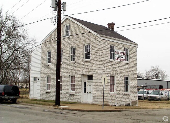
8400 E Vulcan St
3235-00-0071-7
C. B. 3235 VULCAN ST 60 FT X 137 FT CREUZBAURS SUBDN LOTS 3 & 2 & S-1 & N-4
Commercialnec
ST. LOUIS CITY
J
Missouri
B and X Area of moderate flood hazard, usually the area between the limits of the 100-year and 500-year floods.
n
2025
0.12 AC
2026
St Louis City
101400
St. Louis
5,032 SF
St. Louis, MO-IL
NEARBY LISTINGS FOR SALE OR LEASE
DEMOGRAPHICS near 8400 E Vulcan St
1 mile
3 mile
5 mile
2025 Total Population
6,636
76,480
216,607
2030 Population
6,519
73,387
207,906
Pop Growth 2025-2030
(1.76%)
(4.04%)
(4.02%)
Average Age
40
41
41
2025 Total Households
2,799
33,507
98,340
HH Growth 2025-2030
(2.04%)
(4.45%)
(4.49%)
Median Household Inc
$50,804
$61,553
$67,893
Avg Household Size
2.20
2.20
2.10
2025 Avg HH Vehicles
1.00
2.00
2.00
Median Home Value
$129,380
$164,899
$205,042
Median Year Built
1946
1949
1950
Nearby Places
Map Layers
Map Styles
 Street
 Aerial
Layers
 Traffic
 Biking
Places
Listings with unknown addresses are not visible on the map
- Restaurants
- Banks
- Shops
- Fitness
- Groceries
PUBLIC TRANSPORTATION
COMMUTER RAIL
Shrewsbury-Lansdowne (Shrewsbury-Lansdowne I-44 Emerson Park - St. Louis MetroLink (MetroLink))
Drive
Walk
Distance
Shrewsbury-Lansdowne (Shrewsbury-Lansdowne I-44 Emerson Park - St. Louis MetroLink (MetroLink))
12 min
5.5 mi
Sunnen (Shrewsbury-Lansdowne I-44 Emerson Park - St. Louis MetroLink (MetroLink))
Drive
Walk
Distance
Sunnen (Shrewsbury-Lansdowne I-44 Emerson Park - St. Louis MetroLink (MetroLink))
15 min
7.1 mi
AIRPORT
St Louis Lambert International
Drive
Walk
Distance
St Louis Lambert International
33 min
19.2 mi
Scott AFB/Midamerica St Louis
Drive
Walk
Distance
Scott AFB/Midamerica St Louis
50 min
33.2 mi
Freight Ports
Port Milwaukee
Drive
Walk
Distance
Port Milwaukee
429 min
377.4 mi
SALE & LEASE HISTORY
LISTING DATE
SALE/LEASE

Mar 21, 2017
For Sale
Nearby Properties
Address
Land Use
TOTAL SIZE
Lot Size
Zoning
Address
Land Use
TOTAL SIZE
Lot Size
Zoning
0.92 AC
A
Address
Land Use
TOTAL SIZE
Lot Size
Zoning
5.61 AC
A
Address
Land Use
TOTAL SIZE
Lot Size
Zoning
327,966 SF
56.80 AC
FPC8
Address
Land Use
TOTAL SIZE
Lot Size
Zoning
275,354 SF
72.71 AC
FPM2
Address
Land Use
TOTAL SIZE
Lot Size
Zoning
177.77 AC
A
Address
Land Use
TOTAL SIZE
Lot Size
Zoning
124,890 SF
11.91 AC
J
Address
Land Use
TOTAL SIZE
Lot Size
Zoning
3,835 SF
29.77 AC
R5
Address
Land Use
TOTAL SIZE
Lot Size
Zoning
391,268 SF
132.29 AC
R4
Address
Land Use
TOTAL SIZE
Lot Size
Zoning
90,185 SF
407.16 AC
P5
Address
Land Use
TOTAL SIZE
Lot Size
Zoning
22.44 AC
A
Address
Land Use
TOTAL SIZE
Lot Size
Zoning
150,982 SF
18.74 AC
C-8
Address
Land Use
TOTAL SIZE
Lot Size
Zoning
137,432 SF
9.18 AC
C3
Address
Land Use
TOTAL SIZE
Lot Size
Zoning
17.93 AC
R5
Address
Land Use
TOTAL SIZE
Lot Size
Zoning
267,886 SF
27.34 AC
R6
Address
Land Use
TOTAL SIZE
Lot Size
Zoning
219,361 SF
9.36 AC
M1
Address
Land Use
TOTAL SIZE
Lot Size
Zoning
3.22 AC
B
Address
Land Use
TOTAL SIZE
Lot Size
Zoning
9.33 AC
R5
Address
Land Use
TOTAL SIZE
Lot Size
Zoning
5.98 AC
R4
Address
Land Use
TOTAL SIZE
Lot Size
Zoning
928 SF
7.25 AC
R5
Address
Land Use
TOTAL SIZE
Lot Size
Zoning
39.88 AC
A
Address
Land Use
TOTAL SIZE
Lot Size
Zoning
89,205 SF
4.72 AC
C-8
Address
Land Use
TOTAL SIZE
Lot Size
Zoning
264,575 SF
1.50 AC
K
Address
Land Use
TOTAL SIZE
Lot Size
Zoning
88,456 SF
10.48 AC
H
Address
Land Use
TOTAL SIZE
Lot Size
Zoning
99,796 SF
36 AC
NU
Address
Land Use
TOTAL SIZE
Lot Size
Zoning
5.58 AC
R4
Address
Land Use
TOTAL SIZE
Lot Size
Zoning
12.14 AC
R5
Address
Land Use
TOTAL SIZE
Lot Size
Zoning
13.81 AC
A
Address
Land Use
TOTAL SIZE
Lot Size
Zoning
102,714 SF
5.74 AC
R6
Address
Land Use
TOTAL SIZE
Lot Size
Zoning
12.25 AC
R5
Address
Land Use
TOTAL SIZE
Lot Size
Zoning
145,540 SF
13.66 AC
H
The World's #1 Commercial Real Estate Marketplace
Connect with us
© 2026 CoStar Group
The information above has been obtained from sources believed reliable. While we do not doubt its accuracy we have not verified it and make no guarantee, warranty or representation about it. It is your responsibility to independently confirm its accuracy and completeness. Any projections, opinions, assumptions, or estimates used are for example only and do not represent the current or future performance of the property. The value of this transaction to you depends on tax and other factors which should be evaluated by your tax, financial, and legal advisors. You and your advisors should conduct a careful, independent investigation of the property to determine to your satisfaction the suitability of the property for your needs.