Property Record
8401 Chagrin Rd, Chagrin Falls, OH 44023
Property Detail
8401 Chagrin Rd
02-420833
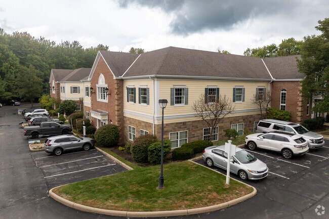
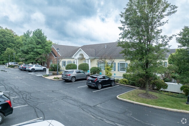
UNIT 1 WINBURY PROFESSIONAL CENTER CONDOMINUM
Officebuilding
GEAUGA
PO
Ohio
B and X Area of moderate flood hazard, usually the area between the limits of the 100-year and 500-year floods.
0.28 AC
2025
Geauga County
2025
Cleveland
311700
Cleveland-Elyria, OH
12,326 SF
NEARBY LISTINGS FOR SALE OR LEASE
DEMOGRAPHICS near 8401 Chagrin Rd
1 mile
3 mile
5 mile
2025 Total Population
3,104
14,792
50,693
2030 Population
3,088
14,758
50,566
Pop Growth 2025-2030
(0.52%)
(0.23%)
(0.25%)
Average Age
46
46
44
2025 Total Households
1,132
5,380
19,399
HH Growth 2025-2030
(0.53%)
(0.22%)
(0.24%)
Median Household Inc
$138,333
$130,999
$123,726
Avg Household Size
2.50
2.60
2.50
2025 Avg HH Vehicles
2.00
2.00
2.00
Median Home Value
$413,333
$439,597
$420,003
Median Year Built
1975
1981
1982
Nearby Places
Map Layers
Map Styles
 Street
 Aerial
Transit
 Traffic
 Biking
Places
Listings with unknown addresses are not visible on the map
- Restaurants
- Banks
- Shops
- Fitness
- Groceries
PUBLIC TRANSPORTATION
AIRPORT
Cleveland-Hopkins International
Drive
Walk
Distance
Cleveland-Hopkins International
42 min
29.5 mi
Freight Ports
Port of Toledo
Drive
Walk
Distance
Port of Toledo
156 min
130.4 mi
SALE & LEASE HISTORY
LISTING DATE
SALE/LEASE

May 31, 2023
For Sale
Jun 21, 2023
For Sale
Jun 09, 2023
For Sale
Jun 09, 2023
For Sale
Jun 09, 2023
For Sale
Jun 01, 2023
For Sale
Feb 29, 2024
For Sale
Feb 29, 2024
For Sale
Feb 19, 2025
For Sale
Apr 08, 2025
For Sale
Nearby Properties
Address
Land Use
TOTAL SIZE
Lot Size
Zoning
Address
Land Use
TOTAL SIZE
Lot Size
Zoning
227,389 SF
27.75 AC
R5A
Address
Land Use
TOTAL SIZE
Lot Size
Zoning
79,668 SF
14 AC
R5A
Address
Land Use
TOTAL SIZE
Lot Size
Zoning
177,246 SF
40.56 AC
R5A
Address
Land Use
TOTAL SIZE
Lot Size
Zoning
18,614 SF
45.79 AC
R3A
Address
Land Use
TOTAL SIZE
Lot Size
Zoning
100,601 SF
40.70 AC
R5A
Address
Land Use
TOTAL SIZE
Lot Size
Zoning
2,620 SF
15.81 AC
R5A
Address
Land Use
TOTAL SIZE
Lot Size
Zoning
120,010 SF
11.92 AC
CB
Address
Land Use
TOTAL SIZE
Lot Size
Zoning
3,124 SF
60.91 AC
R3A
Address
Land Use
TOTAL SIZE
Lot Size
Zoning
30,295 SF
7.12 AC
R5A
Address
Land Use
TOTAL SIZE
Lot Size
Zoning
38,845 SF
8.84 AC
B3
Address
Land Use
TOTAL SIZE
Lot Size
Zoning
36,827 SF
6.54 AC
R5A
Address
Land Use
TOTAL SIZE
Lot Size
Zoning
43,221 SF
14.17 AC
LIR
Address
Land Use
TOTAL SIZE
Lot Size
Zoning
51,653 SF
5.76 AC
CB
Address
Land Use
TOTAL SIZE
Lot Size
Zoning
68,022 SF
3 AC
R3A
Address
Land Use
TOTAL SIZE
Lot Size
Zoning
78.29 AC
CR
Address
Land Use
TOTAL SIZE
Lot Size
Zoning
5,002 SF
105.70 AC
R5A
Address
Land Use
TOTAL SIZE
Lot Size
Zoning
35,911 SF
6.50 AC
CB
Address
Land Use
TOTAL SIZE
Lot Size
Zoning
30,579 SF
2 AC
CB
Address
Land Use
TOTAL SIZE
Lot Size
Zoning
13,240 SF
8.59 AC
PO
Address
Land Use
TOTAL SIZE
Lot Size
Zoning
37,625 SF
5.43 AC
CB
Address
Land Use
TOTAL SIZE
Lot Size
Zoning
31,757 SF
3.76 AC
CB
Address
Land Use
TOTAL SIZE
Lot Size
Zoning
28,200 SF
11.05 AC
R3A
Address
Land Use
TOTAL SIZE
Lot Size
Zoning
28,880 SF
7.14 AC
CB
Address
Land Use
TOTAL SIZE
Lot Size
Zoning
2,995 SF
107.56 AC
R5A
Address
Land Use
TOTAL SIZE
Lot Size
Zoning
20,234 SF
30 AC
R5A
Address
Land Use
TOTAL SIZE
Lot Size
Zoning
64,924 SF
4.21 AC
CB
Address
Land Use
TOTAL SIZE
Lot Size
Zoning
2,400 SF
1.38 AC
CB
Address
Land Use
TOTAL SIZE
Lot Size
Zoning
19,966 SF
4.47 AC
CB
Address
Land Use
TOTAL SIZE
Lot Size
Zoning
4,688 SF
63.67 AC
R5A
Address
Land Use
TOTAL SIZE
Lot Size
Zoning
10,320 SF
10.28 AC
R5A
The World's #1 Commercial Real Estate Marketplace
Connect with us
© 2026 CoStar Group
The information above has been obtained from sources believed reliable. While we do not doubt its accuracy we have not verified it and make no guarantee, warranty or representation about it. It is your responsibility to independently confirm its accuracy and completeness. Any projections, opinions, assumptions, or estimates used are for example only and do not represent the current or future performance of the property. The value of this transaction to you depends on tax and other factors which should be evaluated by your tax, financial, and legal advisors. You and your advisors should conduct a careful, independent investigation of the property to determine to your satisfaction the suitability of the property for your needs.