Property Record
841 N Palm Ave, Upland, CA 91786
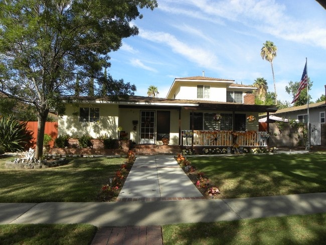
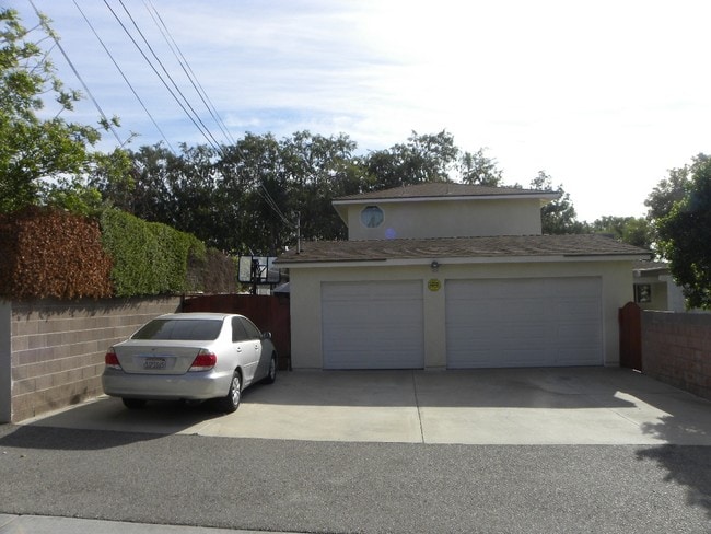
This Property Is For Sale
NEARBY LISTINGS FOR SALE OR LEASE
Property Detail
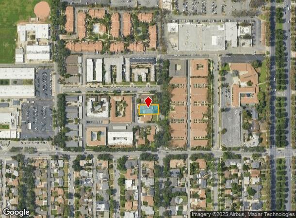
841 N Palm Ave
Riverside-San Bernardino-Ontario, CA
Ontario
1046-043-02
ONTARIO COLONY LANDS N 65 FT S 300 FT E 1/2 E 1/2 LOT 539 EX E 33 FT AND EX W 10 FT
Sfr
San Bernardino
X
California
06037C1750F
539
2025
0.20 AC
2025
Upland/Montclair
000824
Inland Empire (California)
2,957 SF
DEMOGRAPHICS near 841 N Palm Ave
1 mile
3 mile
5 mile
2024 Total Population
21,328
175,363
388,203
2029 Population
21,620
178,167
391,553
Pop Growth 2024-2029
+ 1.37%
+ 1.60%
+ 0.86%
Average Age
38
38
38
2024 Total Households
7,590
56,656
123,370
HH Growth 2024-2029
+ 1.48%
+ 1.68%
+ 0.89%
Median Household Inc
$77,905
$82,329
$83,855
Avg Household Size
2.70
3.00
3.00
2024 Avg HH Vehicles
2.00
2.00
2.00
Median Home Value
$602,517
$598,756
$614,779
Median Year Built
1968
1973
1975
Nearby Places
Map Layers
Map Styles
 Street
 Aerial
Transit
 Traffic
 Biking
Places
Listings with unknown addresses are not visible on the map
- Restaurants
- Banks
- Shops
- Fitness
- Groceries
PUBLIC TRANSPORTATION
COMMUTER RAIL
Upland (San Bernardino Line - Southern California Regional Rail Authority (Metrolink))
Drive
Walk
Distance
Upland (San Bernardino Line - Southern California Regional Rail Authority (Metrolink))
3 min
1.1 mi
Montclair (San Bernardino Line - Southern California Regional Rail Authority (Metrolink))
Drive
Walk
Distance
Montclair (San Bernardino Line - Southern California Regional Rail Authority (Metrolink))
7 min
3.4 mi
AIRPORT
Ontario International
Drive
Walk
Distance
Ontario International
10 min
5.4 mi
Freight Ports
Port of Long Beach
Drive
Walk
Distance
Port of Long Beach
65 min
51.3 mi
Nearby Properties
Address
Land Use
TOTAL SIZE
Lot Size
Zoning
Address
Land Use
TOTAL SIZE
Lot Size
Zoning
376,610 SF
25.22 AC
Address
Land Use
TOTAL SIZE
Lot Size
Zoning
788,560 SF
36.86 AC
Address
Land Use
TOTAL SIZE
Lot Size
Zoning
167,013 SF
30.60 AC
CLE*
Address
Land Use
TOTAL SIZE
Lot Size
Zoning
167,512 SF
8.35 AC
Address
Land Use
TOTAL SIZE
Lot Size
Zoning
251,645 SF
4.50 AC
Address
Land Use
TOTAL SIZE
Lot Size
Zoning
538,944 SF
20.73 AC
Address
Land Use
TOTAL SIZE
Lot Size
Zoning
125,663 SF
7.04 AC
Address
Land Use
TOTAL SIZE
Lot Size
Zoning
218,376 SF
12.50 AC
Address
Land Use
TOTAL SIZE
Lot Size
Zoning
340,104 SF
8.95 AC
Address
Land Use
TOTAL SIZE
Lot Size
Zoning
249,672 SF
13.80 AC
Address
Land Use
TOTAL SIZE
Lot Size
Zoning
1.86 AC
Address
Land Use
TOTAL SIZE
Lot Size
Zoning
175,000 SF
15.24 AC
Address
Land Use
TOTAL SIZE
Lot Size
Zoning
173,531 SF
2.52 AC
Address
Land Use
TOTAL SIZE
Lot Size
Zoning
180,868 SF
8.24 AC
Address
Land Use
TOTAL SIZE
Lot Size
Zoning
73,190 SF
5.43 AC
Address
Land Use
TOTAL SIZE
Lot Size
Zoning
129,480 SF
6.39 AC
Address
Land Use
TOTAL SIZE
Lot Size
Zoning
112,960 SF
6.30 AC
Address
Land Use
TOTAL SIZE
Lot Size
Zoning
99,345 SF
5.15 AC
Address
Land Use
TOTAL SIZE
Lot Size
Zoning
203,092 SF
10 AC
Address
Land Use
TOTAL SIZE
Lot Size
Zoning
63,862 SF
4.77 AC
Address
Land Use
TOTAL SIZE
Lot Size
Zoning
455,226 SF
18.15 AC
Address
Land Use
TOTAL SIZE
Lot Size
Zoning
240,226 SF
10.10 AC
Address
Land Use
TOTAL SIZE
Lot Size
Zoning
171,446 SF
10.88 AC
Address
Land Use
TOTAL SIZE
Lot Size
Zoning
128,627 SF
11.70 AC
Address
Land Use
TOTAL SIZE
Lot Size
Zoning
130,680 SF
6.63 AC
Address
Land Use
TOTAL SIZE
Lot Size
Zoning
50,274 SF
3.76 AC
CLI-CH*
Address
Land Use
TOTAL SIZE
Lot Size
Zoning
54,166 SF
4.60 AC
Address
Land Use
TOTAL SIZE
Lot Size
Zoning
83,392 SF
7.34 AC
Address
Land Use
TOTAL SIZE
Lot Size
Zoning
69,201 SF
7.07 AC
Address
Land Use
TOTAL SIZE
Lot Size
Zoning
82,247 SF
1.10 AC
The World's #1 Commercial Real Estate Marketplace
Connect with us
© 2026 CoStar Group
The information above has been obtained from sources believed reliable. While we do not doubt its accuracy we have not verified it and make no guarantee, warranty or representation about it. It is your responsibility to independently confirm its accuracy and completeness. Any projections, opinions, assumptions, or estimates used are for example only and do not represent the current or future performance of the property. The value of this transaction to you depends on tax and other factors which should be evaluated by your tax, financial, and legal advisors. You and your advisors should conduct a careful, independent investigation of the property to determine to your satisfaction the suitability of the property for your needs.