Property Record
8410 W Cheyenne Ave, Las Vegas, NV 89129


NEARBY LISTINGS FOR SALE OR LEASE
Property Detail
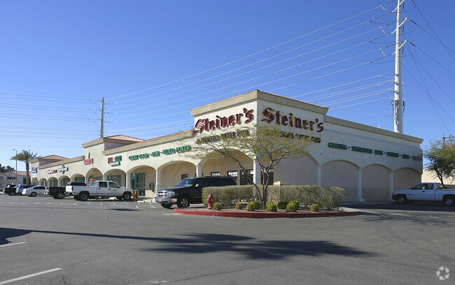
8410 W Cheyenne Ave
138-09-420-007
Northshore Plaza
Storebuilding
NORTHSHORE PLAZA PLAT BOOK 76 PAGE 67 PT UNNUMB LOT
X
Clark
32003C2135F
Nevada
2024
0.93 AC
2025
Northwest Las Vegas
003246
Las Vegas
14,000 SF
Las Vegas-Henderson-Paradise, NV
DEMOGRAPHICS near 8410 W Cheyenne Ave
1 Mile
3 Mile
5 Mile
2024 Total Population
20,900
145,721
373,068
2029 Population
22,303
156,124
400,574
Pop Growth 2024-2029
+ 6.71%
+ 7.14%
+ 7.37%
Average Age
45
43
41
2024 Total Households
8,537
58,638
144,247
HH Growth 2024-2029
+ 6.78%
+ 7.15%
+ 7.36%
Median Household Inc
$72,295
$67,905
$66,421
Avg Household Size
2.40
2.40
2.50
2024 Avg HH Vehicles
2.00
2.00
2.00
Median Home Value
$370,530
$370,623
$370,501
Median Year Built
1993
1993
1993
Nearby Places
Map Layers
Map Styles
 Street
 Aerial
- Restaurants
- Banks
- Shops
- Fitness
- Groceries
PUBLIC TRANSPORTATION
AIRPORT
Harry Reid International
DRIVE
WALK
Distance
Harry Reid International
27 min
16.6 mi
Boulder City Municipal
DRIVE
WALK
Distance
Boulder City Municipal
47 min
36.6 mi
Freight Ports
Port of Long Beach
DRIVE
WALK
Distance
Port of Long Beach
328 min
292.1 mi
SALE & LEASE HISTORY
LISTING DATE
SALE/LEASE

Oct 18, 2017
For Lease
Nearby Properties
Address
Land Use
TOTAL SIZE
Lot Size
Zoning
Address
Land Use
TOTAL SIZE
Lot Size
Zoning
647,754 SF
38.57 AC
C2
Address
Land Use
TOTAL SIZE
Lot Size
Zoning
161.14 AC
CV
Address
Land Use
TOTAL SIZE
Lot Size
Zoning
157.50 AC
Address
Land Use
TOTAL SIZE
Lot Size
Zoning
5,643 SF
10.29 AC
Address
Land Use
TOTAL SIZE
Lot Size
Zoning
9,840 SF
19.89 AC
PD
Address
Land Use
TOTAL SIZE
Lot Size
Zoning
37.31 AC
CV
Address
Land Use
TOTAL SIZE
Lot Size
Zoning
7,148 SF
7.26 AC
Address
Land Use
TOTAL SIZE
Lot Size
Zoning
14,793 SF
9.57 AC
CPB
Address
Land Use
TOTAL SIZE
Lot Size
Zoning
12,031 SF
17.45 AC
PC
Address
Land Use
TOTAL SIZE
Lot Size
Zoning
5,057 SF
9.46 AC
RE
Address
Land Use
TOTAL SIZE
Lot Size
Zoning
263,881 SF
7.49 AC
R-4
Address
Land Use
TOTAL SIZE
Lot Size
Zoning
5,750 SF
19.67 AC
R3
Address
Land Use
TOTAL SIZE
Lot Size
Zoning
21.12 AC
RE
Address
Land Use
TOTAL SIZE
Lot Size
Zoning
4,084 SF
1.84 AC
CPB
Address
Land Use
TOTAL SIZE
Lot Size
Zoning
80.99 AC
RE
Address
Land Use
TOTAL SIZE
Lot Size
Zoning
285,929 SF
5.06 AC
C1
Address
Land Use
TOTAL SIZE
Lot Size
Zoning
211,331 SF
6.70 AC
USC
Address
Land Use
TOTAL SIZE
Lot Size
Zoning
3,618 SF
10 AC
L:R-3
Address
Land Use
TOTAL SIZE
Lot Size
Zoning
3,620 SF
12.96 AC
PD
Address
Land Use
TOTAL SIZE
Lot Size
Zoning
7,103 SF
14.27 AC
L:R-3
Address
Land Use
TOTAL SIZE
Lot Size
Zoning
99,487 SF
22.61 AC
PC
Address
Land Use
TOTAL SIZE
Lot Size
Zoning
18.02 AC
PF
Address
Land Use
TOTAL SIZE
Lot Size
Zoning
4,978 SF
15.05 AC
R3
Address
Land Use
TOTAL SIZE
Lot Size
Zoning
5,171 SF
4.24 AC
RPD14
Address
Land Use
TOTAL SIZE
Lot Size
Zoning
267,271 SF
22.36 AC
C1
Address
Land Use
TOTAL SIZE
Lot Size
Zoning
6,020 SF
10.30 AC
PC
Address
Land Use
TOTAL SIZE
Lot Size
Zoning
9,789 SF
2.10 AC
R3
Address
Land Use
TOTAL SIZE
Lot Size
Zoning
7,427 SF
4.56 AC
R3
Address
Land Use
TOTAL SIZE
Lot Size
Zoning
48,060 SF
7.25 AC
CPB
The World's #1 Commercial Real Estate Marketplace
Connect with us
© 2025 CoStar Group
The information above has been obtained from sources believed reliable. While we do not doubt its accuracy we have not verified it and make no guarantee, warranty or representation about it. It is your responsibility to independently confirm its accuracy and completeness. Any projections, opinions, assumptions, or estimates used are for example only and do not represent the current or future performance of the property. The value of this transaction to you depends on tax and other factors which should be evaluated by your tax, financial, and legal advisors. You and your advisors should conduct a careful, independent investigation of the property to determine to your satisfaction the suitability of the property for your needs.