Property Record
8410 W Thomas Rd, Phoenix, AZ 85037
This Property Is For Sale
NEARBY LISTINGS FOR SALE OR LEASE
Property Detail
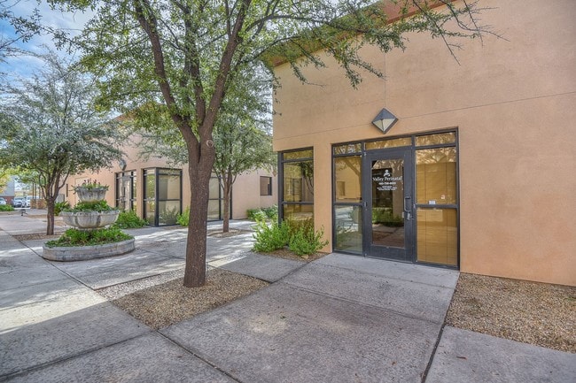
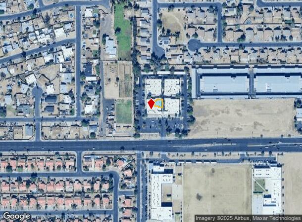
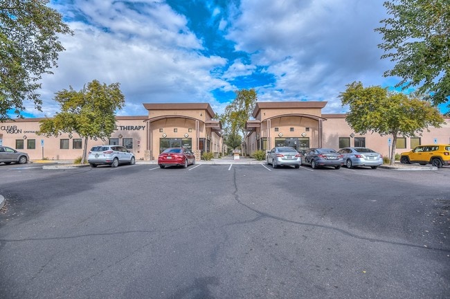
8410 W Thomas Rd
Phoenix-Mesa-Chandler, AZ
Sunrise Medical Center Condominium
102-23-938
SUNRISE MEDICAL CENTER CONDOMINIUM MCR 812-12
Medicalbuilding
Maricopa
X
Arizona
04013C2180L
138
2025
0.05 AC
2025
Glendale
082010
Phoenix
9,644 SF
DEMOGRAPHICS near 8410 W Thomas Rd
1 Mile
3 Mile
5 Mile
2024 Total Population
27,718
155,944
381,655
2029 Population
29,875
168,449
412,356
Pop Growth 2024-2029
+ 7.78%
+ 8.02%
+ 8.04%
Average Age
32
32
33
2024 Total Households
7,549
44,412
109,101
HH Growth 2024-2029
+ 7.87%
+ 8.18%
+ 8.27%
Median Household Inc
$64,570
$57,979
$61,677
Avg Household Size
3.50
3.40
3.40
2024 Avg HH Vehicles
2.00
2.00
2.00
Median Home Value
$243,200
$250,546
$264,248
Median Year Built
1986
1987
1990
Nearby Places
Map Layers
Map Styles
 Street
 Aerial
- Restaurants
- Banks
- Shops
- Fitness
- Groceries
PUBLIC TRANSPORTATION
AIRPORT
Phoenix Sky Harbor International
DRIVE
WALK
Distance
Phoenix Sky Harbor International
25 min
17.2 mi
Nearby Properties
Address
Land Use
TOTAL SIZE
Lot Size
Zoning
Address
Land Use
TOTAL SIZE
Lot Size
Zoning
896,916 SF
25.91 AC
C-C
Address
Land Use
TOTAL SIZE
Lot Size
Zoning
1,539,348 SF
143.97 AC
A-1
Address
Land Use
TOTAL SIZE
Lot Size
Zoning
1,267,497 SF
70.43 AC
A1
Address
Land Use
TOTAL SIZE
Lot Size
Zoning
1,100,500 SF
57.61 AC
PUD
Address
Land Use
TOTAL SIZE
Lot Size
Zoning
348,753 SF
19.36 AC
R-6
Address
Land Use
TOTAL SIZE
Lot Size
Zoning
750,037 SF
49.40 AC
I1
Address
Land Use
TOTAL SIZE
Lot Size
Zoning
587,843 SF
20.49 AC
PAD
Address
Land Use
TOTAL SIZE
Lot Size
Zoning
258,097 SF
32.53 AC
AG
Address
Land Use
TOTAL SIZE
Lot Size
Zoning
351,903 SF
29.13 AC
A1
Address
Land Use
TOTAL SIZE
Lot Size
Zoning
660,838 SF
29.28 AC
C2
Address
Land Use
TOTAL SIZE
Lot Size
Zoning
466,868 SF
45.99 AC
I-1
Address
Land Use
TOTAL SIZE
Lot Size
Zoning
436,817 SF
23.21 AC
I-P
Address
Land Use
TOTAL SIZE
Lot Size
Zoning
580,382 SF
31.77 AC
PAD
Address
Land Use
TOTAL SIZE
Lot Size
Zoning
432,022 SF
19.33 AC
PAD
Address
Land Use
TOTAL SIZE
Lot Size
Zoning
628,480 SF
34.45 AC
PAD
Address
Land Use
TOTAL SIZE
Lot Size
Zoning
660,980 SF
40.15 AC
Address
Land Use
TOTAL SIZE
Lot Size
Zoning
660,807 SF
31.44 AC
PAD-14
Address
Land Use
TOTAL SIZE
Lot Size
Zoning
498,064 SF
12.92 AC
C-N
Address
Land Use
TOTAL SIZE
Lot Size
Zoning
370,522 SF
9.45 AC
Address
Land Use
TOTAL SIZE
Lot Size
Zoning
409,088 SF
21.34 AC
PAD
Address
Land Use
TOTAL SIZE
Lot Size
Zoning
1.05 AC
Address
Land Use
TOTAL SIZE
Lot Size
Zoning
587,158 SF
36.23 AC
I-P
Address
Land Use
TOTAL SIZE
Lot Size
Zoning
409,017 SF
14.30 AC
Address
Land Use
TOTAL SIZE
Lot Size
Zoning
401,437 SF
25.82 AC
Address
Land Use
TOTAL SIZE
Lot Size
Zoning
327,840 SF
22.20 AC
PAD
Address
Land Use
TOTAL SIZE
Lot Size
Zoning
535,852 SF
31.22 AC
I-1
Address
Land Use
TOTAL SIZE
Lot Size
Zoning
543,745 SF
31.09 AC
I-1
Address
Land Use
TOTAL SIZE
Lot Size
Zoning
310,134 SF
64.97 AC
I-1
Address
Land Use
TOTAL SIZE
Lot Size
Zoning
476,073 SF
27.62 AC
I-1
Address
Land Use
TOTAL SIZE
Lot Size
Zoning
92,600 SF
20 AC
C-C
The World's #1 Commercial Real Estate Marketplace
Connect with us
© 2026 CoStar Group
The information above has been obtained from sources believed reliable. While we do not doubt its accuracy we have not verified it and make no guarantee, warranty or representation about it. It is your responsibility to independently confirm its accuracy and completeness. Any projections, opinions, assumptions, or estimates used are for example only and do not represent the current or future performance of the property. The value of this transaction to you depends on tax and other factors which should be evaluated by your tax, financial, and legal advisors. You and your advisors should conduct a careful, independent investigation of the property to determine to your satisfaction the suitability of the property for your needs.