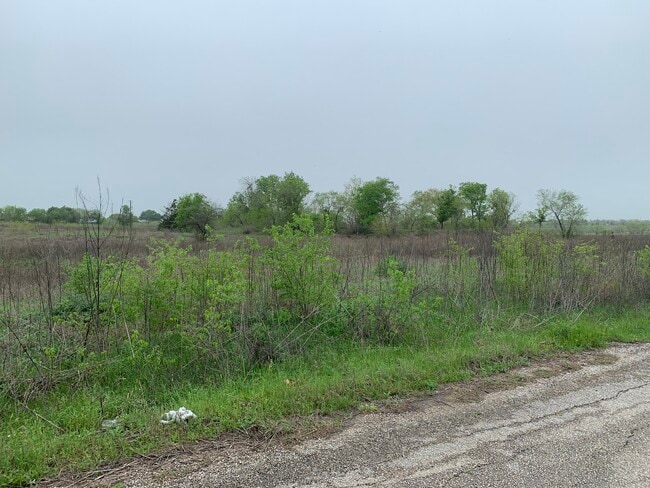
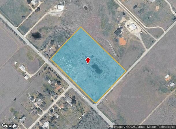
Property Record
8415 Niederwald Strasse, Kyle, TX 78640
Property Detail
8415 Niederwald Strasse
Austin-Round Rock-San Marcos, TX
Otis G Eels Survey
R14035
A0167 OTIS G EELS SURVEY, ACRES 8.9117, AKA LOT 8
Vacantlandnec
Hays
A
Texas
48021C0300F
8
2024
8.91 AC
2025
Hays County
010920
Austin
NEARBY LISTINGS FOR SALE OR LEASE
DEMOGRAPHICS near 8415 Niederwald Strasse
1 mile
3 mile
5 mile
2024 Total Population
998
4,716
24,303
2029 Population
1,310
5,894
30,761
Pop Growth 2024-2029
+ 31.26%
+ 24.98%
+ 26.57%
Average Age
36
36
34
2024 Total Households
291
1,410
6,809
HH Growth 2024-2029
+ 32.30%
+ 25.39%
+ 27.27%
Median Household Inc
$76,645
$77,635
$71,216
Avg Household Size
3.50
3.40
3.40
2024 Avg HH Vehicles
2.00
2.00
2.00
Median Home Value
$248,333
$201,186
$202,889
Median Year Built
1996
1998
2004
Nearby Places
Map Layers
Map Styles
 Street
 Aerial
Transit
 Traffic
 Biking
Places
Listings with unknown addresses are not visible on the map
- Restaurants
- Banks
- Shops
- Fitness
- Groceries
PUBLIC TRANSPORTATION
AIRPORT
Austin-Bergstrom International
Drive
Walk
Distance
Austin-Bergstrom International
26 min
16.9 mi
Freight Ports
Calhoun Port
Drive
Walk
Distance
Calhoun Port
168 min
139.2 mi
SALE & LEASE HISTORY
LISTING DATE
SALE/LEASE

Mar 19, 2020
For Sale
Nearby Properties
Address
Land Use
TOTAL SIZE
Lot Size
Zoning
Address
Land Use
TOTAL SIZE
Lot Size
Zoning
82,000 SF
21.64 AC
Address
Land Use
TOTAL SIZE
Lot Size
Zoning
69,149 SF
4.95 AC
Address
Land Use
TOTAL SIZE
Lot Size
Zoning
14,800 SF
60.41 AC
Address
Land Use
TOTAL SIZE
Lot Size
Zoning
165.83 AC
Address
Land Use
TOTAL SIZE
Lot Size
Zoning
10,153 SF
Address
Land Use
TOTAL SIZE
Lot Size
Zoning
66.38 AC
Address
Land Use
TOTAL SIZE
Lot Size
Zoning
24.71 AC
Address
Land Use
TOTAL SIZE
Lot Size
Zoning
18,301 SF
33.10 AC
Address
Land Use
TOTAL SIZE
Lot Size
Zoning
38.93 AC
Address
Land Use
TOTAL SIZE
Lot Size
Zoning
30,198 SF
8.10 AC
Address
Land Use
TOTAL SIZE
Lot Size
Zoning
33.57 AC
Address
Land Use
TOTAL SIZE
Lot Size
Zoning
800 SF
18.67 AC
Address
Land Use
TOTAL SIZE
Lot Size
Zoning
1,136 SF
50.62 AC
Address
Land Use
TOTAL SIZE
Lot Size
Zoning
7,560 SF
3.72 AC
Address
Land Use
TOTAL SIZE
Lot Size
Zoning
6,576 SF
5.01 AC
Address
Land Use
TOTAL SIZE
Lot Size
Zoning
660 SF
12.90 AC
Address
Land Use
TOTAL SIZE
Lot Size
Zoning
49.92 AC
Address
Land Use
TOTAL SIZE
Lot Size
Zoning
5,658 SF
29.33 AC
Address
Land Use
TOTAL SIZE
Lot Size
Zoning
1,032 SF
3.17 AC
Address
Land Use
TOTAL SIZE
Lot Size
Zoning
12,000 SF
1.63 AC
Address
Land Use
TOTAL SIZE
Lot Size
Zoning
38.26 AC
Address
Land Use
TOTAL SIZE
Lot Size
Zoning
33.08 AC
Address
Land Use
TOTAL SIZE
Lot Size
Zoning
12,274 SF
12.60 AC
Address
Land Use
TOTAL SIZE
Lot Size
Zoning
8,625 SF
15.88 AC
Address
Land Use
TOTAL SIZE
Lot Size
Zoning
12,906 SF
1.32 AC
Address
Land Use
TOTAL SIZE
Lot Size
Zoning
3,200 SF
22.59 AC
Address
Land Use
TOTAL SIZE
Lot Size
Zoning
12,509 SF
13.35 AC
Address
Land Use
TOTAL SIZE
Lot Size
Zoning
9,150 SF
10.57 AC
Address
Land Use
TOTAL SIZE
Lot Size
Zoning
1,216 SF
13.76 AC
Address
Land Use
TOTAL SIZE
Lot Size
Zoning
12,000 SF
5.68 AC
The World's #1 Commercial Real Estate Marketplace
Connect with us
© 2026 CoStar Group
The information above has been obtained from sources believed reliable. While we do not doubt its accuracy we have not verified it and make no guarantee, warranty or representation about it. It is your responsibility to independently confirm its accuracy and completeness. Any projections, opinions, assumptions, or estimates used are for example only and do not represent the current or future performance of the property. The value of this transaction to you depends on tax and other factors which should be evaluated by your tax, financial, and legal advisors. You and your advisors should conduct a careful, independent investigation of the property to determine to your satisfaction the suitability of the property for your needs.