Property Record
8418 20Th St, Vero Beach, FL 32966


NEARBY LISTINGS FOR SALE OR LEASE
Property Detail
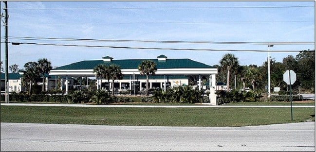
8418 20Th St
33-38-02-00007-0000-00001.0
Knk Ventures Pcd
Storesoffices
KNK VENTURES PCD PBI 16-22 PARCEL & STORMWATER TRACTS BEING MORE PART DESC AS FOLL: THE S 4.64 AC OF THE E 10 AC OF TRACT 7 SEC 02 TWP 33 S RGE 38 E ACCORDING TO THE LAST GENERAL PLAT OF INDIAN RIVER FARMS COMPANY PBS 2-25 MORE PART DESC AS FOLL: COM
X
Indian River
12061C0219J
Florida
2025
4.64 AC
2025
Fort Pierce/Port St Lucie
050907
Other Market Areas
2,470 SF
Sebastian-Vero Beach, FL
DEMOGRAPHICS near 8418 20Th St
1 Mile
3 Mile
5 Mile
2024 Total Population
4,809
16,589
35,793
2029 Population
5,364
18,681
39,978
Pop Growth 2024-2029
+ 11.54%
+ 12.61%
+ 11.69%
Average Age
56
57
51
2024 Total Households
2,478
8,656
16,386
HH Growth 2024-2029
+ 11.02%
+ 12.07%
+ 11.28%
Median Household Inc
$52,848
$54,223
$58,187
Avg Household Size
1.90
1.90
2.10
2024 Avg HH Vehicles
2.00
2.00
2.00
Median Home Value
$109,949
$217,324
$257,416
Median Year Built
1989
1992
1992
Nearby Places
Map Layers
Map Styles
 Street
 Aerial
- Restaurants
- Banks
- Shops
- Fitness
- Groceries
Nearby Properties
Address
Land Use
TOTAL SIZE
Lot Size
Zoning
Address
Land Use
TOTAL SIZE
Lot Size
Zoning
223,614 SF
38.25 AC
RM-8
Address
Land Use
TOTAL SIZE
Lot Size
Zoning
83,174 SF
49.75 AC
PD
Address
Land Use
TOTAL SIZE
Lot Size
Zoning
2,391 SF
44.51 AC
CG
Address
Land Use
TOTAL SIZE
Lot Size
Zoning
204,103 SF
33.89 AC
RM-8
Address
Land Use
TOTAL SIZE
Lot Size
Zoning
27.70 AC
RS-6
Address
Land Use
TOTAL SIZE
Lot Size
Zoning
6,532 SF
21.92 AC
RM-6
Address
Land Use
TOTAL SIZE
Lot Size
Zoning
1,944 SF
21.99 AC
RM-8
Address
Land Use
TOTAL SIZE
Lot Size
Zoning
408,898 SF
78.81 AC
CG
Address
Land Use
TOTAL SIZE
Lot Size
Zoning
241,529 SF
29.18 AC
RM-8
Address
Land Use
TOTAL SIZE
Lot Size
Zoning
83,300 SF
84.34 AC
A-1
Address
Land Use
TOTAL SIZE
Lot Size
Zoning
298,394 SF
14 AC
RM-6
Address
Land Use
TOTAL SIZE
Lot Size
Zoning
351 SF
11.09 AC
CG
Address
Land Use
TOTAL SIZE
Lot Size
Zoning
180,092 SF
14.66 AC
RM-8
Address
Land Use
TOTAL SIZE
Lot Size
Zoning
178,300 SF
5.69 AC
PDTND
Address
Land Use
TOTAL SIZE
Lot Size
Zoning
181,621 SF
28.49 AC
RM-6
Address
Land Use
TOTAL SIZE
Lot Size
Zoning
23,607 SF
39.05 AC
IL
Address
Land Use
TOTAL SIZE
Lot Size
Zoning
37,060 SF
24 AC
RM-6
Address
Land Use
TOTAL SIZE
Lot Size
Zoning
95,845 SF
10 AC
RM-8
Address
Land Use
TOTAL SIZE
Lot Size
Zoning
159,400 SF
13.36 AC
CG
Address
Land Use
TOTAL SIZE
Lot Size
Zoning
69,815 SF
3.28 AC
PDTND
Address
Land Use
TOTAL SIZE
Lot Size
Zoning
23,022 SF
59.40 AC
A-1
Address
Land Use
TOTAL SIZE
Lot Size
Zoning
75.77 AC
RM-6
Address
Land Use
TOTAL SIZE
Lot Size
Zoning
1,660 SF
203.81 AC
RS-3
Address
Land Use
TOTAL SIZE
Lot Size
Zoning
64,392 SF
6.02 AC
CG
Address
Land Use
TOTAL SIZE
Lot Size
Zoning
2,349 SF
8.04 AC
PD
Address
Land Use
TOTAL SIZE
Lot Size
Zoning
2,681 SF
33.93 AC
A-1
Address
Land Use
TOTAL SIZE
Lot Size
Zoning
48,800 SF
4.18 AC
CG
Address
Land Use
TOTAL SIZE
Lot Size
Zoning
83.54 AC
RM-6
Address
Land Use
TOTAL SIZE
Lot Size
Zoning
129,601 SF
10.15 AC
CG
Address
Land Use
TOTAL SIZE
Lot Size
Zoning
2,100 SF
3.92 AC
PD
The World's #1 Commercial Real Estate Marketplace
Connect with us
© 2026 CoStar Group
The information above has been obtained from sources believed reliable. While we do not doubt its accuracy we have not verified it and make no guarantee, warranty or representation about it. It is your responsibility to independently confirm its accuracy and completeness. Any projections, opinions, assumptions, or estimates used are for example only and do not represent the current or future performance of the property. The value of this transaction to you depends on tax and other factors which should be evaluated by your tax, financial, and legal advisors. You and your advisors should conduct a careful, independent investigation of the property to determine to your satisfaction the suitability of the property for your needs.