Property Record
842 Pike St, Marietta, OH 45750

NEARBY LISTINGS FOR SALE OR LEASE
Property Detail
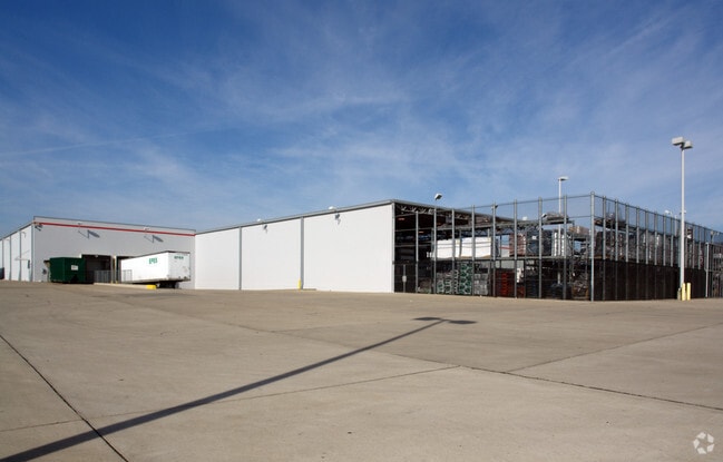
842 Pike St
2400-84566-001
R8 T2 S16 LOT 21 3.3804 AC
Storebuilding
Washington
AE
Ohio
54107C0043D
21
2024
11.11 AC
2024
Ohio South Area
020900
Other Market Areas
99,999 SF
Marietta, OH
DEMOGRAPHICS near 842 Pike St
1 Mile
3 Mile
5 Mile
2024 Total Population
910
18,131
28,325
2029 Population
915
17,949
28,088
Pop Growth 2024-2029
+ 0.55%
(1.00%)
(0.84%)
Average Age
43
42
43
2024 Total Households
417
7,781
12,191
HH Growth 2024-2029
+ 0.24%
(0.98%)
(0.83%)
Median Household Inc
$45,937
$47,525
$52,601
Avg Household Size
2.10
2.20
2.20
2024 Avg HH Vehicles
2.00
2.00
2.00
Median Home Value
$138,281
$156,102
$160,290
Median Year Built
1981
1967
1970
Nearby Places
Map Layers
Map Styles
 Street
 Aerial
- Restaurants
- Banks
- Shops
- Fitness
- Groceries
Nearby Properties
Address
Land Use
TOTAL SIZE
Lot Size
Zoning
Address
Land Use
TOTAL SIZE
Lot Size
Zoning
53,390 SF
0.22 AC
Address
Land Use
TOTAL SIZE
Lot Size
Zoning
106,780 SF
Address
Land Use
TOTAL SIZE
Lot Size
Zoning
Address
Land Use
TOTAL SIZE
Lot Size
Zoning
4.50 AC
Address
Land Use
TOTAL SIZE
Lot Size
Zoning
6,918 SF
3 AC
Address
Land Use
TOTAL SIZE
Lot Size
Zoning
Address
Land Use
TOTAL SIZE
Lot Size
Zoning
31.05 AC
Address
Land Use
TOTAL SIZE
Lot Size
Zoning
6,567 SF
5.05 AC
Address
Land Use
TOTAL SIZE
Lot Size
Zoning
57,631 SF
5.61 AC
Address
Land Use
TOTAL SIZE
Lot Size
Zoning
5,390 SF
Address
Land Use
TOTAL SIZE
Lot Size
Zoning
8.34 AC
Address
Land Use
TOTAL SIZE
Lot Size
Zoning
3.34 AC
Address
Land Use
TOTAL SIZE
Lot Size
Zoning
1,845 SF
7.21 AC
Address
Land Use
TOTAL SIZE
Lot Size
Zoning
70.02 AC
Address
Land Use
TOTAL SIZE
Lot Size
Zoning
24,800 SF
0.32 AC
Address
Land Use
TOTAL SIZE
Lot Size
Zoning
4,256 SF
1.54 AC
Address
Land Use
TOTAL SIZE
Lot Size
Zoning
6,020 SF
0.47 AC
Address
Land Use
TOTAL SIZE
Lot Size
Zoning
62,139 SF
12.10 AC
Address
Land Use
TOTAL SIZE
Lot Size
Zoning
53,121 SF
1.53 AC
Address
Land Use
TOTAL SIZE
Lot Size
Zoning
22,996 SF
2.70 AC
Address
Land Use
TOTAL SIZE
Lot Size
Zoning
Address
Land Use
TOTAL SIZE
Lot Size
Zoning
10,028 SF
2.67 AC
Address
Land Use
TOTAL SIZE
Lot Size
Zoning
17,943 SF
3.70 AC
Address
Land Use
TOTAL SIZE
Lot Size
Zoning
Address
Land Use
TOTAL SIZE
Lot Size
Zoning
Address
Land Use
TOTAL SIZE
Lot Size
Zoning
42,496 SF
1.45 AC
Address
Land Use
TOTAL SIZE
Lot Size
Zoning
36,776 SF
104.50 AC
Address
Land Use
TOTAL SIZE
Lot Size
Zoning
1,449 SF
1.19 AC
Address
Land Use
TOTAL SIZE
Lot Size
Zoning
0.27 AC
The World's #1 Commercial Real Estate Marketplace
Connect with us
© 2026 CoStar Group
The information above has been obtained from sources believed reliable. While we do not doubt its accuracy we have not verified it and make no guarantee, warranty or representation about it. It is your responsibility to independently confirm its accuracy and completeness. Any projections, opinions, assumptions, or estimates used are for example only and do not represent the current or future performance of the property. The value of this transaction to you depends on tax and other factors which should be evaluated by your tax, financial, and legal advisors. You and your advisors should conduct a careful, independent investigation of the property to determine to your satisfaction the suitability of the property for your needs.