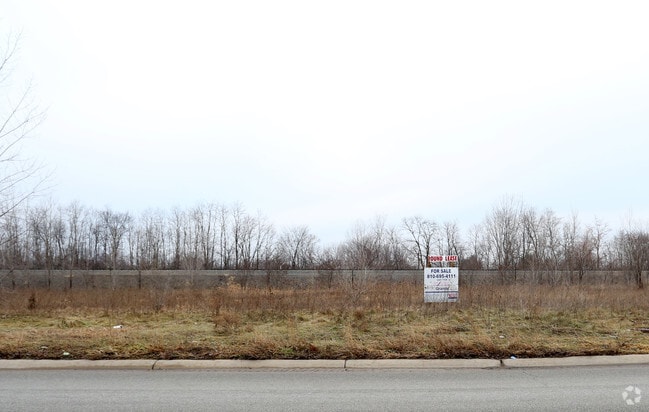
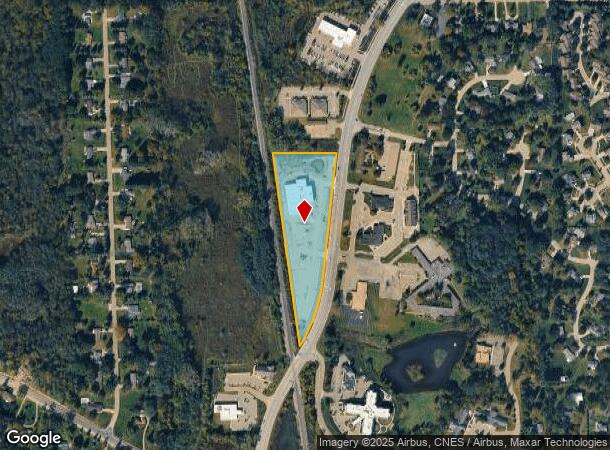
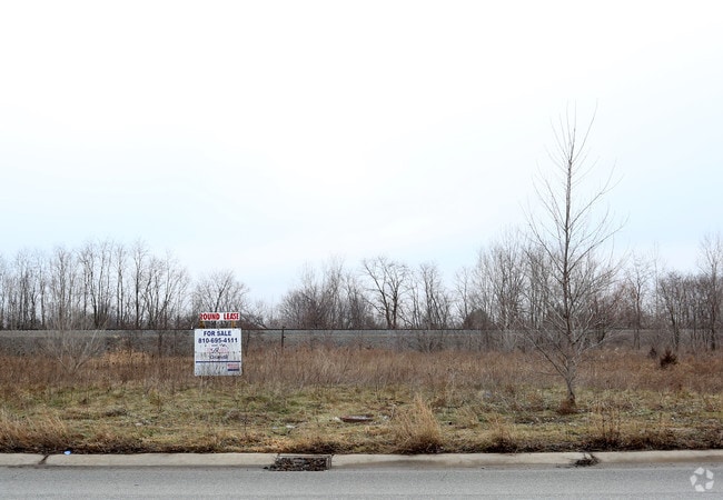
Property Record
8420 Holly Rd, Grand Blanc, MI 48439

NEARBY LISTINGS FOR SALE OR LEASE
Property Detail
8420 Holly Rd
12-22-300-005
N-427 A POL BEG S 7* 08' E 865.70 FT FR INTERSECTION OF E LINE OF C & O R R R/W & E & W 1/4 LINE TH S 7* 08' E 1141.30 FT TO
Commercialacreage
Genesee
X
Michigan
26049C0319D
5.42 AC
2024
Flint
2025
Detroit
011210
Flint, MI
DEMOGRAPHICS near 8420 Holly Rd
1 Mile
3 Mile
5 Mile
2024 Total Population
3,699
27,126
59,476
2029 Population
3,604
26,412
57,909
Pop Growth 2024-2029
(2.57%)
(2.63%)
(2.63%)
Average Age
42
41
41
2024 Total Households
1,400
11,139
24,309
HH Growth 2024-2029
(2.71%)
(2.65%)
(2.69%)
Median Household Inc
$84,288
$74,220
$70,974
Avg Household Size
2.60
2.40
2.40
2024 Avg HH Vehicles
2.00
2.00
2.00
Median Home Value
$234,141
$248,899
$220,777
Median Year Built
1991
1986
1979
Nearby Places
Map Layers
Map Styles
 Street
 Aerial
- Restaurants
- Banks
- Shops
- Fitness
- Groceries
PUBLIC TRANSPORTATION
COMMUTER RAIL
Flint Amtrak Station (Blue Water - Amtrak)
DRIVE
WALK
Distance
Flint Amtrak Station (Blue Water - Amtrak)
15 min
9.5 mi
AIRPORT
Bishop International
DRIVE
WALK
Distance
Bishop International
23 min
10.9 mi
Freight Ports
Port of Toledo
DRIVE
WALK
Distance
Port of Toledo
129 min
102.4 mi
SALE & LEASE HISTORY
LISTING DATE
SALE/LEASE

Sep 06, 2018
For Sale
Nearby Properties
Address
Land Use
TOTAL SIZE
Lot Size
Zoning
Address
Land Use
TOTAL SIZE
Lot Size
Zoning
331,630 SF
63.88 AC
MDM
Address
Land Use
TOTAL SIZE
Lot Size
Zoning
55,378 SF
23 AC
PO
Address
Land Use
TOTAL SIZE
Lot Size
Zoning
507,562 SF
39.37 AC
HDM
Address
Land Use
TOTAL SIZE
Lot Size
Zoning
248,816 SF
20.22 AC
HCD
Address
Land Use
TOTAL SIZE
Lot Size
Zoning
231,775 SF
I-1
Address
Land Use
TOTAL SIZE
Lot Size
Zoning
155,220 SF
33.46 AC
GC
Address
Land Use
TOTAL SIZE
Lot Size
Zoning
33.65 AC
MDM
Address
Land Use
TOTAL SIZE
Lot Size
Zoning
86,286 SF
71.83 AC
HCD
Address
Land Use
TOTAL SIZE
Lot Size
Zoning
147,756 SF
59.86 AC
R2
Address
Land Use
TOTAL SIZE
Lot Size
Zoning
210,684 SF
27.06 AC
GC
Address
Land Use
TOTAL SIZE
Lot Size
Zoning
173,074 SF
10 AC
MDM
Address
Land Use
TOTAL SIZE
Lot Size
Zoning
22.13 AC
MDM
Address
Land Use
TOTAL SIZE
Lot Size
Zoning
612,305 SF
116.49 AC
I-2
Address
Land Use
TOTAL SIZE
Lot Size
Zoning
Address
Land Use
TOTAL SIZE
Lot Size
Zoning
157,756 SF
21.17 AC
MDM
Address
Land Use
TOTAL SIZE
Lot Size
Zoning
76,856 SF
28.13 AC
I-1
Address
Land Use
TOTAL SIZE
Lot Size
Zoning
78,517 SF
16.80 AC
GC
Address
Land Use
TOTAL SIZE
Lot Size
Zoning
125,825 SF
13.01 AC
B-2
Address
Land Use
TOTAL SIZE
Lot Size
Zoning
674,049 SF
24.02 AC
I-2
Address
Land Use
TOTAL SIZE
Lot Size
Zoning
141,748 SF
8.80 AC
MDM
Address
Land Use
TOTAL SIZE
Lot Size
Zoning
64,897 SF
1.86 AC
GC
Address
Land Use
TOTAL SIZE
Lot Size
Zoning
41,010 SF
37.06 AC
RD
Address
Land Use
TOTAL SIZE
Lot Size
Zoning
104,040 SF
17.02 AC
MDM
Address
Land Use
TOTAL SIZE
Lot Size
Zoning
59,043 SF
8.19 AC
MDM
Address
Land Use
TOTAL SIZE
Lot Size
Zoning
36,638 SF
10.01 AC
GC
Address
Land Use
TOTAL SIZE
Lot Size
Zoning
88,701 SF
10.27 AC
GC
Address
Land Use
TOTAL SIZE
Lot Size
Zoning
137,169 SF
18.50 AC
GC
Address
Land Use
TOTAL SIZE
Lot Size
Zoning
210.33 AC
MHP
Address
Land Use
TOTAL SIZE
Lot Size
Zoning
51,625 SF
6 AC
HCD
Address
Land Use
TOTAL SIZE
Lot Size
Zoning
63,088 SF
12.31 AC
I-1
The World's #1 Commercial Real Estate Marketplace
Connect with us
© 2025 CoStar Group
The information above has been obtained from sources believed reliable. While we do not doubt its accuracy we have not verified it and make no guarantee, warranty or representation about it. It is your responsibility to independently confirm its accuracy and completeness. Any projections, opinions, assumptions, or estimates used are for example only and do not represent the current or future performance of the property. The value of this transaction to you depends on tax and other factors which should be evaluated by your tax, financial, and legal advisors. You and your advisors should conduct a careful, independent investigation of the property to determine to your satisfaction the suitability of the property for your needs.