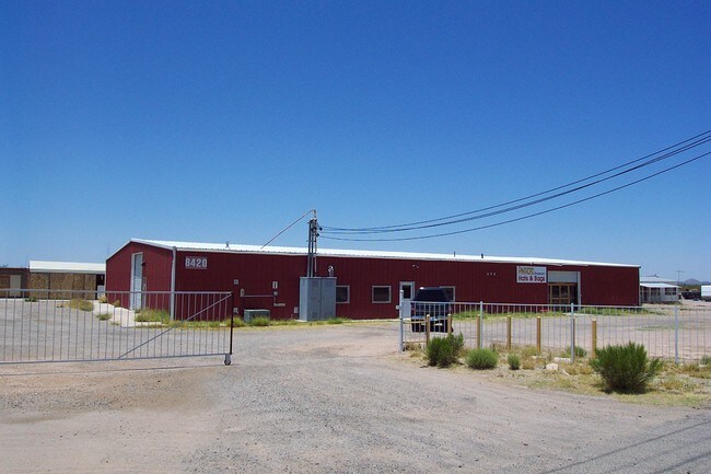
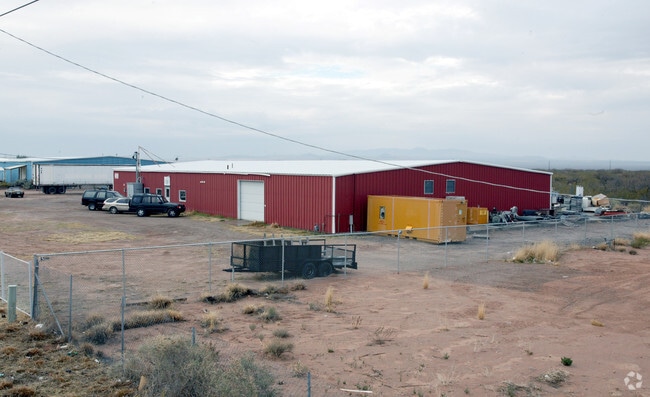
Property Record
8420 S Nogales Hwy, Tucson, AZ 85756


NEARBY LISTINGS FOR SALE OR LEASE
Property Detail
8420 S Nogales Hwy
Tucson, AZ
Null
140-50-0120
N225 S1950 LOTS 2 & 3 LYG W TUC-NOGALES HWY 1.01 AC SEC 30-15-14
Industrialgeneral
Pima
X
Arizona
04019C2880L
2
2025
1.01 AC
2025
SW Tucson/Airport
004131
Tucson
11,260 SF
DEMOGRAPHICS near 8420 S Nogales Hwy
1 Mile
3 Mile
5 Mile
2024 Total Population
220
21,673
105,992
2029 Population
230
22,322
108,981
Pop Growth 2024-2029
+ 4.55%
+ 2.99%
+ 2.82%
Average Age
39
35
35
2024 Total Households
75
6,939
34,934
HH Growth 2024-2029
+ 4.00%
+ 2.97%
+ 2.80%
Median Household Inc
$68,035
$41,299
$47,961
Avg Household Size
2.90
3.00
2.90
2024 Avg HH Vehicles
2.00
2.00
2.00
Median Home Value
$167,241
$135,862
$155,809
Median Year Built
1999
1978
1983
Nearby Places
Map Layers
Map Styles
 Street
 Aerial
- Restaurants
- Banks
- Shops
- Fitness
- Groceries
PUBLIC TRANSPORTATION
AIRPORT
Tucson International
DRIVE
WALK
Distance
Tucson International
11 min
4.8 mi
Nearby Properties
Address
Land Use
TOTAL SIZE
Lot Size
Zoning
Address
Land Use
TOTAL SIZE
Lot Size
Zoning
1,207,845 SF
78.85 AC
Address
Land Use
TOTAL SIZE
Lot Size
Zoning
544,787 SF
84.11 AC
CI1
Address
Land Use
TOTAL SIZE
Lot Size
Zoning
1,042,346 SF
751.86 AC
Address
Land Use
TOTAL SIZE
Lot Size
Zoning
1,037,850 SF
618.47 AC
CI2
Address
Land Use
TOTAL SIZE
Lot Size
Zoning
55,730 SF
4.25 AC
C2
Address
Land Use
TOTAL SIZE
Lot Size
Zoning
413,807 SF
514.76 AC
CI2
Address
Land Use
TOTAL SIZE
Lot Size
Zoning
229,320 SF
25.85 AC
Address
Land Use
TOTAL SIZE
Lot Size
Zoning
91.34 AC
Address
Land Use
TOTAL SIZE
Lot Size
Zoning
5,953 SF
3.89 AC
Address
Land Use
TOTAL SIZE
Lot Size
Zoning
147,919 SF
7.04 AC
RH
Address
Land Use
TOTAL SIZE
Lot Size
Zoning
442,886 SF
118.41 AC
MU
Address
Land Use
TOTAL SIZE
Lot Size
Zoning
251,712 SF
222.91 AC
CI2
Address
Land Use
TOTAL SIZE
Lot Size
Zoning
114,285 SF
5.17 AC
R2
Address
Land Use
TOTAL SIZE
Lot Size
Zoning
175,006 SF
197.10 AC
Address
Land Use
TOTAL SIZE
Lot Size
Zoning
210,359 SF
5.58 AC
Address
Land Use
TOTAL SIZE
Lot Size
Zoning
87,431 SF
7.30 AC
Address
Land Use
TOTAL SIZE
Lot Size
Zoning
73,429 SF
7.77 AC
PI
Address
Land Use
TOTAL SIZE
Lot Size
Zoning
66,054 SF
2.62 AC
PI
Address
Land Use
TOTAL SIZE
Lot Size
Zoning
141,787 SF
11.95 AC
Address
Land Use
TOTAL SIZE
Lot Size
Zoning
64,711 SF
8.62 AC
R1
Address
Land Use
TOTAL SIZE
Lot Size
Zoning
111,752 SF
9.57 AC
I1
Address
Land Use
TOTAL SIZE
Lot Size
Zoning
80,825 SF
4.77 AC
I1
Address
Land Use
TOTAL SIZE
Lot Size
Zoning
286,622 SF
11.14 AC
R3
Address
Land Use
TOTAL SIZE
Lot Size
Zoning
61,698 SF
8.68 AC
GR1
Address
Land Use
TOTAL SIZE
Lot Size
Zoning
140,095 SF
5.79 AC
PI
Address
Land Use
TOTAL SIZE
Lot Size
Zoning
125,966 SF
11.64 AC
Address
Land Use
TOTAL SIZE
Lot Size
Zoning
110,026 SF
9.55 AC
I1
Address
Land Use
TOTAL SIZE
Lot Size
Zoning
82,752 SF
3.34 AC
PI
Address
Land Use
TOTAL SIZE
Lot Size
Zoning
73,748 SF
4.95 AC
PI
Address
Land Use
TOTAL SIZE
Lot Size
Zoning
11,400 SF
3.17 AC
The World's #1 Commercial Real Estate Marketplace
Connect with us
© 2026 CoStar Group
The information above has been obtained from sources believed reliable. While we do not doubt its accuracy we have not verified it and make no guarantee, warranty or representation about it. It is your responsibility to independently confirm its accuracy and completeness. Any projections, opinions, assumptions, or estimates used are for example only and do not represent the current or future performance of the property. The value of this transaction to you depends on tax and other factors which should be evaluated by your tax, financial, and legal advisors. You and your advisors should conduct a careful, independent investigation of the property to determine to your satisfaction the suitability of the property for your needs.